
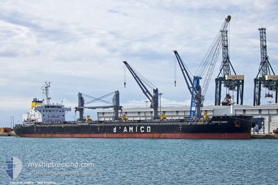
CIELO DI TAMPA
Cargo
Current Trip
| Time Travelled | 6 days |
|---|---|
| Remaining Time | --- |
| Distance Travelled | 1836.62 nm |
| Remaining Distance | --- |
| AVG Speed | 11.3 Noeuds |
| MAX Speed | 15.6 Noeuds |
| AVG Wind | 15.7 knots |
| MAX Wind | 31.5 knots |
| MIN Temp | 6.6°C / 43.88°F |
| MAX Temp | 12.8°C / 55.04°F |
| Tirant d eau | 8.9 m |
| Position reçue | 3 d depuis |
Current Position
| Longitude | -8.96309° |
|---|---|
| Latitude | 49.43189° |
| Etat | Under way using engine |
| Vitesse | 13 Noeuds |
| Parcours | 271.5° |
| Zone | Celtic Sea |
| Station | T-AIS |
| Position reçue | 3 d depuis |
Info
Information
The current position of CIELO DI TAMPA is in Celtic Sea with coordinates 49.43189° / -8.96309° as reported on 2024-04-22 00:18 by AIS to our vessel tracker app. The vessel's current speed is 13 Noeuds and is heading at the port of PHILADELPHIA. The estimated time of arrival as calculated by MyShipTracking vessel tracking app is 2024-05-02 14:00 LT
The vessel CIELO DI TAMPA (IMO: 9707754, MMSI: 636017329) is a Cargo It's sailing under the flag of [LR] Liberia.
In this page you can find informations about the vessels current position, last detected port calls, and current voyage information. If the vessels is not in coverage by AIS you will find the latest position.
The current position of CIELO DI TAMPA is detected by our AIS receivers and we are not responsible for the reliability of the data. The last position was recorded while the vessel was in Coverage by the Ais receivers of our vessel tracking app.
The current draught of CIELO DI TAMPA as reported by AIS is 8.9 meters
Weather
| Temperature | 12.6°C / 54.68°F |
|---|---|
| Wind Speed | 11 knots |
| Direction | 225° SW |
| Pressure | 1029.7 hPa |
| Humidity | 83 % |
| Cloud Coverage | 100 % |
Featured Company
Last Port Calls
| Port | Arrival | Departure | Time In Port |
|---|---|---|---|
| 2024-04-17 10:44 | 2024-04-19 06:42 | 1 d | |
| 2024-04-06 03:37 | 2024-04-15 21:22 | 9 d | |
| 2024-03-25 14:15 | 2024-04-03 22:09 | 9 d | |
| 2024-03-04 22:44 | 2024-03-08 20:02 | 3 d | |
| 2024-02-20 07:35 | 2024-02-22 22:31 | 2 d | |
| 2024-02-17 11:03 | 2024-02-19 21:37 | 2 d | |
| 2024-02-17 10:01 | 2024-02-17 10:22 | 21 m |
Most Visited Ports (Last year)
| Port | Arrivals | |
|---|---|---|
| 3 | ||
| 3 | ||
| 2 | ||
| 2 | ||
| 2 | ||
| 2 |
Last Trips
| Origin | Departure | Destination | Arrival | Distance | |
|---|---|---|---|---|---|
| 2024-04-15 23:22 | 2024-04-17 12:44 | 467.51 nm | |||
| 2024-04-04 00:09 | 2024-04-06 05:37 | 561.06 nm | |||
| 2024-03-08 15:02 | 2024-03-25 15:15 | 4513.46 nm | |||
| 2024-02-22 17:31 | 2024-03-04 17:44 | 960.83 nm | |||
| 2024-02-19 16:37 | 2024-02-20 02:35 | 95.20 nm | |||
| 2024-02-17 05:22 | 2024-02-17 06:03 | 3.25 nm | |||
| 2024-01-31 14:42 | 2024-02-17 05:01 | 4171.57 nm |
Events
| Heure | Evenement | Détails | Position/ Destination | Info |
|---|---|---|---|---|
| 2024-04-22 00:24 | Etat Changé | Default Under way using engine |
49.43167 / -8.99167
US PHL
|
Vitesse: 13 kn Parcours: 271.5° |
| 2024-04-22 00:18 | Hors de la zone couverte |
49.43189 / -8.96309
Celtic Sea
US PHL
|
Vitesse: 13 kn Parcours: 271.5° |
|
| 2024-04-22 00:07 | Etat Changé | Under way using engine Default |
49.43009 / -8.89999
US PHL
|
Vitesse: 13 kn Parcours: 271° |
| 2024-04-21 23:54 | Etat Changé | Default Under way using engine |
49.42833 / -8.82500
US PHL
|
Vitesse: 13.2 kn Parcours: 274° |
| 2024-04-21 21:24 | Etat Changé | Under way using engine Default |
49.38985 / -7.96885
US PHL
|
Vitesse: 13 kn Parcours: 271° |
| 2024-04-21 21:17 | Etat Changé | Default Under way using engine |
49.38667 / -7.92833
US PHL
|
Vitesse: 13.3 kn Parcours: 291.8° |
| 2024-04-21 21:12 | Etat Changé | Under way using engine Default |
49.38451 / -7.89902
US PHL
|
Vitesse: 13.7 kn Parcours: 265° |
| 2024-04-21 20:53 | Dans la zone couverte |
49.38451 / -7.89902
Celtic Sea
US PHL
|
Vitesse: 13.3 kn Parcours: 291.8° |
|
| 2024-04-21 20:09 | Etat Changé | Default Under way using engine |
49.37500 / -7.52833
US PHL
|
Vitesse: 13.6 kn Parcours: 276.7° |
| 2024-04-21 20:01 | Hors de la zone couverte |
49.37218 / -7.48581
Celtic Sea
US PHL
|
Vitesse: 13.6 kn Parcours: 276.7° |