
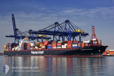
CHICAGO EXPRESS
Container Ship
Current Trip
| Time Travelled | 2 days |
|---|---|
| Remaining Time | --- |
| Distance Travelled | 1110.42 nm |
| Remaining Distance | --- |
| AVG Speed | 19.7 Noeuds |
| MAX Speed | 21.4 Noeuds |
| AVG Wind | 10.5 knots |
| MAX Wind | 21 knots |
| MIN Temp | 9.3°C / 48.74°F |
| MAX Temp | 16.2°C / 61.16°F |
| Tirant d eau | 9.8 m |
| Position reçue | 10 h, 53 m depuis |
Current Position
| Longitude | --- |
|---|---|
| Latitude | --- |
| Etat | Under way using engine |
| Vitesse | 18.8 Noeuds |
| Parcours | 243.7° |
| Zone | North Atlantic Ocean |
| Station | T-AIS |
| Position reçue | 10 h, 53 m depuis |
Info
Information
The current position of CHICAGO EXPRESS is in North Atlantic Ocean with coordinates 35.91954° / -6.34699° as reported on 2025-02-26 16:21 by AIS to our vessel tracker app. The vessel's current speed is 18.8 Noeuds and is heading at the port of JEBEL ALI. The estimated time of arrival as calculated by MyShipTracking vessel tracking app is 2025-03-21 09:00 LT
The vessel CHICAGO EXPRESS (IMO: 9295268, MMSI: 211839000) is a Container Ship that was built in 2006 ( 19 Age ). It's sailing under the flag of [DE] Germany.
In this page you can find informations about the vessels current position, last detected port calls, and current voyage information. If the vessels is not in coverage by AIS you will find the latest position.
The current position of CHICAGO EXPRESS is detected by our AIS receivers and we are not responsible for the reliability of the data. The last position was recorded while the vessel was in Coverage by the Ais receivers of our vessel tracking app.
The current draught of CHICAGO EXPRESS as reported by AIS is 9.8 meters
Weather
| Temperature | 15.7°C / 60.26°F |
|---|---|
| Wind Speed | 5 knots |
| Direction | 337° NNW |
| Pressure | 1021.8 hPa |
| Humidity | 69.4 % |
| Cloud Coverage | 100 % |
Featured Company
Last Port Calls
| Port | Arrival | Departure | Time In Port |
|---|---|---|---|
| 2025-02-21 11:26 | 2025-02-24 18:36 | 3 d | |
| 2025-02-16 13:07 | 2025-02-17 02:52 | 13 h | |
| 2025-02-05 19:54 | 2025-02-06 17:37 | 21 h | |
| 2025-02-02 17:13 | 2025-02-04 03:32 | 1 d | |
| 2025-01-24 21:09 | 2025-01-26 00:05 | 1 d | |
| 2025-01-18 14:33 | 2025-01-21 18:08 | 3 d | |
| 2025-01-05 22:04 | 2025-01-07 20:16 | 1 d | |
| 2024-12-29 07:59 | 2024-12-30 02:15 | 18 h | |
| 2024-12-25 06:55 | 2024-12-26 21:02 | 1 d | |
| 2024-12-17 14:21 | 2024-12-22 17:21 | 5 d |
Most Visited Ports (Last year)
| Port | Arrivals | |
|---|---|---|
| 4 | ||
| 4 | ||
| 3 | ||
| 3 | ||
| 2 | ||
| 2 |
Last Trips
| Origin | Departure | Destination | Arrival | Distance | |
|---|---|---|---|---|---|
| 2025-02-17 03:52 | 2025-02-21 12:26 | 1012.66 nm | |||
| 2025-02-06 12:37 | 2025-02-16 14:07 | 3932.85 nm | |||
| 2025-02-03 22:32 | 2025-02-05 14:54 | 436.32 nm | |||
| 2025-01-25 19:05 | 2025-02-02 12:13 | 520.97 nm | |||
| 2025-01-21 13:08 | 2025-01-24 16:09 | 310.86 nm | |||
| 2025-01-07 21:16 | 2025-01-18 09:33 | 4253.02 nm | |||
| 2024-12-30 03:15 | 2025-01-05 23:04 | 178.66 nm | |||
| 2024-12-26 22:02 | 2024-12-29 08:59 | 239.55 nm | |||
| 2024-12-22 18:21 | 2024-12-25 07:55 | 424.40 nm | |||
| 2024-12-13 13:08 | 2024-12-17 15:21 | 171.21 nm |
Events
| Heure | Evenement | Détails | Position/ Destination | Info |
|---|---|---|---|---|
| 2025-02-26 16:28 | Etat Changé | Default Under way using engine |
35.90227 / -6.38195
AEJEA
|
Vitesse: 18.8 kn Parcours: 243.7° |
| 2025-02-26 16:21 | Changement de zone | Moroccan part of the North Atlantic Ocean Spanish part of the North Atlantic Ocean |
35.91954 / -6.34699
North Atlantic Ocean
AEJEA
|
Vitesse: 18.8 kn Parcours: 243.7° |
| 2025-02-26 16:21 | Hors de la zone couverte |
35.91954 / -6.34699
North Atlantic Ocean
AEJEA
|
Vitesse: 18.8 kn Parcours: 243.7° |
|
| 2025-02-26 15:20 | Changement de zone | Spanish part of the North Atlantic Ocean Spanish part of the Strait of Gibraltar |
35.97395 / -5.97471
North Atlantic Ocean
AEJEA
|
Vitesse: 18.2 kn Parcours: 268° |
| 2025-02-26 14:52 | Etat Changé | Under way using engine Default |
35.96695 / -5.80163
AEJEA
|
Vitesse: 17.5 kn Parcours: 270° |
| 2025-02-26 14:35 | Etat Changé | Default Under way using engine |
35.96679 / -5.70264
AEJEA
|
Vitesse: 17.5 kn Parcours: 268.2° |
| 2025-02-26 14:30 | Etat Changé | Under way using engine Default |
35.96783 / -5.67208
AEJEA
|
Vitesse: 18.3 kn Parcours: 267° |
| 2025-02-26 14:23 | Etat Changé | Default Under way using engine |
35.96927 / -5.63031
AEJEA
|
Vitesse: 18.1 kn Parcours: 257.5° |
| 2025-02-26 13:35 | Changement de zone | Spanish part of the Strait of Gibraltar Gibraltarian part of the Strait of Gibraltar |
36.02116 / -5.34419
Strait of Gibraltar
AEJEA
|
Vitesse: 17.7 kn Parcours: 252.9° |
| 2025-02-26 13:32 | Changement de zone | Gibraltarian part of the Strait of Gibraltar Gibraltarian part of the Alboran Sea |
36.02575 / -5.32687
Strait of Gibraltar
AEJEA
|
Vitesse: 17.8 kn Parcours: 251.5° |