
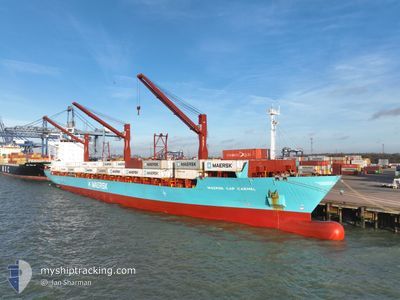
MAERSK CAP CARMEL
Container Ship
Current Trip
| Time Travelled | 7 days |
|---|---|
| Remaining Time | --- |
| Distance Travelled | 1706.39 nm |
| Remaining Distance | 389.44 nm |
| AVG Speed | 14.7 Noeuds |
| MAX Speed | 23.6 Noeuds |
| AVG Wind | 8.1 knots |
| MAX Wind | 14.9 knots |
| MIN Temp | 19.3°C / 66.74°F |
| MAX Temp | 29.9°C / 85.82°F |
| Tirant d eau | 11.5 m |
| Position reçue | 2024-01-03 04:15 |
Current Position
| Longitude | -18.06503° |
|---|---|
| Latitude | 17.85081° |
| Etat | Under way using engine |
| Vitesse | 14.8 Noeuds |
| Parcours | 181.2° |
| Zone | North Atlantic Ocean |
| Station | T-AIS |
| Position reçue | 2024-01-03 04:15 |
Info
Information
The current position of MAERSK CAP CARMEL is in North Atlantic Ocean with coordinates 17.85081° / -18.06503° as reported on 2024-01-03 04:15 by AIS to our vessel tracker app. The vessel's current speed is 14.8 Noeuds and is heading at the port of COTONOU.
The vessel MAERSK CAP CARMEL (IMO: 9273923, MMSI: 563050100) is a Container Ship that was built in 2003 ( 21 Age ). It's sailing under the flag of [SG] Singapore.
In this page you can find informations about the vessels current position, last detected port calls, and current voyage information. If the vessels is not in coverage by AIS you will find the latest position.
The current position of MAERSK CAP CARMEL is detected by our AIS receivers and we are not responsible for the reliability of the data. The last position was recorded while the vessel was in Coverage by the Ais receivers of our vessel tracking app.
The current draught of MAERSK CAP CARMEL as reported by AIS is 11.5 meters
Weather
| Temperature | 29.2°C / 84.56°F |
|---|---|
| Wind Speed | 10 knots |
| Direction | 189° S |
| Pressure | 1008.8 hPa |
| Humidity | 80.2 % |
| Cloud Coverage | 92 % |
Featured Company
Last Port Calls
| Port | Arrival | Departure | Time In Port |
|---|---|---|---|
| 2024-04-09 21:21 | 2024-04-11 04:43 | 1 d | |
| 2024-03-23 05:54 | 2024-03-25 04:49 | 1 d | |
| 2024-03-14 12:42 | |||
| 2024-02-29 21:39 | 2024-03-02 20:29 | 1 d | |
| 2024-02-20 10:17 | 2024-02-22 07:22 | 1 d | |
| 2024-02-08 18:45 | 2024-02-10 17:50 | 1 d |
Most Visited Ports (Last year)
| Port | Arrivals | |
|---|---|---|
| 8 | ||
| 4 | ||
| 4 | ||
| 3 | ||
| 3 | ||
| 3 |
Last Trips
| Origin | Departure | Destination | Arrival | Distance | |
|---|---|---|---|---|---|
| 2024-03-25 05:49 | 2024-04-09 21:21 | 2260.71 nm | |||
| 2024-03-02 21:29 | 2024-03-14 13:42 | 645.85 nm | |||
| 2024-02-22 08:22 | 2024-02-29 22:39 | 665.75 nm | |||
| 2024-02-10 18:50 | 2024-02-20 11:17 | 649.14 nm | |||
| 2024-01-27 03:44 | 2024-02-08 19:45 | 909.13 nm |
Events
| Heure | Evenement | Détails | Position/ Destination | Info |
|---|---|---|---|---|
| 2024-04-18 07:15 | Démarrage | 1.31 nm, South West of TEMA |
5.61398 / -.00110
MAPTM>>>BJCOO
|
Vitesse: 3.9 kn Parcours: 85° |
| 2024-04-16 15:04 | Arret | 1.72 nm, South West of TEMA |
5.61418 / -.01005
MAPTM>>>BJCOO
|
Vitesse: Parcours: 248° |
| 2024-04-16 13:39 | Démarrage | 4.31 nm, South of TEMA |
5.56173 / .03888
MAPTM>>>BJCOO
|
Vitesse: 5.2 kn Parcours: 65° |
| 2024-04-16 09:17 | Arret | 4.35 nm, South of TEMA |
5.56033 / .03669
MAPTM>>>BJCOO
|
Vitesse: 0.3 kn Parcours: 52° |
| 2024-04-16 09:07 | Démarrage | 4.19 nm, South of TEMA |
5.56406 / .03911
MAPTM>>>BJCOO
|
Vitesse: 3.1 kn Parcours: 146° |
| 2024-04-15 08:42 | Arret | 4.22 nm, South East of TEMA |
5.56504 / .04282
MAPTM>>>BJCOO
|
Vitesse: 0.2 kn Parcours: 212° |
| 2024-04-11 04:43 | PORT DE DEPART |
|
14.67811 / -17.41046
MAPTM>>>BJCOO
|
Vitesse: 6.3 kn Parcours: 87° |
| 2024-04-11 04:24 | Démarrage |
14.68434 / -17.42775
[SN] DAKAR
|
Vitesse: 3.8 kn Parcours: 341° |
|
| 2024-04-09 21:39 | Arret |
14.68695 / -17.42789
[SN] DAKAR
|
Vitesse: 0.1 kn Parcours: 333° |
|
| 2024-04-09 21:21 | Port d'arrivée |
|
14.67919 / -17.42326
[SN] DAKAR
|
Vitesse: 6.2 kn Parcours: 268° |