
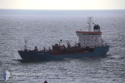
BRO NISSUM
Oil/Chemical Tanker
Current Trip
| Time Travelled | 8 days |
|---|---|
| Remaining Time | 6 days |
| Distance Travelled | 2354.40 nm |
| Remaining Distance | 1824.46 nm |
| AVG Speed | 11 Noeuds |
| MAX Speed | 14 Noeuds |
| AVG Wind | 6.8 knots |
| MAX Wind | 15 knots |
| MIN Temp | 27.1°C / 80.78°F |
| MAX Temp | 30°C / 86°F |
| Tirant d eau | 9.1 m |
| Position reçue | 5 d depuis |
Current Position
| Longitude | 103.54148° |
|---|---|
| Latitude | 1.20495° |
| Etat | Under way using engine |
| Vitesse | 12.9 Noeuds |
| Parcours | 279.5° |
| Zone | Singapore Strait |
| Station | T-AIS |
| Position reçue | 5 d depuis |
Info
Information
The current position of BRO NISSUM is in Singapore Strait with coordinates 1.20495° / 103.54148° as reported on 2024-04-18 16:22 by AIS to our vessel tracker app. The vessel's current speed is 12.9 Noeuds and is heading at the port of PORT LOUIS. The estimated time of arrival as calculated by MyShipTracking vessel tracking app is 2024-04-30 07:16 LT
The vessel BRO NISSUM (IMO: 9340623, MMSI: 220504000) is a Oil/Chemical Tanker that was built in 2008 ( 16 Age ). It's sailing under the flag of [DK] Denmark.
In this page you can find informations about the vessels current position, last detected port calls, and current voyage information. If the vessels is not in coverage by AIS you will find the latest position.
The current position of BRO NISSUM is detected by our AIS receivers and we are not responsible for the reliability of the data. The last position was recorded while the vessel was in Coverage by the Ais receivers of our vessel tracking app.
The current draught of BRO NISSUM as reported by AIS is 9.1 meters
Weather
| Temperature | 28.4°C / 83.12°F |
|---|---|
| Wind Speed | 3 knots |
| Direction | 183° S |
| Pressure | 1006.5 hPa |
| Humidity | 74.3 % |
| Cloud Coverage | 100 % |
Featured Company
Last Port Calls
| Port | Arrival | Departure | Time In Port |
|---|---|---|---|
| 2024-04-13 05:42 | 2024-04-15 02:54 | 1 d | |
| 2024-03-28 06:17 | |||
| 2024-02-20 22:24 | 2024-02-21 19:54 | 21 h |
Last Trips
| Origin | Departure | Destination | Arrival | Distance | |
|---|---|---|---|---|---|
| 2024-03-28 15:17 | 2024-04-13 12:42 | 3067.58 nm | |||
| 2024-01-30 01:49 | 2024-02-20 14:24 | 4570.81 nm |
Events
| Heure | Evenement | Détails | Position/ Destination | Info |
|---|---|---|---|---|
| 2024-04-18 16:22 | Hors de la zone couverte |
1.20495 / 103.54148
Singapore Strait
MU PLU
|
Vitesse: 12.9 kn Parcours: 279.5° |
|
| 2024-04-18 16:11 | Changement d'ETA | 2024/04/30 14:00 2024/04/30 11:00 |
1.19838 / 103.58181
MU PLU
|
Vitesse: 12.8 kn Parcours: 278.4° |
| 2024-04-18 16:08 | Changement de zone | Malaysian part of the Singapore Strait Indonesian part of the Singapore Strait |
1.19705 / 103.59061
Singapore Strait
MU PLU
|
Vitesse: 12.9 kn Parcours: 278.3° |
| 2024-04-18 15:50 | Changement de zone | Indonesian part of the Singapore Strait Singaporean part of the Singapore Strait |
1.19233 / 103.65219
Singapore Strait
MU PLU
|
Vitesse: 9.7 kn Parcours: 259.6° |
| 2024-04-18 15:29 | Démarrage | 3.77 nm, South of JURONG ISLAND |
1.19802 / 103.69828
MU PLU
|
Vitesse: 5.2 kn Parcours: 316.5° |
| 2024-04-18 15:23 | Etat Changé | Under way using engine At anchor |
1.19610 / 103.69826
MU PLU
|
Vitesse: 0.5 kn Parcours: 99° |
| 2024-04-18 13:33 | Tirant d'eau modifié | 9.1 8.9 |
1.19552 / 103.69756
MU PLU
|
Vitesse: Parcours: 68° |
| 2024-04-18 09:35 | Changement de destination | MU PLU ES FRO |
1.19504 / 103.69913
MU PLU
|
Vitesse: Parcours: 330° |
| 2024-04-18 09:35 | Changement d'ETA | 2024/04/30 11:00 2024/06/02 02:00 |
1.19504 / 103.69913
MU PLU
|
Vitesse: Parcours: 330° |
| 2024-04-18 09:09 | Changement de destination | ES FRO MU PLU |
1.19531 / 103.69951
ES FRO
|
Vitesse: Parcours: 300° |