
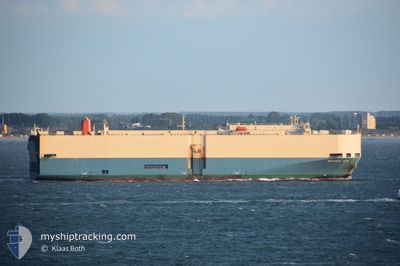
BRAVERY ACE
Vehicles Carrier
Current Trip
| Time Travelled | 2 days |
|---|---|
| Remaining Time | 3 days |
| Distance Travelled | 723.04 nm |
| Remaining Distance | 1450.40 nm |
| AVG Speed | 13.5 Noeuds |
| MAX Speed | 16.7 Noeuds |
| AVG Wind | 16 knots |
| MAX Wind | 22 knots |
| MIN Temp | 6.4°C / 43.52°F |
| MAX Temp | 20.4°C / 68.72°F |
| Tirant d eau | 7.6 m |
| Position reçue | 2 d depuis |
Current Position
| Longitude | -71.35033° |
|---|---|
| Latitude | 41.47837° |
| Etat | Under way using engine |
| Vitesse | 7.9 Noeuds |
| Parcours | 214° |
| Zone | North Atlantic Ocean |
| Station | T-AIS |
| Position reçue | 2 d depuis |
Info
Information
The current position of BRAVERY ACE is in North Atlantic Ocean with coordinates 41.47837° / -71.35033° as reported on 2024-04-14 02:27 by AIS to our vessel tracker app. The vessel's current speed is 7.9 Noeuds and is heading at the port of VERACRUZ. The estimated time of arrival as calculated by MyShipTracking vessel tracking app is 2024-04-20 03:22 LT
The vessel BRAVERY ACE (IMO: 9207120, MMSI: 357961000) is a Vehicles Carrier that was built in 2000 ( 24 Age ). It's sailing under the flag of [PA] Panama.
In this page you can find informations about the vessels current position, last detected port calls, and current voyage information. If the vessels is not in coverage by AIS you will find the latest position.
The current position of BRAVERY ACE is detected by our AIS receivers and we are not responsible for the reliability of the data. The last position was recorded while the vessel was in Coverage by the Ais receivers of our vessel tracking app.
The current draught of BRAVERY ACE as reported by AIS is 7.6 meters
Weather
| Temperature | 20.4°C / 68.72°F |
|---|---|
| Wind Speed | 6 knots |
| Direction | 168° SSE |
| Pressure | 1021.8 hPa |
| Humidity | 61.4 % |
| Cloud Coverage | --- |
Featured Company
Last Port Calls
| Port | Arrival | Departure | Time In Port |
|---|---|---|---|
| 2024-04-13 09:30 | 2024-04-14 01:38 | 16 h | |
| 2024-04-11 02:15 | 2024-04-11 18:20 | 16 h | |
| 2024-04-07 21:03 | 2024-04-09 00:36 | 1 d | |
| 2024-03-30 18:37 | 2024-04-01 19:32 | 2 d | |
| 2024-03-29 03:01 | 2024-03-29 22:38 | 19 h | |
| 2024-03-21 07:02 | 2024-03-22 06:18 | 23 h | |
| 2024-03-19 00:53 | 2024-03-20 00:31 | 23 h | |
| 2024-03-12 12:28 | 2024-03-14 19:54 | 2 d | |
| 2024-03-04 09:37 | 2024-03-07 01:15 | 2 d | |
| 2024-02-24 20:21 | 2024-02-25 23:24 | 1 d |
Last Trips
| Origin | Departure | Destination | Arrival | Distance | |
|---|---|---|---|---|---|
| 2024-04-11 14:20 | 2024-04-13 05:30 | 381.38 nm | |||
| 2024-04-08 20:36 | 2024-04-10 22:15 | 278.55 nm | |||
| 2024-04-01 13:32 | 2024-04-07 17:03 | 2195.74 nm | |||
| 2024-03-29 16:38 | 2024-03-30 12:37 | 239.58 nm | |||
| 2024-03-22 02:18 | 2024-03-28 21:01 | 1498.76 nm | |||
| 2024-03-19 20:31 | 2024-03-21 03:02 | 110.03 nm | |||
| 2024-03-14 13:54 | 2024-03-18 20:53 | 1347.84 nm | |||
| 2024-03-06 20:15 | 2024-03-12 06:28 | 2140.33 nm | |||
| 2024-02-25 17:24 | 2024-03-04 04:37 | 2181.59 nm | |||
| 2024-02-15 21:10 | 2024-02-24 14:21 | 475.70 nm |
Events
| Heure | Evenement | Détails | Position/ Destination | Info |
|---|---|---|---|---|
| 2024-04-14 02:28 | Etat Changé | Default Under way using engine |
41.47753 / -71.35113
MX VER
|
Vitesse: 7.9 kn Parcours: 214° |
| 2024-04-14 02:27 | Etat Changé | Under way using engine Default |
41.47837 / -71.35033
MX VER
|
Vitesse: 9.4 kn Parcours: 178° |
| 2024-04-14 02:27 | Hors de la zone couverte |
41.47837 / -71.35033
North Atlantic Ocean
MX VER
|
Vitesse: 7.9 kn Parcours: 214° |
|
| 2024-04-14 02:24 | Etat Changé | Default Under way using engine |
41.48598 / -71.34737
MX VER
|
Vitesse: 10.7 kn Parcours: 177° |
| 2024-04-14 01:57 | Etat Changé | Under way using engine Default |
41.57613 / -71.36363
MX VER
|
Vitesse: 12.2 kn Parcours: 104° |
| 2024-04-14 01:56 | Etat Changé | Default Under way using engine |
41.57745 / -71.36792
MX VER
|
Vitesse: 8.9 kn Parcours: 123° |
| 2024-04-14 01:41 | Tirant d'eau modifié | 7.6 8.4 |
41.60302 / -71.39598
MX VER
|
Vitesse: 7.9 kn Parcours: 178° |
| 2024-04-14 01:41 | Changement de destination | MX VER USDVV |
41.60302 / -71.39598
MX VER
|
Vitesse: 7.9 kn Parcours: 178° |
| 2024-04-14 01:41 | Changement d'ETA | 2024/04/20 19:00 2024/04/13 08:00 |
41.60302 / -71.39598
MX VER
|
Vitesse: 7.9 kn Parcours: 178° |
| 2024-04-14 01:38 | PORT DE DEPART |
|
41.60768 / -71.39673
USDVV
|
Vitesse: 7.1 kn Parcours: 151° |