
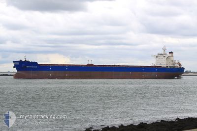
BRAVE SAILOR
Bulk Carrier
Current Trip
| Time Travelled | 47 days |
|---|---|
| Remaining Time | 3 days |
| Distance Travelled | 8265.10 nm |
| Remaining Distance | 984.45 nm |
| AVG Speed | 9.4 Noeuds |
| MAX Speed | 12.4 Noeuds |
| AVG Wind | 12.6 knots |
| MAX Wind | 34.8 knots |
| MIN Temp | 12.7°C / 54.86°F |
| MAX Temp | 28.4°C / 83.12°F |
| Tirant d eau | 18.4 m |
| Position reçue | 8 d depuis |
Current Position
| Longitude | --- |
|---|---|
| Latitude | --- |
| Etat | Under way using engine |
| Vitesse | 6.7 Noeuds |
| Parcours | 95.1° |
| Zone | Singapore Strait |
| Station | T-AIS |
| Position reçue | 8 d depuis |
Info
Information
The current position of BRAVE SAILOR is in Singapore Strait with coordinates 1.25989° / 104.04129° as reported on 2025-11-29 06:59 by AIS to our vessel tracker app. The vessel's current speed is 6.7 Noeuds and is heading at the port of LIANYUNGANG. The estimated time of arrival as calculated by MyShipTracking vessel tracking app is 2025-12-11 10:22 LT
The vessel BRAVE SAILOR (IMO: 9457012, MMSI: 215150000) is a Bulk Carrier that was built in 2011 ( 14 Age ). It's sailing under the flag of [MT] Malta.
In this page you can find informations about the vessels current position, last detected port calls, and current voyage information. If the vessels is not in coverage by AIS you will find the latest position.
The current position of BRAVE SAILOR is detected by our AIS receivers and we are not responsible for the reliability of the data. The last position was recorded while the vessel was in Coverage by the Ais receivers of our vessel tracking app.
The current draught of BRAVE SAILOR as reported by AIS is 18.4 meters
Weather
| Temperature | 24.4°C / 75.92°F |
|---|---|
| Wind Speed | 6 knots |
| Direction | 47° NE |
| Pressure | 1019.7 hPa |
| Humidity | 57.6 % |
| Cloud Coverage | 4 % |
Featured Company
Most Visited Ports (Last year)
| Port | Arrivals | |
|---|---|---|
| 3 | ||
| 1 | ||
| 1 |
Last Trips
| Origin | Departure | Destination | Arrival | Distance |
|---|
Events
| Heure | Evenement | Détails | Position/ Destination | Info |
|---|---|---|---|---|
| 2025-11-29 07:04 | Etat Changé | Default Under way using engine |
1.25937 / 104.05293
CN LYG
|
Vitesse: 6.7 kn Parcours: 95.1° |
| 2025-11-29 06:59 | Hors de la zone couverte |
1.25989 / 104.04129
Singapore Strait
CN LYG
|
Vitesse: 6.7 kn Parcours: 95.1° |
|
| 2025-11-29 06:52 | Changement de zone | Indonesian part of the Singapore Strait Singaporean part of the Singapore Strait |
1.26429 / 104.03132
Singapore Strait
CN LYG
|
Vitesse: 5.4 kn Parcours: 124.2° |
| 2025-11-29 06:44 | Tirant d'eau modifié | 18.4 18.3 |
1.27491 / 104.02675
CN LYG
|
Vitesse: 4.2 kn Parcours: 152° |
| 2025-11-29 06:44 | Changement de destination | CN LYG SINGAPORE-PEBG-B |
1.27491 / 104.02675
CN LYG
|
Vitesse: 4.2 kn Parcours: 152° |
| 2025-11-29 06:44 | Changement d'ETA | 2025/12/09 15:00 2025/11/28 18:00 |
1.27491 / 104.02675
CN LYG
|
Vitesse: 4.2 kn Parcours: 152° |
| 2025-11-29 06:39 | Démarrage | 2.11 nm, South of TANAH MERAH |
1.27729 / 104.02326
SINGAPORE-PEBG-B
|
Vitesse: 3.1 kn Parcours: 112° |
| 2025-11-29 06:26 | Etat Changé | Under way using engine Default |
1.28046 / 104.01726
SINGAPORE-PEBG-B
|
Vitesse: 0.6 kn Parcours: 87° |
| 2025-11-29 06:11 | Dans la zone couverte |
1.28046 / 104.01726
Singapore Strait
|
Vitesse: 0.7 kn Parcours: 80.4° |
|
| 2025-11-28 21:35 | Hors de la zone couverte |
1.28086 / 104.01633
Singapore Strait
SINGAPORE-PEBG-B
|
Vitesse: 0.1 kn Parcours: 268° |