
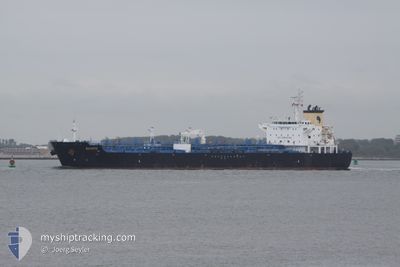
BIXBITE
Oil/Chemical Tanker
Current Trip
| Time Travelled | 1 day |
|---|---|
| Remaining Time | 1 day |
| Distance Travelled | 545.74 nm |
| Remaining Distance | 321.82 nm |
| AVG Speed | 12.6 Noeuds |
| MAX Speed | 14.2 Noeuds |
| AVG Wind | 15.6 knots |
| MAX Wind | 31.5 knots |
| MIN Temp | 10.7°C / 51.26°F |
| MAX Temp | 16.3°C / 61.34°F |
| Tirant d eau | 9.1 m |
| Position reçue | Maintenant |
Current Position
| Longitude | 24.68495° |
|---|---|
| Latitude | 38.02953° |
| Etat | Under way using engine |
| Vitesse | 12 Noeuds |
| Parcours | 30° |
| Zone | Aegean Sea |
| Station | T-AIS |
| Position reçue | Maintenant |
Info
Information
The current position of BIXBITE is in Aegean Sea with coordinates 38.02953° / 24.68495° as reported on 2024-04-20 11:03 by AIS to our vessel tracker app. The vessel's current speed is 12 Noeuds and is heading at the port of KORFEZ. The estimated time of arrival as calculated by MyShipTracking vessel tracking app is 2024-04-21 13:08 LT
The vessel BIXBITE (IMO: 9316610, MMSI: 229339000) is a Oil/Chemical Tanker that was built in 2009 ( 15 Age ). It's sailing under the flag of [MT] Malta.
In this page you can find informations about the vessels current position, last detected port calls, and current voyage information. If the vessels is not in coverage by AIS you will find the latest position.
The current position of BIXBITE is detected by our AIS receivers and we are not responsible for the reliability of the data. The last position was recorded while the vessel was in Coverage by the Ais receivers of our vessel tracking app.
The current draught of BIXBITE as reported by AIS is 9.1 meters
Weather
| Temperature | 13.8°C / 56.84°F |
|---|---|
| Wind Speed | 23 knots |
| Direction | 347° NNW |
| Pressure | 1008.8 hPa |
| Humidity | 74.8 % |
| Cloud Coverage | 83 % |
Featured Company
Last Port Calls
| Port | Arrival | Departure | Time In Port |
|---|---|---|---|
| 2024-04-17 20:47 | 2024-04-18 18:18 | 21 h | |
| 2024-04-15 08:55 | 2024-04-16 12:38 | 1 d | |
| 2024-04-07 19:51 | 2024-04-10 06:39 | 2 d | |
| 2024-04-04 09:20 | 2024-04-06 05:54 | 1 d | |
| 2024-03-25 20:03 | 2024-03-27 10:01 | 1 d | |
| 2024-03-20 02:05 | 2024-03-22 02:58 | 2 d | |
| 2024-03-06 04:23 | 2024-03-06 04:55 | 32 m | |
| 2024-03-04 11:51 | 2024-03-06 02:57 | 1 d | |
| 2024-02-24 22:01 | 2024-02-25 15:09 | 17 h | |
| 2024-02-20 09:26 | 2024-02-23 03:47 | 2 d |
Last Trips
| Origin | Departure | Destination | Arrival | Distance | |
|---|---|---|---|---|---|
| 2024-04-16 14:38 | 2024-04-17 22:47 | 6.68 nm | |||
| 2024-04-10 08:39 | 2024-04-15 10:55 | 642.78 nm | |||
| 2024-04-06 06:54 | 2024-04-07 21:51 | 505.83 nm | |||
| 2024-03-27 11:01 | 2024-04-04 10:20 | 574.23 nm | |||
| 2024-03-22 03:58 | 2024-03-25 21:03 | 527.69 nm | |||
| 2024-03-06 05:55 | 2024-03-20 03:05 | 1814.47 nm | |||
| 2024-03-06 03:57 | 2024-03-06 05:23 | 5.20 nm | |||
| 2024-02-25 16:09 | 2024-03-04 12:51 | 1509.54 nm | |||
| 2024-02-23 04:47 | 2024-02-24 23:01 | 497.23 nm | |||
| 2024-02-19 01:45 | 2024-02-20 10:26 | 6.29 nm |
Events
| Heure | Evenement | Détails | Position/ Destination | Info |
|---|---|---|---|---|
| 2024-04-20 03:17 | Detecté en mer | Greek part of the Aegean Sea |
36.55594 / 23.78862
Aegean Sea
TR TUT
|
Vitesse: 13.6 kn Parcours: 42.4° |
| 2024-04-20 03:14 | Etat Changé | Under way using engine Default |
36.54845 / 23.78013
TR TUT
|
Vitesse: 13.6 kn Parcours: 43° |
| 2024-04-20 03:14 | Dans la zone couverte |
36.55594 / 23.78862
Aegean Sea
TR TUT
|
Vitesse: 13.6 kn Parcours: 42.4° |
|
| 2024-04-19 14:41 | Hors de la zone couverte |
37.06495 / 20.89096
Ionian Sea
TR TUT
|
Vitesse: 13.6 kn Parcours: 131.9° |
|
| 2024-04-19 07:07 | Detecté en mer | Greek part of the Ionian Sea |
38.30633 / 19.46618
Ionian Sea
TR TUT
|
Vitesse: 13.7 kn Parcours: 136.8° |
| 2024-04-19 07:07 | Dans la zone couverte |
38.30633 / 19.46618
Ionian Sea
TR TUT
|
Vitesse: 13.7 kn Parcours: 136.8° |
|
| 2024-04-18 20:48 | Hors de la zone couverte |
40.06243 / 17.40453
Ionian Sea
TR TUT
|
Vitesse: 13.3 kn Parcours: 136.6° |
|
| 2024-04-18 18:50 | Changement d'ETA | 2024/04/21 09:00 2024/04/21 14:00 |
40.41634 / 17.14250
TR TUT
|
Vitesse: 13.1 kn Parcours: 238.8° |
| 2024-04-18 18:43 | Changement d'ETA | 2024/04/21 14:00 2024/04/20 14:00 |
40.42724 / 17.16632
TR TUT
|
Vitesse: 11.1 kn Parcours: 240.3° |
| 2024-04-18 18:18 | PORT DE DEPART |
|
40.46848 / 17.19718
TR TUT
|
Vitesse: 3.8 kn Parcours: 158° |