
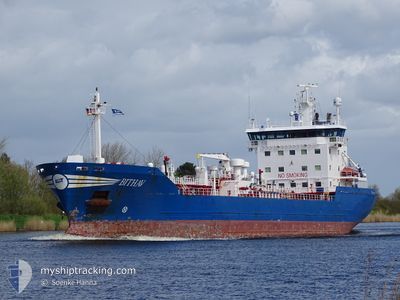
BITHAV
Oil/Chemical Tanker
Current Trip
| Time Travelled | 1 day |
|---|---|
| Remaining Time | 21 h, 10 mins |
| Distance Travelled | 363.13 nm |
| Remaining Distance | 290.17 nm |
| AVG Speed | 12.6 Noeuds |
| MAX Speed | 14.8 Noeuds |
| AVG Wind | 15.1 knots |
| MAX Wind | 23.7 knots |
| MIN Temp | 8.2°C / 46.76°F |
| MAX Temp | 12.1°C / 53.78°F |
| Tirant d eau | 6.5 m |
| Position reçue | Maintenant |
Current Position
| Longitude | -4.20420° |
|---|---|
| Latitude | 50.02923° |
| Etat | Under way using engine |
| Vitesse | 12.7 Noeuds |
| Parcours | 260.1° |
| Zone | English Channel |
| Station | T-AIS |
| Position reçue | Maintenant |
Info
Information
The current position of BITHAV is in English Channel with coordinates 50.02923° / -4.20420° as reported on 2024-04-19 14:11 by AIS to our vessel tracker app. The vessel's current speed is 12.7 Noeuds and is heading at the port of EASTHAM. The estimated time of arrival as calculated by MyShipTracking vessel tracking app is 2024-04-20 11:22 LT
The vessel BITHAV (IMO: 9211535, MMSI: 246697000) is a Oil/Chemical Tanker that was built in 2000 ( 24 Age ). It's sailing under the flag of [NL] Netherlands.
In this page you can find informations about the vessels current position, last detected port calls, and current voyage information. If the vessels is not in coverage by AIS you will find the latest position.
The current position of BITHAV is detected by our AIS receivers and we are not responsible for the reliability of the data. The last position was recorded while the vessel was in Coverage by the Ais receivers of our vessel tracking app.
The current draught of BITHAV as reported by AIS is 6.5 meters
Weather
| Temperature | 12.1°C / 53.78°F |
|---|---|
| Wind Speed | 13 knots |
| Direction | 317° NW |
| Pressure | 1021.9 hPa |
| Humidity | 85.5 % |
| Cloud Coverage | 98 % |
Featured Company
Last Port Calls
| Port | Arrival | Departure | Time In Port |
|---|---|---|---|
| 2024-04-16 02:53 | 2024-04-18 09:23 | 2 d | |
| 2024-04-13 18:03 | 2024-04-13 18:34 | 30 m | |
| 2024-04-12 07:03 | 2024-04-13 02:47 | 19 h | |
| 2024-04-08 21:17 | 2024-04-10 01:23 | 1 d | |
| 2024-04-06 09:34 | 2024-04-07 21:13 | 1 d | |
| 2024-03-28 07:32 | 2024-04-06 06:45 | 8 d | |
| 2024-03-21 19:55 | 2024-03-22 17:57 | 22 h | |
| 2024-03-19 23:21 | 2024-03-20 13:08 | 13 h | |
| 2024-03-18 05:01 | 2024-03-19 10:22 | 1 d | |
| 2024-03-17 10:22 | 2024-03-18 04:36 | 18 h |
Most Visited Ports (Last year)
| Port | Arrivals | |
|---|---|---|
| 17 | ||
| 9 | ||
| 8 | ||
| 5 | ||
| 4 | ||
| 3 |
Last Trips
| Origin | Departure | Destination | Arrival | Distance | |
|---|---|---|---|---|---|
| 2024-04-13 20:34 | 2024-04-16 04:53 | 222.99 nm | |||
| 2024-04-13 04:47 | 2024-04-13 20:03 | 203.58 nm | |||
| 2024-04-10 02:23 | 2024-04-12 09:03 | 654.55 nm | |||
| 2024-04-07 22:13 | 2024-04-08 22:17 | 129.82 nm | |||
| 2024-03-22 18:57 | 2024-04-06 10:34 | 1302.36 nm | |||
| 2024-03-22 18:57 | 2024-03-28 07:32 | 1264.75 nm | |||
| 2024-03-20 13:08 | 2024-03-21 20:55 | 166.32 nm | |||
| 2024-03-19 11:22 | 2024-03-19 23:21 | 163.94 nm | |||
| 2024-03-18 05:36 | 2024-03-18 06:01 | 2.57 nm | |||
| 2024-03-13 06:03 | 2024-03-17 11:22 | 115.96 nm |
Events
| Heure | Evenement | Détails | Position/ Destination | Info |
|---|---|---|---|---|
| 2024-04-19 09:07 | Etat Changé | Under way using engine Default |
50.23855 / -2.46211
NLRTM > GBEAM
|
Vitesse: 13.4 kn Parcours: 260° |
| 2024-04-19 09:06 | Dans la zone couverte |
50.23855 / -2.46211
English Channel
NLRTM > GBEAM
|
Vitesse: 13.2 kn Parcours: 259.2° |
|
| 2024-04-19 07:47 | Hors de la zone couverte |
50.29015 / -2.03295
English Channel
NLRTM > GBEAM
|
Vitesse: 11.8 kn Parcours: 259.3° |
|
| 2024-04-19 06:46 | Etat Changé | Under way using engine Default |
50.32672 / -1.72875
NLRTM > GBEAM
|
Vitesse: 11 kn Parcours: 260° |
| 2024-04-19 06:46 | Dans la zone couverte |
50.32672 / -1.72875
English Channel
NLRTM > GBEAM
|
Vitesse: 12.3 kn Parcours: 260.6° |
|
| 2024-04-19 04:55 | Etat Changé | Default Under way using engine |
50.38796 / -1.21832
NLRTM > GBEAM
|
Vitesse: 9.9 kn Parcours: 257.2° |
| 2024-04-19 04:50 | Hors de la zone couverte |
50.39076 / -1.19505
English Channel
NLRTM > GBEAM
|
Vitesse: 9.9 kn Parcours: 257.2° |
|
| 2024-04-19 04:15 | Etat Changé | Under way using engine Default |
50.40895 / -1.04320
NLRTM > GBEAM
|
Vitesse: 10.3 kn Parcours: 260° |
| 2024-04-19 04:10 | Etat Changé | Default Under way using engine |
50.41161 / -1.02116
NLRTM > GBEAM
|
Vitesse: 10.2 kn Parcours: 257.7° |
| 2024-04-18 19:35 | Changement de zone | United Kingdom part of the English Channel United Kingdom part of the North Sea |
51.06993 / 1.46498
English Channel
NLRTM > GBEAM
|
Vitesse: 12.2 kn Parcours: 232.1° |