
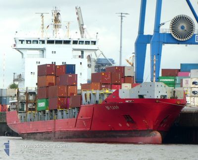
BF CARP
Container Ship
Current Trip
| Time Travelled | 4 days |
|---|---|
| Remaining Time | 16 h, 44 mins |
| Distance Travelled | 1424.86 nm |
| Remaining Distance | 335.21 nm |
| AVG Speed | 13.8 Noeuds |
| MAX Speed | 19.1 Noeuds |
| AVG Wind | 14 knots |
| MAX Wind | 37.5 knots |
| MIN Temp | 4.5°C / 40.1°F |
| MAX Temp | 18.7°C / 65.66°F |
| Tirant d eau | 6.8 m |
| Position reçue | 11 h, 56 m depuis |
Current Position
| Longitude | --- |
|---|---|
| Latitude | --- |
| Etat | Under way using engine |
| Vitesse | 15.9 Noeuds |
| Parcours | 176.5° |
| Zone | North Atlantic Ocean |
| Station | T-AIS |
| Position reçue | 11 h, 56 m depuis |
Info
Information
The current position of BF CARP is in North Atlantic Ocean with coordinates 37.47958° / -10.49417° as reported on 2025-12-07 00:01 by AIS to our vessel tracker app. The vessel's current speed is 15.9 Noeuds and is heading at the port of AGADIR. The estimated time of arrival as calculated by MyShipTracking vessel tracking app is 2025-12-08 05:41 LT
The vessel BF CARP (IMO: 9437256, MMSI: 304520000) is a Container Ship that was built in 2009 ( 16 Age ). It's sailing under the flag of [AG] Antigua Barbuda.
In this page you can find informations about the vessels current position, last detected port calls, and current voyage information. If the vessels is not in coverage by AIS you will find the latest position.
The current position of BF CARP is detected by our AIS receivers and we are not responsible for the reliability of the data. The last position was recorded while the vessel was in Coverage by the Ais receivers of our vessel tracking app.
The current draught of BF CARP as reported by AIS is 6.8 meters
Weather
| Temperature | 18.4°C / 65.12°F |
|---|---|
| Wind Speed | 8 knots |
| Direction | 124° SE |
| Pressure | 1024.2 hPa |
| Humidity | 75.7 % |
| Cloud Coverage | 100 % |
Featured Company
Last Port Calls
| Port | Arrival | Departure | Time In Port |
|---|---|---|---|
| 2025-12-02 21:22 | 2025-12-03 07:48 | 10 h | |
| 2025-12-01 09:50 | 2025-12-01 17:22 | 7 h | |
| 2025-11-25 09:16 | 2025-11-26 01:32 | 16 h | |
| 2025-11-17 09:50 | 2025-11-18 03:53 | 18 h | |
| 2025-11-08 16:43 | 2025-11-10 01:35 | 1 d | |
| 2025-10-31 08:29 | 2025-11-04 12:22 | 4 d | |
| 2025-10-28 02:27 | 2025-10-28 14:46 | 12 h | |
| 2025-10-27 21:22 | 2025-10-27 21:31 | 9 m | |
| 2025-10-24 09:39 | 2025-10-25 04:38 | 18 h | |
| 2025-10-22 15:15 | 2025-10-22 15:18 | 3 m |
Most Visited Ports (Last year)
| Port | Arrivals | |
|---|---|---|
| 4 | ||
| 3 | ||
| 2 | ||
| 2 | ||
| 2 | ||
| 2 |
Last Trips
| Origin | Departure | Destination | Arrival | Distance | |
|---|---|---|---|---|---|
| 2025-12-01 17:22 | 2025-12-02 21:22 | 174.23 nm | |||
| 2025-11-26 01:32 | 2025-12-01 09:50 | 1589.03 nm | |||
| 2025-11-18 03:53 | 2025-11-25 09:16 | 65.85 nm | |||
| 2025-11-10 01:35 | 2025-11-17 09:50 | 1665.78 nm | |||
| 2025-11-04 12:22 | 2025-11-08 16:43 | 55.41 nm | |||
| 2025-10-28 14:46 | 2025-10-31 08:29 | 396.95 nm | |||
| 2025-10-27 21:31 | 2025-10-28 02:27 | 37.73 nm | |||
| 2025-10-25 04:38 | 2025-10-27 21:22 | 680.55 nm | |||
| 2025-10-22 15:18 | 2025-10-24 09:39 | 626.16 nm | |||
| 2025-10-21 23:38 | 2025-10-22 15:15 | 89.35 nm |
Events
| Heure | Evenement | Détails | Position/ Destination | Info |
|---|---|---|---|---|
| 2025-12-07 00:07 | Etat Changé | Default Under way using engine |
37.45515 / -10.49240
MA AGA
|
Vitesse: 15.9 kn Parcours: 176.5° |
| 2025-12-07 00:01 | Etat Changé | Under way using engine Default |
37.47958 / -10.49417
MA AGA
|
Vitesse: 15.1 kn Parcours: 177° |
| 2025-12-07 00:01 | Hors de la zone couverte |
37.47958 / -10.49417
North Atlantic Ocean
MA AGA
|
Vitesse: 15.9 kn Parcours: 176.5° |
|
| 2025-12-06 23:59 | Dans la zone couverte |
37.47958 / -10.49417
North Atlantic Ocean
MA AGA
|
Vitesse: 15.9 kn Parcours: 176.5° |
|
| 2025-12-06 19:09 | Etat Changé | Default Under way using engine |
38.73000 / -10.54333
MA AGA
|
Vitesse: 15.8 kn Parcours: 178.9° |
| 2025-12-06 18:59 | Etat Changé | Under way using engine Default |
38.77740 / -10.54719
MA AGA
|
Vitesse: 16 kn Parcours: 182° |
| 2025-12-06 18:59 | Hors de la zone couverte |
38.77740 / -10.54719
North Atlantic Ocean
MA AGA
|
Vitesse: 15.8 kn Parcours: 178.9° |
|
| 2025-12-06 18:45 | Etat Changé | Default Under way using engine |
38.83500 / -10.54500
MA AGA
|
Vitesse: 15.2 kn Parcours: 180.5° |
| 2025-12-06 18:40 | Changement de zone | Portuguese part of the North Atlantic Ocean United Kingdom part of the English Channel |
38.85738 / -10.54500
North Atlantic Ocean
MA AGA
|
Vitesse: 15.2 kn Parcours: 180.5° |
| 2025-12-06 18:40 | Etat Changé | Under way using engine Default |
38.85815 / -10.54499
MA AGA
|
Vitesse: 15.8 kn Parcours: 178° |