
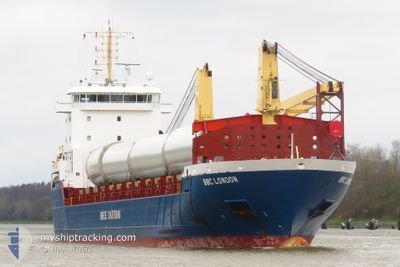
BBC LONDON
General Cargo
Current Trip
| Time Travelled | 8 days |
|---|---|
| Remaining Time | 23 h, 53 mins |
| Distance Travelled | 2238.76 nm |
| Remaining Distance | 305.41 nm |
| AVG Speed | 11.4 Noeuds |
| MAX Speed | 16.1 Noeuds |
| AVG Wind | 10.2 knots |
| MAX Wind | 32 knots |
| MIN Temp | 3.2°C / 37.76°F |
| MAX Temp | 18.4°C / 65.12°F |
| Tirant d eau | 7.1 m |
| Position reçue | 1 d depuis |
Current Position
| Longitude | 0.20072° |
|---|---|
| Latitude | 36.72981° |
| Etat | Under way using engine |
| Vitesse | 11.1 Noeuds |
| Parcours | 78° |
| Zone | Mediterranean Sea - Western Basin |
| Station | T-AIS |
| Position reçue | 1 d depuis |
Info
Information
The current position of BBC LONDON is in Mediterranean Sea - Western Basin with coordinates 36.72981° / 0.20072° as reported on 2024-04-24 06:58 by AIS to our vessel tracker app. The vessel's current speed is 11.1 Noeuds and is heading at the port of RADES. The estimated time of arrival as calculated by MyShipTracking vessel tracking app is 2024-04-26 07:22 LT
The vessel BBC LONDON (IMO: 9513658, MMSI: 305690000) is a General Cargo that was built in 2011 ( 13 Age ). It's sailing under the flag of [AG] Antigua Barbuda.
In this page you can find informations about the vessels current position, last detected port calls, and current voyage information. If the vessels is not in coverage by AIS you will find the latest position.
The current position of BBC LONDON is detected by our AIS receivers and we are not responsible for the reliability of the data. The last position was recorded while the vessel was in Coverage by the Ais receivers of our vessel tracking app.
The current draught of BBC LONDON as reported by AIS is 7.1 meters
Weather
| Temperature | 14°C / 57.2°F |
|---|---|
| Wind Speed | 3 knots |
| Direction | 169° S |
| Pressure | 1013.1 hPa |
| Humidity | 57.2 % |
| Cloud Coverage | 12 % |
Featured Company
Last Port Calls
| Port | Arrival | Departure | Time In Port |
|---|---|---|---|
| 2024-04-16 02:04 | 2024-04-16 21:36 | 19 h | |
| 2024-04-09 14:41 | 2024-04-12 20:18 | 3 d | |
| 2024-04-05 21:04 | 2024-04-08 19:50 | 2 d | |
| 2024-03-24 08:35 | 2024-03-29 09:55 | 5 d | |
| 2024-03-21 22:10 | 2024-03-23 18:39 | 1 d | |
| 2024-03-16 02:09 | 2024-03-16 03:55 | 1 h | |
| 2024-03-08 07:42 | 2024-03-11 22:06 | 3 d | |
| 2024-03-06 05:21 | 2024-03-07 15:23 | 1 d | |
| 2024-02-20 09:31 | 2024-02-27 09:20 | 6 d | |
| 2024-02-16 05:54 | 2024-02-16 21:00 | 15 h |
Last Trips
| Origin | Departure | Destination | Arrival | Distance | |
|---|---|---|---|---|---|
| 2024-04-12 22:18 | 2024-04-16 04:04 | 786.42 nm | |||
| 2024-04-08 22:50 | 2024-04-09 16:41 | 199.16 nm | |||
| 2024-03-29 10:55 | 2024-04-06 00:04 | 1896.76 nm | |||
| 2024-03-23 19:39 | 2024-03-24 09:35 | 116.60 nm | |||
| 2024-03-16 04:55 | 2024-03-21 23:10 | 1015.17 nm | |||
| 2024-03-11 23:06 | 2024-03-16 03:09 | 948.09 nm | |||
| 2024-03-07 17:23 | 2024-03-08 08:42 | 122.49 nm | |||
| 2024-02-27 10:20 | 2024-03-06 07:21 | 1875.19 nm | |||
| 2024-02-16 21:00 | 2024-02-20 10:31 | 924.11 nm | |||
| 2024-02-09 19:15 | 2024-02-11 15:35 | 437.06 nm |
Events
| Heure | Evenement | Détails | Position/ Destination | Info |
|---|---|---|---|---|
| 2024-04-24 07:21 | Etat Changé | Default Under way using engine |
36.75006 / .33123
TN TUN
|
Vitesse: 11.1 kn Parcours: 78° |
| 2024-04-24 06:58 | Hors de la zone couverte |
36.72981 / .20072
Mediterranean Sea - Western Basin
TN TUN
|
Vitesse: 11.1 kn Parcours: 78° |
|
| 2024-04-24 00:45 | Detecté en mer | Algerian part of the Mediterranean Sea - Western Basin |
36.52232 / -1.11746
Mediterranean Sea - Western Basin
TN TUN
|
Vitesse: 10.8 kn Parcours: 80.1° |
| 2024-04-23 21:48 | Changement de zone | Spanish part of the Mediterranean Sea - Western Basin Spanish part of the Alboran Sea |
36.42433 / -1.74738
Mediterranean Sea - Western Basin
TN TUN
|
Vitesse: 11.3 kn Parcours: 78.3° |
| 2024-04-23 21:47 | Etat Changé | Under way using engine Default |
36.42368 / -1.75118
TN TUN
|
Vitesse: 11.8 kn Parcours: 81° |
| 2024-04-23 21:16 | Etat Changé | Default Under way using engine |
36.40765 / -1.86947
TN TUN
|
Vitesse: 11.5 kn Parcours: 79.7° |
| 2024-04-23 20:25 | Etat Changé | Under way using engine Default |
36.37372 / -2.09233
TN TUN
|
Vitesse: 11.4 kn Parcours: 80° |
| 2024-04-23 20:16 | Dans la zone couverte |
36.37372 / -2.09233
Alboran Sea
TN TUN
|
Vitesse: 11.4 kn Parcours: 77.9° |
|
| 2024-04-23 19:53 | Etat Changé | Default Under way using engine |
36.35832 / -2.19607
TN TUN
|
Vitesse: 10.8 kn Parcours: 82° |
| 2024-04-23 19:07 | Hors de la zone couverte |
36.29340 / -2.75573
Alboran Sea
TN TUN
|
Vitesse: 10.8 kn Parcours: 82° |