
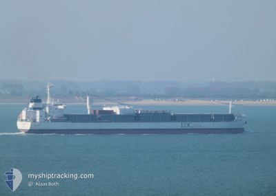
ATLANTIC ORCHARD
Cargo
Current Trip
| Time Travelled | 9 days |
|---|---|
| Remaining Time | 7 days |
| Distance Travelled | 2979.52 nm |
| Remaining Distance | 2487.31 nm |
| AVG Speed | 12.5 Noeuds |
| MAX Speed | 17.6 Noeuds |
| AVG Wind | 11.3 knots |
| MAX Wind | 25 knots |
| MIN Temp | 8.2°C / 46.76°F |
| MAX Temp | 25.4°C / 77.72°F |
| Tirant d eau | 7.1 m |
| Position reçue | 2 m depuis |
Current Position
| Longitude | -24.38115° |
|---|---|
| Latitude | 9.64271° |
| Etat | Under way using engine |
| Vitesse | 14.1 Noeuds |
| Parcours | 206.4° |
| Zone | North Atlantic Ocean |
| Station | T-AIS |
| Position reçue | 2 m depuis |
Info
Information
The current position of ATLANTIC ORCHARD is in North Atlantic Ocean with coordinates 9.64271° / -24.38115° as reported on 2024-04-19 00:07 by AIS to our vessel tracker app. The vessel's current speed is 14.1 Noeuds and is heading at the port of SANTOS. The estimated time of arrival as calculated by MyShipTracking vessel tracking app is 2024-04-26 08:04 LT
The vessel ATLANTIC ORCHARD (IMO: 9638159, MMSI: 636018592) is a Cargo It's sailing under the flag of [LR] Liberia.
In this page you can find informations about the vessels current position, last detected port calls, and current voyage information. If the vessels is not in coverage by AIS you will find the latest position.
The current position of ATLANTIC ORCHARD is detected by our AIS receivers and we are not responsible for the reliability of the data. The last position was recorded while the vessel was in Coverage by the Ais receivers of our vessel tracking app.
The current draught of ATLANTIC ORCHARD as reported by AIS is 7.1 meters
Weather
| Temperature | 25.3°C / 77.54°F |
|---|---|
| Wind Speed | 9 knots |
| Direction | 48° NE |
| Pressure | 1011.9 hPa |
| Humidity | 83.3 % |
| Cloud Coverage | 98 % |
Featured Company
Most Visited Ports (Last year)
| Port | Arrivals | |
|---|---|---|
| 10 | ||
| 8 | ||
| 1 |
Last Trips
| Origin | Departure | Destination | Arrival | Distance | |
|---|---|---|---|---|---|
| 2024-03-18 11:38 | 2024-04-06 22:48 | 5453.85 nm | |||
| 2024-03-13 22:20 | 2024-03-13 22:57 | 3.06 nm | |||
| 2024-02-26 13:36 | 2024-03-13 14:43 | 5103.37 nm | |||
| 2024-02-02 15:37 | 2024-02-17 20:00 | 5115.01 nm |
Events
| Heure | Evenement | Détails | Position/ Destination | Info |
|---|---|---|---|---|
| 2024-04-18 22:42 | Etat Changé | Under way using engine Default |
9.94949 / -24.23588
BR SSZ
|
Vitesse: 14.4 kn Parcours: 206° |
| 2024-04-18 22:36 | Etat Changé | Default Under way using engine |
9.96952 / -24.22633
BR SSZ
|
Vitesse: 14.4 kn Parcours: 204.2° |
| 2024-04-18 20:53 | Etat Changé | Under way using engine Default |
10.33844 / -24.05138
BR SSZ
|
Vitesse: 13.9 kn Parcours: 205° |
| 2024-04-18 20:44 | Etat Changé | Default Under way using engine |
10.36866 / -24.03697
BR SSZ
|
Vitesse: 14.1 kn Parcours: 206.1° |
| 2024-04-18 19:59 | Etat Changé | Under way using engine Default |
10.52937 / -23.96054
BR SSZ
|
Vitesse: 14.1 kn Parcours: 205° |
| 2024-04-18 19:55 | Etat Changé | Default Under way using engine |
10.54528 / -23.95319
BR SSZ
|
Vitesse: 14.2 kn Parcours: 205.2° |
| 2024-04-18 19:17 | Etat Changé | Under way using engine Default |
10.67860 / -23.88972
BR SSZ
|
Vitesse: 14 kn Parcours: 206° |
| 2024-04-18 18:56 | Etat Changé | Default Under way using engine |
10.75631 / -23.85288
BR SSZ
|
Vitesse: 13.8 kn Parcours: 204.4° |
| 2024-04-18 15:40 | Etat Changé | Under way using engine Default |
11.45061 / -23.52247
BR SSZ
|
Vitesse: 14 kn Parcours: 207° |
| 2024-04-18 15:36 | Etat Changé | Default Under way using engine |
11.46469 / -23.51580
BR SSZ
|
Vitesse: 13.8 kn Parcours: 204.9° |