
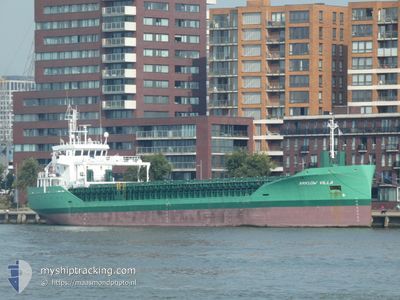
ARKLOW VILLA
Cargo
Current Trip
| Time Travelled | 4 days |
|---|---|
| Remaining Time | 3 days |
| Distance Travelled | 1048.51 nm |
| Remaining Distance | 877.19 nm |
| AVG Speed | 10.1 Noeuds |
| MAX Speed | 12 Noeuds |
| AVG Wind | 17.2 knots |
| MAX Wind | 30.6 knots |
| MIN Temp | 11.1°C / 51.98°F |
| MAX Temp | 23.1°C / 73.58°F |
| Tirant d eau | 6.6 m |
| Position reçue | 39 m depuis |
Current Position
| Longitude | -5.37688° |
|---|---|
| Latitude | 48.84600° |
| Etat | Under way using engine |
| Vitesse | 8.8 Noeuds |
| Parcours | 58.7° |
| Zone | Celtic Sea |
| Station | T-AIS |
| Position reçue | 39 m depuis |
Info
Information
The current position of ARKLOW VILLA is in Celtic Sea with coordinates 48.84600° / -5.37688° as reported on 2024-04-19 20:20 by AIS to our vessel tracker app. The vessel's current speed is 8.8 Noeuds and is heading at the port of BREVIK. The estimated time of arrival as calculated by MyShipTracking vessel tracking app is 2024-04-23 10:30 LT
The vessel ARKLOW VILLA (IMO: 9772618, MMSI: 244170690) is a Cargo It's sailing under the flag of [NL] Netherlands.
In this page you can find informations about the vessels current position, last detected port calls, and current voyage information. If the vessels is not in coverage by AIS you will find the latest position.
The current position of ARKLOW VILLA is detected by our AIS receivers and we are not responsible for the reliability of the data. The last position was recorded while the vessel was in Coverage by the Ais receivers of our vessel tracking app.
The current draught of ARKLOW VILLA as reported by AIS is 6.6 meters
Weather
| Temperature | 12.4°C / 54.32°F |
|---|---|
| Wind Speed | 15 knots |
| Direction | 13° NNE |
| Pressure | 1024.7 hPa |
| Humidity | 76.2 % |
| Cloud Coverage | 53 % |
Featured Company
Last Port Calls
| Port | Arrival | Departure | Time In Port |
|---|---|---|---|
| 2024-04-13 15:34 | 2024-04-15 16:08 | 2 d | |
| 2024-04-09 18:35 | 2024-04-10 22:20 | 1 d | |
| 2024-04-02 03:34 | 2024-04-05 21:58 | 3 d | |
| 2024-03-25 00:22 | 2024-03-27 16:00 | 2 d | |
| 2024-03-17 21:37 | 2024-03-21 23:43 | 4 d | |
| 2024-03-12 19:51 | 2024-03-13 22:14 | 1 d | |
| 2024-03-08 19:03 | 2024-03-09 20:17 | 1 d | |
| 2024-03-05 04:55 | 2024-03-07 12:19 | 2 d | |
| 2024-03-02 08:42 | 2024-03-02 10:02 | 1 h | |
| 2024-02-29 05:08 | 2024-03-02 08:15 | 2 d |
Last Trips
| Origin | Departure | Destination | Arrival | Distance | |
|---|---|---|---|---|---|
| 2024-04-11 00:20 | 2024-04-13 15:34 | 775.01 nm | |||
| 2024-04-05 22:58 | 2024-04-09 20:35 | 580.46 nm | |||
| 2024-03-27 16:00 | 2024-04-02 04:34 | 297.51 nm | |||
| 2024-03-22 00:43 | 2024-03-25 00:22 | 750.61 nm | |||
| 2024-03-13 23:14 | 2024-03-17 22:37 | 790.07 nm | |||
| 2024-03-09 20:17 | 2024-03-12 20:51 | 607.53 nm | |||
| 2024-03-07 12:19 | 2024-03-08 19:03 | 303.53 nm | |||
| 2024-03-02 11:02 | 2024-03-05 04:55 | 699.90 nm | |||
| 2024-03-02 09:15 | 2024-03-02 09:42 | 1.85 nm | |||
| 2024-02-23 18:09 | 2024-02-29 06:08 | 183.76 nm |
Events
| Heure | Evenement | Détails | Position/ Destination | Info |
|---|---|---|---|---|
| 2024-04-19 20:25 | Etat Changé | Default Under way using engine |
48.85166 / -5.36167
NOBVK
|
Vitesse: 8.8 kn Parcours: 58.7° |
| 2024-04-19 20:20 | Etat Changé | Under way using engine Default |
48.84600 / -5.37688
NOBVK
|
Vitesse: 8.8 kn Parcours: 59° |
| 2024-04-19 20:20 | Dans la zone couverte |
48.84600 / -5.37688
Celtic Sea
NOBVK
|
Vitesse: 8.8 kn Parcours: 58.7° |
|
| 2024-04-19 17:21 | Etat Changé | Default Under way using engine |
48.46167 / -5.82500
NOBVK
|
Vitesse: 10.6 kn Parcours: 26.4° |
| 2024-04-19 17:10 | Changement de zone | French part of the Celtic Sea Portuguese part of the North Atlantic Ocean |
48.43235 / -5.84775
Celtic Sea
NOBVK
|
Vitesse: 10.6 kn Parcours: 26.4° |
| 2024-04-19 17:10 | Etat Changé | Under way using engine Default |
48.43235 / -5.84775
NOBVK
|
Vitesse: 10.6 kn Parcours: 28° |
| 2024-04-19 17:10 | Hors de la zone couverte |
48.43235 / -5.84775
Celtic Sea
NOBVK
|
Vitesse: 10.6 kn Parcours: 26.4° |
|
| 2024-04-19 17:03 | Dans la zone couverte |
48.43235 / -5.84775
Celtic Sea
NOBVK
|
Vitesse: 10.6 kn Parcours: 26.4° |
|
| 2024-04-17 21:54 | Etat Changé | Default Under way using engine |
41.49833 / -9.80833
NOBVK
|
Vitesse: 8.8 kn Parcours: 359.7° |
| 2024-04-17 21:47 | Hors de la zone couverte |
41.48268 / -9.80867
North Atlantic Ocean
NOBVK
|
Vitesse: 8.8 kn Parcours: 359.7° |