
ANNA
General Cargo
Current Trip
SG SIN PEBGA
| Time Travelled | 7 days |
|---|---|
| Remaining Time | --- |
| Distance Travelled | 1858.02 nm |
| Remaining Distance | --- |
| AVG Speed | 13.9 Noeuds |
| MAX Speed | 17 Noeuds |
| AVG Wind | 14.6 knots |
| MAX Wind | 27 knots |
| MIN Temp | 15.7°C / 60.26°F |
| MAX Temp | 28.4°C / 83.12°F |
| Tirant d eau | 7.3 m |
| Position reçue | 9 h, 31 m depuis |
Current Position
| Longitude | --- |
|---|---|
| Latitude | --- |
| Etat | Under way using engine |
| Vitesse | 15.3 Noeuds |
| Parcours | 284.9° |
| Zone | Singapore Strait |
| Station | T-AIS |
| Position reçue | 9 h, 31 m depuis |
Info
Information
The current position of ANNA is in Singapore Strait with coordinates 1.20677° / 103.53798° as reported on 2025-02-27 02:06 by AIS to our vessel tracker app. The vessel's current speed is 15.3 Noeuds
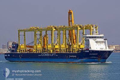
The vessel ANNA (IMO: 9501887, MMSI: 305544000) is a General Cargo that was built in 2010 ( 15 Age ). It's sailing under the flag of [AG] Antigua Barbuda.
In this page you can find informations about the vessels current position, last detected port calls, and current voyage information. If the vessels is not in coverage by AIS you will find the latest position.
The current position of ANNA is detected by our AIS receivers and we are not responsible for the reliability of the data. The last position was recorded while the vessel was in Coverage by the Ais receivers of our vessel tracking app.
The current draught of ANNA as reported by AIS is 7.3 meters
Weather
| Temperature | 26.8°C / 80.24°F |
|---|---|
| Wind Speed | 9 knots |
| Direction | 268° W |
| Pressure | 1009.7 hPa |
| Humidity | 82.4 % |
| Cloud Coverage | 41 % |
Featured Company
Last Port Calls
| Port | Arrival | Departure | Time In Port |
|---|---|---|---|
| 2025-02-20 02:37 | 2025-02-20 10:33 | 7 h | |
| 2025-02-12 22:08 | 2025-02-15 10:24 | 2 d | |
| 2025-02-09 06:05 | 2025-02-12 06:04 | 2 d | |
| 2025-01-26 03:17 | 2025-01-29 05:57 | 3 d | |
| 2025-01-10 11:33 | 2025-01-13 02:33 | 2 d | |
| 2024-12-02 08:48 |
Most Visited Ports (Last year)
| Port | Arrivals | |
|---|---|---|
| 2 | ||
| 2 | ||
| 2 | ||
| 1 | ||
| 1 | ||
| 1 |
Last Trips
| Origin | Departure | Destination | Arrival | Distance | |
|---|---|---|---|---|---|
| 2025-02-15 19:24 | 2025-02-20 10:37 | 821.95 nm | |||
| 2025-02-12 15:04 | 2025-02-13 07:08 | 154.35 nm | |||
| 2025-01-29 13:57 | 2025-02-09 15:05 | 743.22 nm | |||
| 2025-01-13 10:33 | 2025-01-26 11:17 | 2294.82 nm | |||
| 2024-12-02 16:48 | 2025-01-10 19:33 | 1623.01 nm |
Events
| Heure | Evenement | Détails | Position/ Destination | Info |
|---|---|---|---|---|
| 2025-02-27 02:13 | Etat Changé | Default Under way using engine |
1.21546 / 103.50754
SG SIN PEBGA
|
Vitesse: 15.3 kn Parcours: 284.9° |
| 2025-02-27 02:06 | Hors de la zone couverte |
1.20677 / 103.53798
Singapore Strait
|
Vitesse: 15.3 kn Parcours: 284.9° |
|
| 2025-02-27 02:02 | Etat Changé | Under way using engine Default |
1.20283 / 103.55255
SG SIN PEBGA
|
Vitesse: 15.8 kn Parcours: 285° |
| 2025-02-27 02:02 | Etat Changé | Default Under way using engine |
1.20182 / 103.55653
SG SIN PEBGA
|
Vitesse: 15.7 kn Parcours: 282.6° |
| 2025-02-27 01:55 | Changement de zone | Malaysian part of the Singapore Strait Indonesian part of the Singapore Strait |
1.19441 / 103.58416
Singapore Strait
|
Vitesse: 15.7 kn Parcours: 281.8° |
| 2025-02-27 01:21 | Changement de zone | Indonesian part of the Singapore Strait Singaporean part of the Singapore Strait |
1.14296 / 103.71755
Singapore Strait
|
Vitesse: 15.6 kn Parcours: 297.5° |
| 2025-02-27 00:13 | Démarrage | 2.04 nm, East of SINGAPORE |
1.26503 / 103.88762
SG SIN PEBGA
|
Vitesse: 3.1 kn Parcours: 129° |
| 2025-02-27 00:12 | Etat Changé | Under way using engine At anchor |
1.26573 / 103.88729
SG SIN PEBGA
|
Vitesse: 1.8 kn Parcours: 101° |
| 2025-02-26 16:38 | Tirant d'eau modifié | 7.3 7.5 |
1.26625 / 103.88546
SG SIN PEBGA
|
Vitesse: Parcours: 39° |
| 2025-02-25 19:43 | Etat Changé | At anchor Default |
1.26669 / 103.88523
SG SIN PEBGA
|
Vitesse: 0.3 kn Parcours: 57° |