
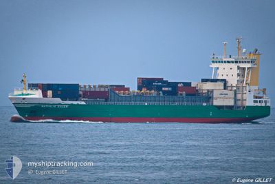
AMELIE BORCHARD
Container Ship
Current Trip
| Time Travelled | 1 day |
|---|---|
| Remaining Time | 12 h, 24 mins |
| Distance Travelled | 282.24 nm |
| Remaining Distance | 402.59 nm |
| AVG Speed | 13.7 Noeuds |
| MAX Speed | 14.4 Noeuds |
| AVG Wind | 15.4 knots |
| MAX Wind | 26.8 knots |
| MIN Temp | 9.4°C / 48.92°F |
| MAX Temp | 14.6°C / 58.28°F |
| Tirant d eau | 8 m |
| Position reçue | 17 h, 35 m depuis |
Current Position
| Longitude | --- |
|---|---|
| Latitude | --- |
| Etat | Under way using engine |
| Vitesse | 13.6 Noeuds |
| Parcours | 261° |
| Zone | Mediterranean Sea - Western Basin |
| Station | T-AIS |
| Position reçue | 17 h, 35 m depuis |
Info
Information
The current position of AMELIE BORCHARD is in Mediterranean Sea - Western Basin with coordinates 41.24248° / 8.67079° as reported on 2025-02-26 23:16 by AIS to our vessel tracker app. The vessel's current speed is 13.6 Noeuds and is heading at the port of CASTELLON. The estimated time of arrival as calculated by MyShipTracking vessel tracking app is 2025-02-28 05:16 LT
The vessel AMELIE BORCHARD (IMO: 9242560, MMSI: 305886000) is a Container Ship that was built in 2002 ( 23 Age ). It's sailing under the flag of [AG] Antigua Barbuda.
In this page you can find informations about the vessels current position, last detected port calls, and current voyage information. If the vessels is not in coverage by AIS you will find the latest position.
The current position of AMELIE BORCHARD is detected by our AIS receivers and we are not responsible for the reliability of the data. The last position was recorded while the vessel was in Coverage by the Ais receivers of our vessel tracking app.
The current draught of AMELIE BORCHARD as reported by AIS is 8 meters
Weather
| Temperature | 13.6°C / 56.48°F |
|---|---|
| Wind Speed | 16 knots |
| Direction | 301° WNW |
| Pressure | 1015.7 hPa |
| Humidity | 63.1 % |
| Cloud Coverage | 74 % |
Featured Company
Last Port Calls
| Port | Arrival | Departure | Time In Port |
|---|---|---|---|
| 2025-02-25 11:13 | 2025-02-26 02:21 | 15 h | |
| 2025-02-21 15:13 | 2025-02-22 12:41 | 21 h | |
| 2025-02-20 05:10 | 2025-02-20 13:49 | 8 h | |
| 2025-02-18 22:31 | 2025-02-19 16:22 | 17 h | |
| 2025-02-15 05:13 | 2025-02-15 11:47 | 6 h | |
| 2025-02-12 23:10 | 2025-02-13 08:17 | 9 h | |
| 2025-02-09 14:13 | 2025-02-10 11:13 | 21 h | |
| 2025-02-05 22:13 | 2025-02-07 00:47 | 1 d | |
| 2025-02-02 22:59 | 2025-02-03 12:43 | 13 h | |
| 2025-02-02 10:48 | 2025-02-02 21:29 | 10 h |
Last Trips
| Origin | Departure | Destination | Arrival | Distance | |
|---|---|---|---|---|---|
| 2025-02-22 14:41 | 2025-02-25 12:13 | 989.34 nm | |||
| 2025-02-20 15:49 | 2025-02-21 17:13 | 276.39 nm | |||
| 2025-02-19 18:22 | 2025-02-20 07:10 | 189.77 nm | |||
| 2025-02-15 12:47 | 2025-02-19 00:31 | 1195.36 nm | |||
| 2025-02-13 09:17 | 2025-02-15 06:13 | 686.51 nm | |||
| 2025-02-10 11:13 | 2025-02-13 00:10 | 921.21 nm | |||
| 2025-02-07 01:47 | 2025-02-09 14:13 | 967.47 nm | |||
| 2025-02-03 12:43 | 2025-02-05 23:13 | 726.13 nm | |||
| 2025-02-01 23:00 | 2025-02-02 22:59 | 123.95 nm | |||
| 2025-02-01 23:00 | 2025-02-02 10:48 | 104.28 nm |
Events
| Heure | Evenement | Détails | Position/ Destination | Info |
|---|---|---|---|---|
| 2025-02-26 23:16 | Hors de la zone couverte |
41.24248 / 8.67079
Mediterranean Sea - Western Basin
ESCAS
|
Vitesse: 13.6 kn Parcours: 261° |
|
| 2025-02-26 22:49 | Changement de zone | Italian part of the Mediterranean Sea - Western Basin French part of the Mediterranean Sea - Western Basin |
41.25922 / 8.79799
Mediterranean Sea - Western Basin
ESCAS
|
Vitesse: 14 kn Parcours: 261° |
| 2025-02-26 22:38 | Changement de zone | French part of the Mediterranean Sea - Western Basin Italian part of the Mediterranean Sea - Western Basin |
41.26581 / 8.85116
Mediterranean Sea - Western Basin
ESCAS
|
Vitesse: 13.4 kn Parcours: 261° |
| 2025-02-26 22:28 | Detecté en mer | Italian part of the Mediterranean Sea - Western Basin |
41.27171 / 8.89855
Mediterranean Sea - Western Basin
ESCAS
|
Vitesse: 13.1 kn Parcours: 259° |
| 2025-02-26 22:28 | Dans la zone couverte |
41.27171 / 8.89855
Mediterranean Sea - Western Basin
ESCAS
|
Vitesse: 13.1 kn Parcours: 259° |
|
| 2025-02-26 10:48 | Hors de la zone couverte |
40.84985 / 12.27180
Tyrrhenian Sea
ESCAS
|
Vitesse: 13.8 kn Parcours: 283° |
|
| 2025-02-26 10:35 | Etat Changé | Under way using engine Default |
40.83882 / 12.33764
ESCAS
|
Vitesse: 13.9 kn Parcours: 284° |
| 2025-02-26 10:35 | Dans la zone couverte |
40.83882 / 12.33764
Tyrrhenian Sea
ESCAS
|
Vitesse: 13.8 kn Parcours: 282° |
|
| 2025-02-26 08:56 | Hors de la zone couverte |
40.74925 / 12.82480
Tyrrhenian Sea
ESCAS
|
Vitesse: 13.8 kn Parcours: 284° |
|
| 2025-02-26 04:39 | Etat Changé | Under way using engine Default |
40.51873 / 14.10011
ESCAS
|
Vitesse: 14 kn Parcours: 284° |