
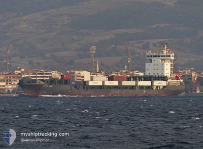
ADMIRAL MOON
Container Ship
Current Trip
| Time Travelled | 1 day |
|---|---|
| Remaining Time | --- |
| Distance Travelled | 233.21 nm |
| Remaining Distance | --- |
| AVG Speed | 7 Noeuds |
| MAX Speed | 16.2 Noeuds |
| AVG Wind | 23.8 knots |
| MAX Wind | 29.8 knots |
| MIN Temp | 14.7°C / 58.46°F |
| MAX Temp | 18°C / 64.4°F |
| Tirant d eau | 7.3 m |
| Position reçue | 1 m depuis |
Current Position
| Longitude | 28.47462° |
|---|---|
| Latitude | 36.32604° |
| Etat | Under way using engine |
| Vitesse | 8.2 Noeuds |
| Parcours | 138.6° |
| Zone | Mediterranean Sea - Eastern Basin |
| Station | T-AIS |
| Position reçue | 1 m depuis |
Info
Information
The current position of ADMIRAL MOON is in Mediterranean Sea - Eastern Basin with coordinates 36.32604° / 28.47462° as reported on 2024-04-20 14:49 by AIS to our vessel tracker app. The vessel's current speed is 8.2 Noeuds and is heading at the port of ASHDOD. The estimated time of arrival as calculated by MyShipTracking vessel tracking app is 2024-04-22 14:00 LT
The vessel ADMIRAL MOON (IMO: 9437220, MMSI: 636020582) is a Container Ship that was built in 2008 ( 16 Age ). It's sailing under the flag of [LR] Liberia.
In this page you can find informations about the vessels current position, last detected port calls, and current voyage information. If the vessels is not in coverage by AIS you will find the latest position.
The current position of ADMIRAL MOON is detected by our AIS receivers and we are not responsible for the reliability of the data. The last position was recorded while the vessel was in Coverage by the Ais receivers of our vessel tracking app.
The current draught of ADMIRAL MOON as reported by AIS is 7.3 meters
Weather
| Temperature | 18.1°C / 64.58°F |
|---|---|
| Wind Speed | 17 knots |
| Direction | 285° WNW |
| Pressure | 1008.8 hPa |
| Humidity | 62.9 % |
| Cloud Coverage | 30 % |
Featured Company
Last Port Calls
| Port | Arrival | Departure | Time In Port |
|---|---|---|---|
| 2024-04-18 12:24 | 2024-04-19 05:30 | 17 h | |
| 2024-04-11 22:21 | 2024-04-13 16:30 | 1 d | |
| 2024-04-05 16:45 | 2024-04-06 21:37 | 1 d | |
| 2024-04-02 02:57 | 2024-04-02 11:38 | 8 h | |
| 2024-03-29 14:09 | 2024-03-30 08:21 | 18 h | |
| 2024-03-25 14:55 | 2024-03-25 23:43 | 8 h | |
| 2024-03-12 00:01 | 2024-03-12 15:37 | 15 h | |
| 2024-03-09 11:25 | 2024-03-09 23:39 | 12 h | |
| 2024-03-07 21:09 | |||
| 2024-03-04 16:06 | 2024-03-05 08:38 | 16 h |
Most Visited Ports (Last year)
| Port | Arrivals | |
|---|---|---|
| 15 | ||
| 15 | ||
| 14 | ||
| 14 | ||
| 13 | ||
| 11 |
Last Trips
| Origin | Departure | Destination | Arrival | Distance | |
|---|---|---|---|---|---|
| 2024-04-13 19:30 | 2024-04-18 15:24 | 752.05 nm | |||
| 2024-04-07 00:37 | 2024-04-12 01:21 | 835.38 nm | |||
| 2024-04-02 14:38 | 2024-04-05 19:45 | 910.31 nm | |||
| 2024-03-30 10:21 | 2024-04-02 05:57 | 307.14 nm | |||
| 2024-03-26 02:43 | 2024-03-29 16:09 | 768.88 nm | |||
| 2024-03-12 18:37 | 2024-03-25 17:55 | 1128.17 nm | |||
| 2024-03-10 02:39 | 2024-03-12 03:01 | 336.14 nm | |||
| 2024-03-07 23:09 | 2024-03-09 14:25 | 518.06 nm | |||
| 2024-03-02 00:43 | 2024-03-04 18:06 | 915.89 nm | |||
| 2024-02-28 16:00 | 2024-03-01 18:10 | 533.78 nm |
Events
| Heure | Evenement | Détails | Position/ Destination | Info |
|---|---|---|---|---|
| 2024-04-20 12:47 | Changement de zone | Greek part of the Mediterranean Sea - Eastern Basin Greek part of the Aegean Sea |
36.48362 / 28.22128
Mediterranean Sea - Eastern Basin
ASHDOD
|
Vitesse: 6.8 kn Parcours: 84.8° |
| 2024-04-20 11:22 | Changement de zone | Greek part of the Aegean Sea Turkish part of the Aegean Sea |
36.47835 / 28.02526
Aegean Sea
ASHDOD
|
Vitesse: 6.9 kn Parcours: 91.5° |
| 2024-04-20 10:53 | Changement de zone | Turkish part of the Aegean Sea Greek part of the Aegean Sea |
36.48116 / 27.95651
Aegean Sea
ASHDOD
|
Vitesse: 6.5 kn Parcours: 94.5° |
| 2024-04-20 06:14 | Etat Changé | Under way using engine Default |
36.54292 / 27.21256
ASHDOD
|
Vitesse: 8.5 kn Parcours: 94° |
| 2024-04-20 05:14 | Etat Changé | Default Under way using engine |
36.56300 / 27.00309
ASHDOD
|
Vitesse: 15.7 kn Parcours: 113.7° |
| 2024-04-19 23:42 | Etat Changé | Under way using engine Default |
37.08745 / 26.67878
ASHDOD
|
Vitesse: 4 kn Parcours: -1° |
| 2024-04-19 23:15 | Etat Changé | Default Under way using engine |
37.12299 / 26.66592
ASHDOD
|
Vitesse: 4.6 kn Parcours: 166.9° |
| 2024-04-19 18:43 | Etat Changé | Under way using engine Default |
37.53095 / 26.61400
ASHDOD
|
Vitesse: 6 kn Parcours: 161° |
| 2024-04-19 18:22 | Etat Changé | Default Under way using engine |
37.56667 / 26.60500
ASHDOD
|
Vitesse: 6.3 kn Parcours: 173° |
| 2024-04-19 14:06 | Changement de destination | ASHDOD ALEXANDRIA |
37.90982 / 26.32989
ASHDOD
|
Vitesse: 5 kn Parcours: 139.3° |