
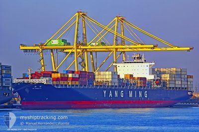
YM MOBILITY
Container Ship
Current Trip
| Time Travelled | 36 days |
|---|---|
| Remaining Time | --- |
| Distance Travelled | 1292.05 nm |
| Remaining Distance | --- |
| AVG Speed | 10.2 Knots |
| MAX Speed | 15.7 Knots |
| AVG Wind | 14 knots |
| MAX Wind | 26.9 knots |
| MIN Temp | 21.4°C / 70.52°F |
| MAX Temp | 31.2°C / 88.16°F |
| Dybgang | 10 m |
| Position Modtaget | 2024-08-04 00:03 |
Current Position
| Longitude | 120.43983° |
|---|---|
| Latitude | 25.44300° |
| Status | Under way using engine |
| Fart | 14.6 Knots |
| Kurs | 36.9° |
| Område | Eastern China Sea |
| Station | T-AIS |
| Position Modtaget | 2024-08-04 00:03 |
Info
Information
The current position of YM MOBILITY is in Eastern China Sea with coordinates 25.44300° / 120.43983° as reported on 2024-08-04 00:03 by AIS to our vessel tracker app. The vessel's current speed is 14.6 Knots
The vessel YM MOBILITY (IMO: 9457737, MMSI: 636014997) is a Container Ship that was built in 2011 ( 13 år gamle ). It's sailing under the flag of [LR] Liberia.
In this page you can find informations about the vessels current position, last detected port calls, and current voyage information. If the vessels is not in coverage by AIS you will find the latest position.
The current position of YM MOBILITY is detected by our AIS receivers and we are not responsible for the reliability of the data. The last position was recorded while the vessel was in Coverage by the Ais receivers of our vessel tracking app.
The current draught of YM MOBILITY as reported by AIS is 10 meters
Weather
| Temperature | 24.3°C / 75.74°F |
|---|---|
| Wind Speed | 9 knots |
| Direction | 42° NE |
| Pressure | 1013.3 hPa |
| Humidity | 78.9 % |
| Cloud Coverage | 25 % |
Featured Company
Last Trips
| Origin | Departure | Destination | Arrival | Distance | |
|---|---|---|---|---|---|
| 2024-08-07 01:04 | 2024-08-09 02:49 | 230.55 nm | |||
| 2024-07-22 16:29 | 2024-08-06 02:26 | 5795.66 nm | |||
| 2024-07-19 02:07 | 2024-07-21 18:23 | 636.67 nm | |||
| 2024-07-12 03:30 | 2024-07-14 17:42 | 629.65 nm | |||
| 2024-06-29 14:35 | 2024-07-10 08:06 | 3413.27 nm |
Events
| Tid | Hændelsen | Detaljer | Position / Dest | Info |
|---|---|---|---|---|
| 2024-09-22 08:01 | STOP Sejllads | 11.1 nm, South of ZHOUSHAN |
29.79533 / 122.11900
AEJEA>CNSHA
|
Fart: 0.2 kn Kurs: 259° |
| 2024-09-22 07:09 | START Sejllads | 8.76 nm, South West of ZHOUSHAN |
29.83333 / 122.13116
AEJEA>CNSHA
|
Fart: 4.6 kn Kurs: 10° |
| 2024-09-22 02:11 | STOP Sejllads | 8.84 nm, South West of ZHOUSHAN |
29.83433 / 122.12517
AEJEA>CNSHA
|
Fart: 0.3 kn Kurs: 85° |
| 2024-09-21 05:24 | START Sejllads |
29.81350 / 123.13650
AEJEA>CNSHA
|
Fart: 7.5 kn Kurs: 169° |
|
| 2024-09-20 18:42 | STOP Sejllads |
29.67516 / 123.25450
AEJEA>CNSHA
|
Fart: Kurs: 237° |
|
| 2024-09-20 15:28 | START Sejllads |
29.73683 / 122.75217
AEJEA>CNSHA
|
Fart: 6 kn Kurs: 196° |
|
| 2024-09-20 07:10 | STOP Sejllads |
29.73766 / 122.75750
AEJEA>CNSHA
|
Fart: Kurs: 300° |
|
| 2024-09-19 03:14 | START Sejllads |
26.30531 / 121.92358
AEJEA>CNSHA
|
Fart: 4.9 kn Kurs: 117° |
|
| 2024-09-18 20:06 | STOP Sejllads |
26.28650 / 121.95367
AEJEA>CNSHA
|
Fart: Kurs: 116° |
|
| 2024-09-18 01:05 | START Sejllads |
29.82083 / 122.79650
AEJEA>CNSHA
|
Fart: 5.5 kn Kurs: 81° |