
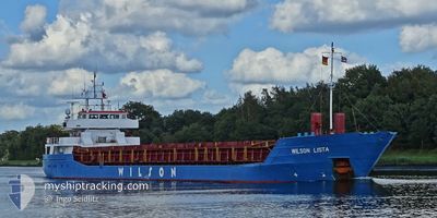
WILSON LISTA
General Cargo
Current Trip
| Time Travelled | 7 days |
|---|---|
| Remaining Time | --- |
| Distance Travelled | 792.83 nm |
| Remaining Distance | --- |
| AVG Speed | 8.2 Knots |
| MAX Speed | 12.9 Knots |
| AVG Wind | 20.9 knots |
| MAX Wind | 34.9 knots |
| MIN Temp | 6.8°C / 44.24°F |
| MAX Temp | 13.7°C / 56.66°F |
| Dybgang | 5.6 m |
| Position Modtaget | 3 d siden |
Current Position
| Longitude | -3.76507° |
|---|---|
| Latitude | 53.57388° |
| Status | Under way using engine |
| Fart | 0.9 Knots |
| Kurs | 275° |
| Område | Irish Sea and St. George's Channel |
| Station | T-AIS |
| Position Modtaget | 3 d siden |
Info
Information
The current position of WILSON LISTA is in Irish Sea and St. George's Channel with coordinates 53.57388° / -3.76507° as reported on 2024-04-15 05:31 by AIS to our vessel tracker app. The vessel's current speed is 0.9 Knots
The vessel WILSON LISTA (IMO: 9117208, MMSI: 314188000) is a General Cargo that was built in 1994 ( 30 år gamle ). It's sailing under the flag of [BB] Barbados.
In this page you can find informations about the vessels current position, last detected port calls, and current voyage information. If the vessels is not in coverage by AIS you will find the latest position.
The current position of WILSON LISTA is detected by our AIS receivers and we are not responsible for the reliability of the data. The last position was recorded while the vessel was in Coverage by the Ais receivers of our vessel tracking app.
The current draught of WILSON LISTA as reported by AIS is 5.6 meters
Weather
| Temperature | 9.8°C / 49.64°F |
|---|---|
| Wind Speed | 21 knots |
| Direction | 254° WSW |
| Pressure | 1017.8 hPa |
| Humidity | 90.5 % |
| Cloud Coverage | 100 % |
Featured Company
Last Port Calls
| Port | Arrival | Departure | Time In Port |
|---|---|---|---|
| 2024-04-14 00:57 | 2024-04-14 21:01 | 20 h | |
| 2024-04-13 17:15 | 2024-04-13 23:49 | 6 h | |
| 2024-04-09 19:22 | 2024-04-10 19:12 | 23 h | |
| 2024-04-08 06:14 | 2024-04-08 20:24 | 14 h | |
| 2024-03-20 16:09 | 2024-03-20 22:07 | 5 h | |
| 2024-03-18 15:10 | 2024-03-19 13:40 | 22 h | |
| 2024-03-15 07:34 | 2024-03-16 08:23 | 1 d | |
| 2024-03-10 20:53 | 2024-03-12 00:22 | 1 d | |
| 2024-02-27 00:31 | 2024-02-28 23:48 | 1 d | |
| 2024-02-25 06:09 | 2024-02-25 22:12 | 16 h |
Last Trips
| Origin | Departure | Destination | Arrival | Distance | |
|---|---|---|---|---|---|
| 2024-04-10 21:12 | 2024-04-14 01:57 | 683.70 nm | |||
| 2024-04-10 21:12 | 2024-04-13 18:15 | 673.64 nm | |||
| 2024-04-08 21:24 | 2024-04-09 21:22 | 206.35 nm | |||
| 2024-03-20 23:07 | 2024-04-08 07:14 | 1548.86 nm | |||
| 2024-03-19 14:40 | 2024-03-20 17:09 | 224.77 nm | |||
| 2024-03-16 08:23 | 2024-03-18 16:10 | 540.83 nm | |||
| 2024-03-12 00:22 | 2024-03-15 07:34 | 162.98 nm | |||
| 2024-02-28 23:48 | 2024-03-10 20:53 | 1442.84 nm | |||
| 2024-02-25 22:12 | 2024-02-27 00:31 | 252.72 nm | |||
| 2024-02-23 04:39 | 2024-02-25 06:09 | 214.03 nm |
Events
| Tid | Hændelsen | Detaljer | Position / Dest | Info |
|---|---|---|---|---|
| 2024-04-16 20:42 | STOP Sejllads | 5.52 nm, South of DOUGLAS |
54.05542 / -4.48321
ESFRO > GBLIV
|
Fart: 0.3 kn Kurs: 14° |
| 2024-04-16 05:25 | START Sejllads | 16.29 nm, North of CONWY |
53.55473 / -3.94764
ESFRO > GBLIV
|
Fart: 3.1 kn Kurs: 310° |
| 2024-04-16 01:13 | STOP Sejllads | 12.76 nm, North of CONWY |
53.50370 / -3.85464
ESFRO > GBLIV
|
Fart: 0.2 kn Kurs: 297° |
| 2024-04-15 05:36 | Status er ændret | Default Under way using engine |
53.57407 / -3.76735
ESFRO > GBLIV
|
Fart: 0.9 kn Kurs: 275° |
| 2024-04-15 05:31 | Status er ændret | Under way using engine Default |
53.57388 / -3.76507
ESFRO > GBLIV
|
Fart: 1.2 kn Kurs: 276° |
| 2024-04-15 05:31 | Udenfor Dækning |
53.57388 / -3.76507
Irish Sea and St. George's Channel
|
Fart: 0.9 kn Kurs: 295.4° |
|
| 2024-04-15 05:28 | Status er ændret | Default Under way using engine |
53.57375 / -3.76410
ESFRO > GBLIV
|
Fart: 0.9 kn Kurs: 272° |
| 2024-04-15 05:21 | Status er ændret | Under way using engine Default |
53.57296 / -3.76140
ESFRO > GBLIV
|
Fart: 2.1 kn Kurs: 272° |
| 2024-04-15 05:04 | Status er ændret | Default Under way using engine |
53.57116 / -3.74594
ESFRO > GBLIV
|
Fart: 2.3 kn Kurs: 275° |
| 2024-04-15 04:53 | Status er ændret | Under way using engine Default |
53.57026 / -3.73363
ESFRO > GBLIV
|
Fart: 2.6 kn Kurs: 272° |