
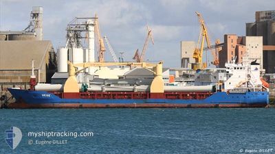
TITUS
General Cargo
Current Trip
| Trip Time | 23 days |
|---|---|
| Trip Distance | 4934.31 nm |
| AVG Speed | 9.6 Knots |
| MAX Speed | 11.4 Knots |
| Dybgang | 5.1 m |
| AVG Wind | 14 knots |
| MAX Wind | 31.3 knots |
| MIN Temp | 10.1°C / 50.18°F |
| MAX Temp | 18.5°C / 65.3°F |
| Position Modtaget | 3 m siden |
Current Position
| Longitude | 115.66080° |
|---|---|
| Latitude | -33.32391° |
| Status | Moored |
| Fart | |
| Kurs | 133° |
| Område | Indian Ocean |
| Station | T-AIS |
| Position Modtaget | 3 m siden |
Info
Information
The current position of TITUS is in Indian Ocean with coordinates -33.32391° / 115.66080° as reported on 2024-09-27 01:15 by AIS to our vessel tracker app. The vessel's current speed is 0 Knots and is currently inside the port of BUNBURY.
The vessel TITUS (IMO: 9195470, MMSI: 236325000) is a General Cargo that was built in 2006 ( 18 år gamle ). It's sailing under the flag of [GI] Gibraltar.
In this page you can find informations about the vessels current position, last detected port calls, and current voyage information. If the vessels is not in coverage by AIS you will find the latest position.
The current position of TITUS is detected by our AIS receivers and we are not responsible for the reliability of the data. The last position was recorded while the vessel was in Coverage by the Ais receivers of our vessel tracking app.
The current draught of TITUS as reported by AIS is 5.1 meters
Weather
| Temperature | 12.3°C / 54.14°F |
|---|---|
| Wind Speed | 10 knots |
| Direction | 221° SW |
| Pressure | 1010 hPa |
| Humidity | 85.2 % |
| Cloud Coverage | 100 % |
Featured Company
Events
| Tid | Hændelsen | Detaljer | Position / Dest | Info |
|---|---|---|---|---|
| 2024-09-26 11:20 | Status er ændret | Moored Under way using engine |
-33.32390 / 115.66082
[AU] BUNBURY
|
Fart: Kurs: 133° |
| 2024-09-26 10:52 | STOP Sejllads |
-33.32296 / 115.66107
[AU] BUNBURY
|
Fart: 0.3 kn Kurs: 156° |
|
| 2024-09-26 10:36 | Skibe i havn |
|
-33.30403 / 115.65247
[AU] BUNBURY
|
Fart: 6.6 kn Kurs: 179.7° |
| 2024-09-26 09:43 | START Sejllads | 6.67 nm, North West of BUNBURY |
-33.26490 / 115.53086
AU BUY
|
Fart: 3.1 kn Kurs: 82° |
| 2024-09-26 09:37 | Status er ændret | Under way using engine At anchor |
-33.26803 / 115.53046
AU BUY
|
Fart: 0.8 kn Kurs: 306° |
| 2024-09-26 08:33 | Status er ændret | At anchor Default |
-33.26818 / 115.53023
AU BUY
|
Fart: 0.2 kn Kurs: 270° |
| 2024-09-26 08:30 | Status er ændret | Default At anchor |
-33.26812 / 115.53019
AU BUY
|
Fart: 0.4 kn Kurs: 285° |
| 2024-09-26 06:33 | Status er ændret | At anchor Default |
-33.26951 / 115.52883
AU BUY
|
Fart: 0.3 kn Kurs: 313° |
| 2024-09-26 06:30 | Status er ændret | Default At anchor |
-33.26937 / 115.52918
AU BUY
|
Fart: 0.2 kn Kurs: 328° |
| 2024-09-26 06:18 | Status er ændret | At anchor Default |
-33.26950 / 115.52886
AU BUY
|
Fart: 0.2 kn Kurs: 316° |