
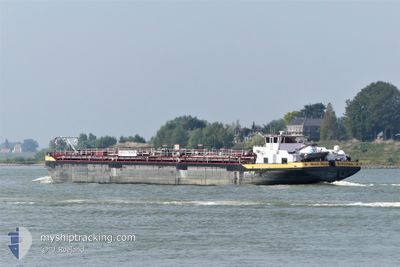
STOLT MAAS
Tanker
Current Trip
STRAENBRUCKE ILVESHE
| Time Travelled | 13 h, 36 mins |
|---|---|
| Remaining Time | --- |
| Distance Travelled | 68.59 nm |
| Remaining Distance | --- |
| AVG Speed | 5.7 Knots |
| MAX Speed | 9.2 Knots |
| AVG Wind | 10.8 knots |
| MAX Wind | 16.1 knots |
| MIN Temp | 4.8°C / 40.64°F |
| MAX Temp | 9.1°C / 48.38°F |
| Dybgang | 2.7 m |
| Position Modtaget | Nu |
Current Position
| Longitude | 6.70764° |
|---|---|
| Latitude | 51.49479° |
| Status | Under way using engine |
| Fart | 4.4 Knots |
| Kurs | 251.6° |
| Område | North Sea |
| Station | T-AIS |
| Position Modtaget | Nu |
Info
Information
The current position of STOLT MAAS is in North Sea with coordinates 51.49479° / 6.70764° as reported on 2024-04-20 12:26 by AIS to our vessel tracker app. The vessel's current speed is 4.4 Knots
The vessel STOLT MAAS (MMSI: 244660644) is a Tanker It's sailing under the flag of [NL] Netherlands.
In this page you can find informations about the vessels current position, last detected port calls, and current voyage information. If the vessels is not in coverage by AIS you will find the latest position.
The current position of STOLT MAAS is detected by our AIS receivers and we are not responsible for the reliability of the data. The last position was recorded while the vessel was in Coverage by the Ais receivers of our vessel tracking app.
The current draught of STOLT MAAS as reported by AIS is 2.7 meters
Weather
| Temperature | 8.7°C / 47.66°F |
|---|---|
| Wind Speed | 8 knots |
| Direction | 324° NW |
| Pressure | 1020.8 hPa |
| Humidity | 69.1 % |
| Cloud Coverage | 87 % |
Featured Company
Last Port Calls
| Port | Arrival | Departure | Time In Port |
|---|---|---|---|
| 2024-04-19 22:28 | 2024-04-19 22:50 | 21 m | |
| 2024-04-18 10:12 | 2024-04-19 18:34 | 1 d | |
| 2024-04-18 05:46 | 2024-04-18 06:39 | 52 m | |
| 2024-04-16 16:41 | 2024-04-17 19:47 | 1 d | |
| 2024-04-15 10:52 | 2024-04-16 08:21 | 21 h | |
| 2024-04-14 10:05 | 2024-04-15 03:39 | 17 h | |
| 2024-04-14 04:21 | 2024-04-14 04:29 | 8 m | |
| 2024-04-12 21:13 | 2024-04-14 02:31 | 1 d | |
| 2024-04-07 11:15 | 2024-04-12 13:52 | 5 d | |
| 2024-04-06 20:24 | 2024-04-07 08:45 | 12 h |
Most Visited Ports (Last year)
| Port | Arrivals | |
|---|---|---|
| 44 | ||
| 32 | ||
| 19 | ||
| 19 | ||
| 19 | ||
| 18 |
Last Trips
| Origin | Departure | Destination | Arrival | Distance | |
|---|---|---|---|---|---|
| 2024-04-19 20:34 | 2024-04-20 00:28 | 30.98 nm | |||
| 2024-04-18 08:39 | 2024-04-18 12:12 | 22.76 nm | |||
| 2024-04-17 21:47 | 2024-04-18 07:46 | 65.85 nm | |||
| 2024-04-16 10:21 | 2024-04-16 18:41 | 50.31 nm | |||
| 2024-04-15 05:39 | 2024-04-15 12:52 | 52.06 nm | |||
| 2024-04-14 06:29 | 2024-04-14 12:05 | 37.87 nm | |||
| 2024-04-14 04:31 | 2024-04-14 06:21 | 13.56 nm | |||
| 2024-04-12 15:52 | 2024-04-12 23:13 | 51.78 nm | |||
| 2024-04-07 10:45 | 2024-04-07 13:15 | 29.67 nm | |||
| 2024-04-06 19:30 | 2024-04-06 22:24 | 28.97 nm |
Events
| Tid | Hændelsen | Detaljer | Position / Dest | Info |
|---|---|---|---|---|
| 2024-04-20 10:03 | Indenfor Dækning |
51.60813 / 6.59118
North Sea
STRAENBRUCKE ILVESHE
|
Fart: 5.6 kn Kurs: 166.2° |
|
| 2024-04-20 05:51 | Udenfor Dækning |
51.82177 / 6.26220
North Sea
STRAENBRUCKE ILVESHE
|
Fart: 5.6 kn Kurs: 130.8° |
|
| 2024-04-20 00:01 | START Sejllads | 0.87 nm, North East of TIEL |
51.89917 / 5.45529
STRAENBRUCKE ILVESHE
|
Fart: 4.3 kn Kurs: 158.5° |
| 2024-04-19 23:46 | STOP Sejllads | 0.94 nm, North East of TIEL |
51.90102 / 5.45412
STRAENBRUCKE ILVESHE
|
Fart: 0.3 kn Kurs: 511° |
| 2024-04-19 23:40 | START Sejllads | 1.1 nm, North of TIEL |
51.90437 / 5.45207
STRAENBRUCKE ILVESHE
|
Fart: 3.7 kn Kurs: 161.3° |
| 2024-04-19 23:29 | STOP Sejllads | 1.2 nm, North of TIEL |
51.90631 / 5.45072
STRAENBRUCKE ILVESHE
|
Fart: 0.3 kn Kurs: 511° |
| 2024-04-19 22:50 | Afsejlet fra sidste havn |
|
51.95887 / 5.34499
STRAENBRUCKE ILVESHE
|
Fart: 7.5 kn Kurs: 116.4° |
| 2024-04-19 22:42 | START Sejllads |
51.96650 / 5.32221
[NL] WIJK BIJ DUURSTEDE
|
Fart: 3.9 kn Kurs: 115.2° |
|
| 2024-04-19 22:29 | STOP Sejllads |
51.96771 / 5.31788
[NL] WIJK BIJ DUURSTEDE
|
Fart: 0.3 kn Kurs: 511° |
|
| 2024-04-19 22:28 | Skibe i havn |
|
51.96771 / 5.31788
[NL] WIJK BIJ DUURSTEDE
|
Fart: 5.3 kn Kurs: 115.5° |