
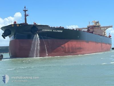
SONANGOL KULUMBIMBI
Tanker
Current Trip
| Time Travelled | 4 days |
|---|---|
| Remaining Time | 3 days |
| Distance Travelled | 763.23 nm |
| Remaining Distance | 1013.49 nm |
| AVG Speed | 7.5 Knots |
| MAX Speed | 11.3 Knots |
| AVG Wind | 29.7 knots |
| MAX Wind | 41 knots |
| MIN Temp | 9°C / 48.2°F |
| MAX Temp | 16.7°C / 62.06°F |
| Dybgang | 9.2 m |
| Position Modtaget | 4 d siden |
Current Position
| Longitude | --- |
|---|---|
| Latitude | --- |
| Status | Under way using engine |
| Fart | 7.9 Knots |
| Kurs | 217° |
| Område | Celtic Sea |
| Station | T-AIS |
| Position Modtaget | 4 d siden |
Info
Information
The current position of SONANGOL KULUMBIMBI is in Celtic Sea with coordinates 51.47800° / -5.43483° as reported on 2025-12-05 08:33 by AIS to our vessel tracker app. The vessel's current speed is 7.9 Knots and is heading at the port of LAS PALMAS. The estimated time of arrival as calculated by MyShipTracking vessel tracking app is 2025-12-13 09:47 LT
The vessel SONANGOL KULUMBIMBI (IMO: 9938482, MMSI: 311001272) is a Tanker It's sailing under the flag of [BS] Bahamas.
In this page you can find informations about the vessels current position, last detected port calls, and current voyage information. If the vessels is not in coverage by AIS you will find the latest position.
The current position of SONANGOL KULUMBIMBI is detected by our AIS receivers and we are not responsible for the reliability of the data. The last position was recorded while the vessel was in Coverage by the Ais receivers of our vessel tracking app.
The current draught of SONANGOL KULUMBIMBI as reported by AIS is 9.2 meters
Weather
| Temperature | 16°C / 60.8°F |
|---|---|
| Wind Speed | 14 knots |
| Direction | 275° W |
| Pressure | 1015.8 hPa |
| Humidity | 72.6 % |
| Cloud Coverage | 75 % |
Featured Company
Last Port Calls
| Port | Arrival | Departure | Time In Port |
|---|---|---|---|
| 2025-12-02 15:49 | 2025-12-05 06:28 | 2 d | |
| 2025-11-07 11:17 | 2025-11-09 08:25 | 1 d | |
| 2025-10-21 12:38 | 2025-10-22 15:29 | 1 d | |
| 2025-10-18 16:12 | 2025-10-20 06:05 | 1 d |
Last Trips
| Origin | Departure | Destination | Arrival | Distance | |
|---|---|---|---|---|---|
| 2025-11-09 08:25 | 2025-12-02 15:49 | 5280.51 nm | |||
| 2025-10-22 15:29 | 2025-11-07 11:17 | 5039.59 nm | |||
| 2025-10-20 06:05 | 2025-10-21 12:38 | 284.87 nm | |||
| 2025-09-28 16:15 | 2025-10-18 16:12 | 4859.54 nm |
Events
| Tid | Hændelsen | Detaljer | Position / Dest | Info |
|---|---|---|---|---|
| 2025-12-05 08:35 | Status er ændret | Default Under way using engine |
51.47522 / -5.43814
ESLPA
|
Fart: 7.9 kn Kurs: 217° |
| 2025-12-05 08:33 | Udenfor Dækning |
51.47800 / -5.43483
Celtic Sea
ESLPA
|
Fart: 7.9 kn Kurs: 217° |
|
| 2025-12-05 06:28 | Afsejlet fra sidste havn |
|
51.69660 / -5.09396
ESLPA
|
Fart: 7.6 kn Kurs: 258° |
| 2025-12-05 06:11 | START Sejllads |
51.70033 / -5.04363
[GB] PEMBROKE
|
Fart: 3.1 kn Kurs: 255° |
|
| 2025-12-05 05:57 | Status er ændret | Under way using engine Moored |
51.69816 / -5.04230
[GB] PEMBROKE
|
Fart: Kurs: 86° |
| 2025-12-05 04:20 | Status er ændret | Moored Default |
51.69805 / -5.04235
[GB] PEMBROKE
|
Fart: Kurs: 85° |
| 2025-12-05 04:14 | Status er ændret | Default Moored |
51.69808 / -5.04230
[GB] PEMBROKE
|
Fart: 0.1 kn Kurs: 85° |
| 2025-12-05 03:44 | Dybgangen er ændret | 9.2 15 |
51.69805 / -5.04230
[GB] PEMBROKE
|
Fart: Kurs: 85° |
| 2025-12-05 03:44 | Destination er ændret | ESLPA GBMLF |
51.69805 / -5.04230
[GB] PEMBROKE
|
Fart: Kurs: 85° |
| 2025-12-05 03:44 | ETA er ændret | 2025/12/09 06:00 2026/11/26 23:00 |
51.69805 / -5.04230
[GB] PEMBROKE
|
Fart: Kurs: 85° |