
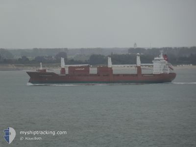
SLUISGRACHT
General Cargo
Current Trip
| Time Travelled | 3 days |
|---|---|
| Remaining Time | --- |
| Distance Travelled | 1428.03 nm |
| Remaining Distance | --- |
| AVG Speed | 15.7 Knots |
| MAX Speed | 17.9 Knots |
| AVG Wind | 14.3 knots |
| MAX Wind | 29.8 knots |
| MIN Temp | 3.1°C / 37.58°F |
| MAX Temp | 12.6°C / 54.68°F |
| Dybgang | 7.3 m |
| Position Modtaget | 1 m siden |
Current Position
| Longitude | 12.14936° |
|---|---|
| Latitude | 54.40879° |
| Status | Under way using engine |
| Fart | 16.5 Knots |
| Kurs | 61.8° |
| Område | Baltic Sea |
| Station | T-AIS |
| Position Modtaget | 1 m siden |
Info
Information
The current position of SLUISGRACHT is in Baltic Sea with coordinates 54.40879° / 12.14936° as reported on 2024-04-20 12:30 by AIS to our vessel tracker app. The vessel's current speed is 16.5 Knots and is heading at the port of PORI. The estimated time of arrival as calculated by MyShipTracking vessel tracking app is 2024-04-21 19:00 LT
The vessel SLUISGRACHT (IMO: 9202522, MMSI: 244903000) is a General Cargo that was built in 2001 ( 23 år gamle ). It's sailing under the flag of [NL] Netherlands.
In this page you can find informations about the vessels current position, last detected port calls, and current voyage information. If the vessels is not in coverage by AIS you will find the latest position.
The current position of SLUISGRACHT is detected by our AIS receivers and we are not responsible for the reliability of the data. The last position was recorded while the vessel was in Coverage by the Ais receivers of our vessel tracking app.
The current draught of SLUISGRACHT as reported by AIS is 7.3 meters
Weather
| Temperature | 4.2°C / 39.56°F |
|---|---|
| Wind Speed | 4 knots |
| Direction | 43° NE |
| Pressure | 1017.8 hPa |
| Humidity | 56.4 % |
| Cloud Coverage | 48 % |
Featured Company
Last Port Calls
| Port | Arrival | Departure | Time In Port |
|---|---|---|---|
| 2024-04-15 05:36 | 2024-04-16 19:29 | 1 d | |
| 2024-04-03 21:27 | 2024-04-05 18:15 | 1 d | |
| 2024-03-19 21:24 | 2024-03-22 15:33 | 2 d | |
| 2024-03-04 02:17 | 2024-03-06 01:40 | 1 d | |
| 2024-02-27 20:39 | 2024-03-02 00:38 | 3 d | |
| 2024-02-15 16:28 | 2024-02-16 11:55 | 19 h | |
| 2024-02-11 22:47 | 2024-02-13 13:21 | 1 d | |
| 2024-02-06 22:02 | 2024-02-08 17:22 | 1 d | |
| 2024-02-04 20:12 | 2024-02-06 09:07 | 1 d |
Last Trips
| Origin | Departure | Destination | Arrival | Distance | |
|---|---|---|---|---|---|
| 2024-04-05 20:15 | 2024-04-15 07:36 | 2024.61 nm | |||
| 2024-03-22 11:33 | 2024-04-03 23:27 | 3351.64 nm | |||
| 2024-03-05 20:40 | 2024-03-19 17:24 | 2993.89 nm | |||
| 2024-03-01 19:38 | 2024-03-03 21:17 | 712.96 nm | |||
| 2024-02-16 11:55 | 2024-02-27 15:39 | 3753.69 nm | |||
| 2024-02-13 14:21 | 2024-02-15 16:28 | 863.83 nm | |||
| 2024-02-08 18:22 | 2024-02-11 23:47 | 1275.72 nm | |||
| 2024-02-06 11:07 | 2024-02-06 23:02 | 153.72 nm | |||
| 2024-01-21 11:19 | 2024-02-04 22:12 | 5278.42 nm |
Events
| Tid | Hændelsen | Detaljer | Position / Dest | Info |
|---|---|---|---|---|
| 2024-04-20 12:23 | Ændre havområde | German part of the Baltic Sea Danish part of the Baltic Sea |
54.40422 / 12.09356
Baltic Sea
PORI
|
Fart: 17 kn Kurs: 84.8° |
| 2024-04-20 10:56 | Ændre havområde | Danish part of the Baltic Sea German part of the Baltic Sea |
54.50737 / 11.43579
Baltic Sea
PORI
|
Fart: 16.8 kn Kurs: 115.8° |
| 2024-04-20 09:56 | Ændre havområde | German part of the Baltic Sea Danish part of the Baltic Sea |
54.63519 / 11.01102
Baltic Sea
PORI
|
Fart: 16.2 kn Kurs: 125.5° |
| 2024-04-20 09:23 | Ændre havområde | Danish part of the Baltic Sea Danish part of the Kattegat |
54.73466 / 10.84936
Baltic Sea
PORI
|
Fart: 16 kn Kurs: 183.1° |
| 2024-04-19 20:29 | Ændre havområde | Danish part of the Kattegat Danish part of the Skaggerak |
57.77897 / 10.88699
Kattegat
PORI
|
Fart: 16.1 kn Kurs: 136.9° |
| 2024-04-19 15:05 | Ændre havområde | Danish part of the Skaggerak Danish part of the North Sea |
57.18739 / 8.51292
Skaggerak
PORI
|
Fart: 16.4 kn Kurs: 56° |
| 2024-04-19 07:17 | Fundet i havområde | Danish part of the North Sea |
55.55975 / 6.46028
North Sea
PORI
|
Fart: 13.8 kn Kurs: 25.8° |
| 2024-04-19 07:17 | Indenfor Dækning |
55.55975 / 6.46028
North Sea
PORI
|
Fart: 13.8 kn Kurs: 25.8° |
|
| 2024-04-18 22:53 | Udenfor Dækning |
53.62813 / 4.85059
North Sea
PORI
|
Fart: 16 kn Kurs: 22.7° |
|
| 2024-04-18 16:47 | Indenfor Dækning |
52.27515 / 3.35883
North Sea
PORI
|
Fart: 16.5 kn Kurs: 44.2° |