
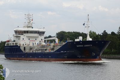
SARNIA LIBERTY
Oil Products Tanker
Current Trip
| Time Travelled | 4 days |
|---|---|
| Remaining Time | --- |
| Distance Travelled | 558.35 nm |
| Remaining Distance | --- |
| AVG Speed | 8.3 Knots |
| MAX Speed | 13.8 Knots |
| AVG Wind | 18.5 knots |
| MAX Wind | 38 knots |
| MIN Temp | 3.1°C / 37.58°F |
| MAX Temp | 8.7°C / 47.66°F |
| Dybgang | 4.5 m |
| Position Modtaget | 13 h, 47 m siden |
Current Position
| Longitude | --- |
|---|---|
| Latitude | --- |
| Status | Under way using engine |
| Fart | 10.9 Knots |
| Kurs | 145.1° |
| Område | Irish Sea and St. George's Channel |
| Station | T-AIS |
| Position Modtaget | 13 h, 47 m siden |
Info
Information
The current position of SARNIA LIBERTY is in Irish Sea and St. George's Channel with coordinates 53.98698° / -4.86745° as reported on 2025-02-26 23:11 by AIS to our vessel tracker app. The vessel's current speed is 10.9 Knots
The vessel SARNIA LIBERTY (IMO: 9322176, MMSI: 236399000) is a Oil Products Tanker that was built in 2008 ( 17 år gamle ). It's sailing under the flag of [GI] Gibraltar.
In this page you can find informations about the vessels current position, last detected port calls, and current voyage information. If the vessels is not in coverage by AIS you will find the latest position.
The current position of SARNIA LIBERTY is detected by our AIS receivers and we are not responsible for the reliability of the data. The last position was recorded while the vessel was in Coverage by the Ais receivers of our vessel tracking app.
The current draught of SARNIA LIBERTY as reported by AIS is 4.5 meters
Weather
| Temperature | 7.9°C / 46.22°F |
|---|---|
| Wind Speed | 9 knots |
| Direction | 320° NW |
| Pressure | 1023.4 hPa |
| Humidity | 71.3 % |
| Cloud Coverage | 4 % |
Featured Company
Last Port Calls
| Port | Arrival | Departure | Time In Port |
|---|---|---|---|
| 2025-02-22 14:51 | 2025-02-22 20:11 | 5 h | |
| 2025-02-20 04:11 | 2025-02-20 16:30 | 12 h | |
| 2025-02-15 14:17 | 2025-02-17 18:22 | 2 d | |
| 2025-02-11 07:24 | 2025-02-12 00:19 | 16 h | |
| 2025-02-06 21:56 | 2025-02-07 21:03 | 23 h | |
| 2025-02-04 20:18 | 2025-02-05 08:31 | 12 h | |
| 2025-02-03 05:12 | 2025-02-03 16:26 | 11 h | |
| 2025-02-01 15:08 | 2025-02-02 05:58 | 14 h | |
| 2025-01-27 21:13 | 2025-01-28 21:17 | 1 d | |
| 2025-01-25 23:00 | 2025-01-26 11:48 | 12 h |
Most Visited Ports (Last year)
| Port | Arrivals | |
|---|---|---|
| 28 | ||
| 12 | ||
| 8 | ||
| 7 | ||
| 6 | ||
| 5 |
Last Trips
| Origin | Departure | Destination | Arrival | Distance | |
|---|---|---|---|---|---|
| 2025-02-20 16:30 | 2025-02-22 14:51 | 231.30 nm | |||
| 2025-02-17 18:22 | 2025-02-20 04:11 | 535.31 nm | |||
| 2025-02-12 00:19 | 2025-02-15 14:17 | 653.88 nm | |||
| 2025-02-07 21:03 | 2025-02-11 07:24 | 762.96 nm | |||
| 2025-02-05 08:31 | 2025-02-06 21:56 | 253.01 nm | |||
| 2025-02-03 16:26 | 2025-02-04 20:18 | 141.64 nm | |||
| 2025-02-02 05:58 | 2025-02-03 05:12 | 234.18 nm | |||
| 2025-01-28 21:17 | 2025-02-01 15:08 | 163.81 nm | |||
| 2025-01-26 11:48 | 2025-01-27 21:13 | 110.68 nm | |||
| 2025-01-22 18:31 | 2025-01-25 23:00 | 123.27 nm |
Events
| Tid | Hændelsen | Detaljer | Position / Dest | Info |
|---|---|---|---|---|
| 2025-02-27 03:50 | STOP Sejllads | 13.39 nm, West of CONWY |
53.37116 / -4.18591
GBSOW
|
Fart: 0.3 kn Kurs: 37° |
| 2025-02-26 23:20 | Status er ændret | Default Under way using engine |
53.96674 / -4.84177
GBSOW
|
Fart: 10.9 kn Kurs: 145.1° |
| 2025-02-26 23:11 | Udenfor Dækning |
53.98698 / -4.86745
Irish Sea and St. George's Channel
GBSOW
|
Fart: 10.9 kn Kurs: 145.1° |
|
| 2025-02-26 23:09 | Status er ændret | Under way using engine Default |
53.99307 / -4.87491
GBSOW
|
Fart: 10.8 kn Kurs: 144° |
| 2025-02-26 23:04 | Status er ændret | Default Under way using engine |
54.00524 / -4.89028
GBSOW
|
Fart: 10.7 kn Kurs: 143.6° |
| 2025-02-26 22:57 | Status er ændret | Under way using engine Default |
54.02103 / -4.91033
GBSOW
|
Fart: 10.7 kn Kurs: 142° |
| 2025-02-26 22:35 | Status er ændret | Default Under way using engine |
54.07632 / -4.96723
GBSOW
|
Fart: 11 kn Kurs: 152.2° |
| 2025-02-26 22:28 | Status er ændret | Under way using engine Default |
54.09741 / -4.98710
GBSOW
|
Fart: 11 kn Kurs: 153° |
| 2025-02-26 21:56 | Status er ændret | Default Under way using engine |
54.18353 / -5.07006
GBSOW
|
Fart: 11.2 kn Kurs: 169.9° |
| 2025-02-26 20:22 | Ændre havområde | United Kingdom part of the Irish Sea and St. George's Channel United Kingdom part of the Inner Seas off the West Coast of Scotland |
54.46325 / -5.24650
Irish Sea and St. George's Channel
GBSOW
|
Fart: 12.1 kn Kurs: 155.5° |