
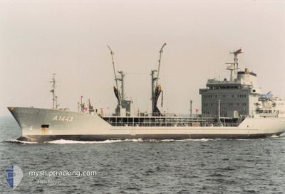
NATO WARSHIP A1443
Military ops
Current Trip
UNDEFINED .
| Time Travelled | 15 days |
|---|---|
| Remaining Time | --- |
| Distance Travelled | 1201.50 nm |
| Remaining Distance | --- |
| AVG Speed | 12.3 Knots |
| MAX Speed | 16.2 Knots |
| AVG Wind | 13.9 knots |
| MAX Wind | 32 knots |
| MIN Temp | 1°C / 33.8°F |
| MAX Temp | 9.4°C / 48.92°F |
| Dybgang | 7.3 m |
| Position Modtaget | 1 d siden |
Current Position
| Longitude | 24.70883° |
|---|---|
| Latitude | 59.82418° |
| Status | Under way using engine |
| Fart | 13.1 Knots |
| Kurs | 256.6° |
| Område | Gulf of Finland |
| Station | T-AIS |
| Position Modtaget | 1 d siden |
Info
Information
The current position of NATO WARSHIP A1443 is in Gulf of Finland with coordinates 59.82418° / 24.70883° as reported on 2024-04-15 16:01 by AIS to our vessel tracker app. The vessel's current speed is 13.1 Knots
The vessel NATO WARSHIP A1443 (MMSI: 211211840) is a Military ops It's sailing under the flag of [DE] Germany.
In this page you can find informations about the vessels current position, last detected port calls, and current voyage information. If the vessels is not in coverage by AIS you will find the latest position.
The current position of NATO WARSHIP A1443 is detected by our AIS receivers and we are not responsible for the reliability of the data. The last position was recorded while the vessel was in Coverage by the Ais receivers of our vessel tracking app.
The current draught of NATO WARSHIP A1443 as reported by AIS is 7.3 meters
Weather
| Temperature | 4°C / 39.2°F |
|---|---|
| Wind Speed | 11 knots |
| Direction | 302° WNW |
| Pressure | 997.5 hPa |
| Humidity | 84.7 % |
| Cloud Coverage | 100 % |
Featured Company
Last Port Calls
| Port | Arrival | Departure | Time In Port |
|---|---|---|---|
| 2024-04-12 06:05 | |||
| 2024-04-01 14:26 |
Most Visited Ports (Last year)
| Port | Arrivals | |
|---|---|---|
| 3 | ||
| 1 | ||
| 1 |
Last Trips
| Origin | Departure | Destination | Arrival | Distance | |
|---|---|---|---|---|---|
| 2024-04-01 16:26 | 2024-04-12 09:05 | 1176.56 nm |
Events
| Tid | Hændelsen | Detaljer | Position / Dest | Info |
|---|---|---|---|---|
| 2024-04-15 16:01 | Udenfor Dækning |
59.82418 / 24.70883
Gulf of Finland
|
Fart: 13.1 kn Kurs: 256.6° |
|
| 2024-04-15 15:50 | Ændre havområde | Finnish part of the Gulf of Finland Estonian part of the Gulf of Finland |
59.83310 / 24.78581
Gulf of Finland
|
Fart: 13 kn Kurs: 257.5° |
| 2024-04-15 15:41 | Status er ændret | Under way using engine Moored |
59.83957 / 24.84970
UNDEFINED .
|
Fart: 13.1 kn Kurs: 245.7° |
| 2024-04-15 15:29 | Ændre havområde | Estonian part of the Gulf of Finland Finnish part of the Gulf of Finland |
59.85820 / 24.92345
Gulf of Finland
|
Fart: 13.2 kn Kurs: 186.5° |
| 2024-04-15 14:09 | Indenfor Dækning |
60.13808 / 24.90491
Gulf of Finland
|
Fart: 9.6 kn Kurs: 189.1° |
|
| 2024-04-12 08:56 | Udenfor Dækning |
60.14693 / 24.92100
Gulf of Finland
[FI] HELSINKI
|
Fart: Kurs: 0.1° |
|
| 2024-04-12 08:55 | Status er ændret | Moored Under way using engine |
60.14693 / 24.92100
[FI] HELSINKI
|
Fart: Kurs: 323° |
| 2024-04-12 06:05 | STOP Sejllads |
60.14679 / 24.92082
[FI] HELSINKI
|
Fart: 0.3 kn Kurs: 320° |
|
| 2024-04-12 06:05 | Skibe i havn |
|
60.14674 / 24.92075
[FI] HELSINKI
|
Fart: 0.6 kn Kurs: 319° |
| 2024-04-12 03:52 | Ændre havområde | Finnish part of the Gulf of Finland Estonian part of the Gulf of Finland |
59.86469 / 24.92179
Gulf of Finland
|
Fart: 12.5 kn Kurs: 7.8° |