
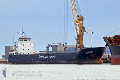
PROUD
General Cargo
Current Trip
| Trip Time | 22 h, 11 mins |
|---|---|
| Trip Distance | 234.36 nm |
| AVG Speed | 8.8 Knots |
| MAX Speed | 11.9 Knots |
| Dybgang | 3.8 m |
| AVG Wind | 7.8 knots |
| MAX Wind | 14 knots |
| MIN Temp | 7.3°C / 45.14°F |
| MAX Temp | 10.3°C / 50.54°F |
| Position Modtaget | 2 m siden |
Current Position
| Longitude | -4.12561° |
|---|---|
| Latitude | 50.36442° |
| Status | Moored |
| Fart | |
| Kurs | 354° |
| Område | English Channel |
| Station | T-AIS |
| Position Modtaget | 2 m siden |
Info
Information
The current position of PROUD is in English Channel with coordinates 50.36442° / -4.12561° as reported on 2024-04-19 08:16 by AIS to our vessel tracker app. The vessel's current speed is 0 Knots and is currently inside the port of PLYMOUTH.
The vessel PROUD (IMO: 9386433, MMSI: 246611000) is a General Cargo that was built in 2009 ( 15 år gamle ). It's sailing under the flag of [NL] Netherlands.
In this page you can find informations about the vessels current position, last detected port calls, and current voyage information. If the vessels is not in coverage by AIS you will find the latest position.
The current position of PROUD is detected by our AIS receivers and we are not responsible for the reliability of the data. The last position was recorded while the vessel was in Coverage by the Ais receivers of our vessel tracking app.
The current draught of PROUD as reported by AIS is 3.8 meters
Weather
| Temperature | 10.7°C / 51.26°F |
|---|---|
| Wind Speed | 12 knots |
| Direction | 314° NW |
| Pressure | 1021.7 hPa |
| Humidity | 84.3 % |
| Cloud Coverage | 31 % |
Featured Company
Last Port Calls
| Port | Arrival | Departure | Time In Port |
|---|---|---|---|
| 2024-04-18 21:58 | |||
| 2024-04-16 17:26 | 2024-04-17 23:47 | 1 d | |
| 2024-04-11 03:56 | 2024-04-13 15:20 | 2 d | |
| 2024-04-05 23:37 | 2024-04-11 03:17 | 5 d | |
| 2024-04-03 22:24 | 2024-04-05 23:09 | 2 d | |
| 2024-04-02 12:52 | 2024-04-03 21:49 | 1 d | |
| 2024-03-30 08:23 | 2024-04-01 05:21 | 1 d | |
| 2024-03-26 21:55 | 2024-03-29 15:38 | 2 d | |
| 2024-03-24 14:28 | 2024-03-24 18:32 | 4 h | |
| 2024-03-19 15:08 | 2024-03-23 17:52 | 4 d |
Last Trips
| Origin | Departure | Destination | Arrival | Distance | |
|---|---|---|---|---|---|
| 2024-04-18 00:47 | 2024-04-18 22:58 | 234.36 nm | |||
| 2024-04-13 17:20 | 2024-04-16 18:26 | 609.80 nm | |||
| 2024-04-11 05:17 | 2024-04-11 05:56 | 3.20 nm | |||
| 2024-04-06 01:09 | 2024-04-06 01:37 | 3.30 nm | |||
| 2024-04-03 23:49 | 2024-04-04 00:24 | 3.27 nm | |||
| 2024-04-01 06:21 | 2024-04-02 14:52 | 273.85 nm | |||
| 2024-03-29 15:38 | 2024-03-30 08:23 | 122.06 nm | |||
| 2024-03-24 19:32 | 2024-03-26 21:55 | 409.43 nm | |||
| 2024-03-23 18:52 | 2024-03-24 15:28 | 177.09 nm | |||
| 2024-03-18 10:58 | 2024-03-19 16:08 | 263.00 nm |
Events
| Tid | Hændelsen | Detaljer | Position / Dest | Info |
|---|---|---|---|---|
| 2024-04-18 22:40 | Status er ændret | Moored Under way using engine |
50.36442 / -4.12558
[GB] PLYMOUTH
|
Fart: Kurs: 355° |
| 2024-04-18 22:14 | STOP Sejllads |
50.36429 / -4.12559
[GB] PLYMOUTH
|
Fart: 0.3 kn Kurs: 353° |
|
| 2024-04-18 21:58 | Skibe i havn |
|
50.36232 / -4.13326
[GB] PLYMOUTH
|
Fart: 2.4 kn Kurs: 56° |
| 2024-04-18 21:22 | START Sejllads | 3.57 nm, South of PLYMOUTH |
50.30525 / -4.17469
GBPLY
|
Fart: 6.6 kn Kurs: 355.4° |
| 2024-04-18 21:15 | STOP Sejllads | 3.66 nm, South of PLYMOUTH |
50.30352 / -4.17332
GBPLY
|
Fart: 0.3 kn Kurs: 249° |
| 2024-04-18 18:22 | ETA er ændret | 2024/04/18 20:50 2024/04/18 21:00 |
50.06525 / -4.57525
GBPLY
|
Fart: 11.3 kn Kurs: 65.8° |
| 2024-04-18 17:21 | ETA er ændret | 2024/04/18 21:00 2024/04/18 22:00 |
49.99103 / -4.85435
GBPLY
|
Fart: 11.5 kn Kurs: 66.5° |
| 2024-04-18 16:44 | Status er ændret | Under way using engine Default |
49.94326 / -5.02227
GBPLY
|
Fart: 11.6 kn Kurs: 62° |
| 2024-04-18 16:43 | Status er ændret | Default Under way using engine |
49.94080 / -5.02970
GBPLY
|
Fart: 11.7 kn Kurs: 62.7° |
| 2024-04-18 16:43 | Ændre havområde | United Kingdom part of the English Channel Irish part of the Celtic Sea |
49.94055 / -5.03044
English Channel
GBPLY
|
Fart: 11.7 kn Kurs: 62.7° |