
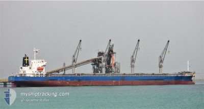
OUTRIDER
Cargo
Current Trip
| Time Travelled | 11 days |
|---|---|
| Remaining Time | --- |
| Distance Travelled | 3349.67 nm |
| Remaining Distance | --- |
| AVG Speed | 11.8 Knots |
| MAX Speed | 14.8 Knots |
| AVG Wind | 12.1 knots |
| MAX Wind | 23 knots |
| MIN Temp | 2.8°C / 37.04°F |
| MAX Temp | 18.6°C / 65.48°F |
| Dybgang | 8.7 m |
| Position Modtaget | 49 m siden |
Current Position
| Longitude | -7.02412° |
|---|---|
| Latitude | 49.51230° |
| Status | Under way using engine |
| Fart | 13.4 Knots |
| Kurs | 94.3° |
| Område | Celtic Sea |
| Station | T-AIS |
| Position Modtaget | 49 m siden |
Info
Information
The current position of OUTRIDER is in Celtic Sea with coordinates 49.51230° / -7.02412° as reported on 2024-04-18 14:25 by AIS to our vessel tracker app. The vessel's current speed is 13.4 Knots
The vessel OUTRIDER (IMO: 9701061, MMSI: 636021127) is a Cargo It's sailing under the flag of [LR] Liberia.
In this page you can find informations about the vessels current position, last detected port calls, and current voyage information. If the vessels is not in coverage by AIS you will find the latest position.
The current position of OUTRIDER is detected by our AIS receivers and we are not responsible for the reliability of the data. The last position was recorded while the vessel was in Coverage by the Ais receivers of our vessel tracking app.
The current draught of OUTRIDER as reported by AIS is 8.7 meters
Weather
| Temperature | 10°C / 50°F |
|---|---|
| Wind Speed | 1 knots |
| Direction | 142° SE |
| Pressure | 1027.1 hPa |
| Humidity | 67.1 % |
| Cloud Coverage | 21 % |
Featured Company
Last Port Calls
| Port | Arrival | Departure | Time In Port |
|---|---|---|---|
| 2024-04-03 17:06 | 2024-04-06 19:16 | 3 d | |
| 2024-03-29 12:35 | 2024-03-31 11:34 | 1 d | |
| 2024-03-01 12:49 | 2024-03-05 20:17 | 4 d | |
| 2024-02-29 03:31 | 2024-02-29 22:03 | 18 h |
Most Visited Ports (Last year)
| Port | Arrivals | |
|---|---|---|
| 2 | ||
| 2 | ||
| 1 | ||
| 1 | ||
| 1 | ||
| 1 |
Last Trips
| Origin | Departure | Destination | Arrival | Distance | |
|---|---|---|---|---|---|
| 2024-03-31 07:34 | 2024-04-03 13:06 | 180.62 nm | |||
| 2024-03-05 22:17 | 2024-03-29 08:35 | 6009.85 nm | |||
| 2023-12-27 12:31 | 2024-03-01 14:49 | 5266.50 nm | |||
| 2023-12-27 12:31 | 2024-02-29 05:31 | 13365.69 nm |
Events
| Tid | Hændelsen | Detaljer | Position / Dest | Info |
|---|---|---|---|---|
| 2024-04-18 14:30 | Status er ændret | Default Under way using engine |
49.51093 / -6.99456
BE GNE
|
Fart: 13.4 kn Kurs: 94.3° |
| 2024-04-18 14:25 | Status er ændret | Under way using engine Default |
49.51230 / -7.02412
BE GNE
|
Fart: 13.4 kn Kurs: 95° |
| 2024-04-18 14:15 | Status er ændret | Default Under way using engine |
49.51512 / -7.08035
BE GNE
|
Fart: 13.5 kn Kurs: 95.2° |
| 2024-04-18 14:09 | Status er ændret | Under way using engine Default |
49.51720 / -7.11765
BE GNE
|
Fart: 13.4 kn Kurs: 96° |
| 2024-04-18 13:48 | Status er ændret | Default Under way using engine |
49.52382 / -7.23847
BE GNE
|
Fart: 13.4 kn Kurs: 96° |
| 2024-04-18 13:05 | Status er ændret | Under way using engine Default |
49.54116 / -7.48153
BE GNE
|
Fart: 13.3 kn Kurs: 94° |
| 2024-04-18 13:05 | Indenfor Dækning |
49.54111 / -7.48050
Celtic Sea
BE GNE
|
Fart: 13.2 kn Kurs: 96.2° |
|
| 2024-04-18 11:30 | Udenfor Dækning |
49.57620 / -8.01174
Celtic Sea
BE GNE
|
Fart: 12.9 kn Kurs: 94.9° |
|
| 2024-04-18 11:30 | Fundet i havområde | United Kingdom part of the Celtic Sea |
49.57620 / -8.01174
Celtic Sea
BE GNE
|
Fart: 12.9 kn Kurs: 94.9° |
| 2024-04-18 11:30 | Status er ændret | Under way using engine Default |
49.57620 / -8.01174
BE GNE
|
Fart: 12.7 kn Kurs: 96° |