
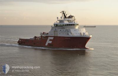
NORMAND SAPPHIRE
Anchor Handling Vessel
Current Trip
BELL ROCK
| Time Travelled | 4 days |
|---|---|
| Remaining Time | --- |
| Distance Travelled | 42.06 nm |
| Remaining Distance | --- |
| AVG Speed | 6.3 Knots |
| MAX Speed | 10.2 Knots |
| AVG Wind | 20.3 knots |
| MAX Wind | 25 knots |
| MIN Temp | 5.1°C / 41.18°F |
| MAX Temp | 8.4°C / 47.12°F |
| Dybgang | 7.5 m |
| Position Modtaget | 4 h, 41 m siden |
Current Position
| Longitude | -2.34351° |
|---|---|
| Latitude | 56.38232° |
| Status | Under way using engine |
| Fart | 0.3 Knots |
| Kurs | 10° |
| Område | North Sea |
| Station | T-AIS |
| Position Modtaget | 4 h, 41 m siden |
Info
Information
The current position of NORMAND SAPPHIRE is in North Sea with coordinates 56.38232° / -2.34351° as reported on 2024-04-19 16:09 by AIS to our vessel tracker app. The vessel's current speed is 0.3 Knots
The vessel NORMAND SAPPHIRE (IMO: 9372169, MMSI: 257282000) is a Anchor Handling Vessel that was built in 2007 ( 17 år gamle ). It's sailing under the flag of [NO] Norway.
In this page you can find informations about the vessels current position, last detected port calls, and current voyage information. If the vessels is not in coverage by AIS you will find the latest position.
The current position of NORMAND SAPPHIRE is detected by our AIS receivers and we are not responsible for the reliability of the data. The last position was recorded while the vessel was in Coverage by the Ais receivers of our vessel tracking app.
The current draught of NORMAND SAPPHIRE as reported by AIS is 7.5 meters
Weather
| Temperature | 6.3°C / 43.34°F |
|---|---|
| Wind Speed | 18 knots |
| Direction | 352° N |
| Pressure | 1024.9 hPa |
| Humidity | 64.2 % |
| Cloud Coverage | 11 % |
Featured Company
Last Port Calls
| Port | Arrival | Departure | Time In Port |
|---|---|---|---|
| 2024-04-15 06:58 | 2024-04-15 19:22 | 12 h | |
| 2024-04-10 15:10 | 2024-04-13 15:12 | 3 d | |
| 2024-04-09 08:32 | 2024-04-10 07:16 | 22 h | |
| 2024-04-08 16:45 | 2024-04-09 06:26 | 13 h | |
| 2024-04-06 14:58 | 2024-04-08 12:20 | 1 d | |
| 2024-04-06 12:54 | 2024-04-06 13:57 | 1 h | |
| 2024-04-04 10:53 | 2024-04-04 14:42 | 3 h | |
| 2024-04-03 04:11 | 2024-04-04 08:28 | 1 d | |
| 2024-04-02 08:25 | 2024-04-02 23:06 | 14 h | |
| 2024-03-26 21:24 | 2024-03-27 00:02 | 2 h |
Most Visited Ports (Last year)
| Port | Arrivals | |
|---|---|---|
| 37 | ||
| 19 | ||
| 7 | ||
| 7 | ||
| 6 | ||
| 5 |
Last Trips
| Origin | Departure | Destination | Arrival | Distance | |
|---|---|---|---|---|---|
| 2024-04-13 17:12 | 2024-04-15 07:58 | 337.20 nm | |||
| 2024-04-10 09:16 | 2024-04-10 17:10 | 7.44 nm | |||
| 2024-04-09 08:26 | 2024-04-09 10:32 | 9.11 nm | |||
| 2024-04-08 14:20 | 2024-04-08 18:45 | 33.25 nm | |||
| 2024-04-06 15:57 | 2024-04-06 16:58 | 8.78 nm | |||
| 2024-04-04 16:42 | 2024-04-06 14:54 | 230.50 nm | |||
| 2024-04-04 10:28 | 2024-04-04 12:53 | 8.57 nm | |||
| 2024-04-03 01:06 | 2024-04-03 06:11 | 44.45 nm | |||
| 2024-03-27 01:02 | 2024-04-02 10:25 | 408.72 nm | |||
| 2024-03-24 06:36 | 2024-03-26 22:24 | 300.90 nm |
Events
| Tid | Hændelsen | Detaljer | Position / Dest | Info |
|---|---|---|---|---|
| 2024-04-19 16:16 | Status er ændret | Default Under way using engine |
56.38167 / -2.34333
BELL ROCK
|
Fart: 0.3 kn Kurs: 10° |
| 2024-04-19 16:09 | Udenfor Dækning |
56.38232 / -2.34351
North Sea
BELL ROCK
|
Fart: 0.3 kn Kurs: 103.3° |
|
| 2024-04-19 16:09 | Status er ændret | Under way using engine Default |
56.38232 / -2.34352
BELL ROCK
|
Fart: Kurs: -1° |
| 2024-04-19 16:04 | Status er ændret | Default Under way using engine |
56.38167 / -2.34333
BELL ROCK
|
Fart: 0.1 kn Kurs: 6° |
| 2024-04-19 15:07 | Status er ændret | Under way using engine Default |
56.38232 / -2.34354
BELL ROCK
|
Fart: Kurs: -1° |
| 2024-04-19 14:49 | Status er ændret | Default Under way using engine |
56.38167 / -2.34333
BELL ROCK
|
Fart: 0.3 kn Kurs: 6° |
| 2024-04-19 14:30 | STOP Sejllads | 13.07 nm, South East of ARBROATH |
56.38231 / -2.34352
BELL ROCK
|
Fart: 0.2 kn Kurs: 6° |
| 2024-04-19 12:32 | START Sejllads | 8.14 nm, North of ANSTRUTHER |
56.34873 / -2.61976
BELL ROCK
|
Fart: 4.3 kn Kurs: 91° |
| 2024-04-19 12:23 | ETA er ændret | 2024/04/19 23:00 2024/04/16 00:00 |
56.34845 / -2.62399
BELL ROCK
|
Fart: 0.1 kn Kurs: 351° |
| 2024-04-19 12:23 | Status er ændret | Under way using engine At anchor |
56.34846 / -2.62399
BELL ROCK
|
Fart: 0.2 kn Kurs: 352° |