
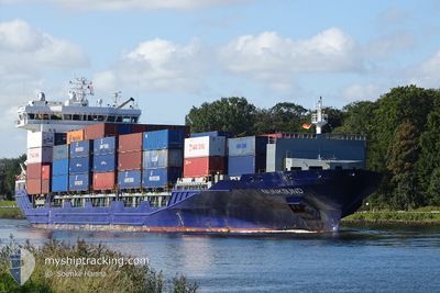
MUNKSUND
Container Ship
Current Trip
| Time Travelled | 4 days |
|---|---|
| Remaining Time | --- |
| Distance Travelled | 754.70 nm |
| Remaining Distance | --- |
| AVG Speed | 11.3 Knots |
| MAX Speed | 16.4 Knots |
| AVG Wind | 17.2 knots |
| MAX Wind | 32.8 knots |
| MIN Temp | 2.7°C / 36.86°F |
| MAX Temp | 9.4°C / 48.92°F |
| Dybgang | 8.2 m |
| Position Modtaget | 1 d siden |
Current Position
| Longitude | 16.43524° |
|---|---|
| Latitude | 55.94801° |
| Status | Under way using engine |
| Fart | 11.6 Knots |
| Kurs | 60.7° |
| Område | Baltic Sea |
| Station | T-AIS |
| Position Modtaget | 1 d siden |
Info
Information
The current position of MUNKSUND is in Baltic Sea with coordinates 55.94801° / 16.43524° as reported on 2024-04-17 10:37 by AIS to our vessel tracker app. The vessel's current speed is 11.6 Knots
The vessel MUNKSUND (IMO: 9429223, MMSI: 636020532) is a Container Ship that was built in 2012 ( 12 år gamle ). It's sailing under the flag of [LR] Liberia.
In this page you can find informations about the vessels current position, last detected port calls, and current voyage information. If the vessels is not in coverage by AIS you will find the latest position.
The current position of MUNKSUND is detected by our AIS receivers and we are not responsible for the reliability of the data. The last position was recorded while the vessel was in Coverage by the Ais receivers of our vessel tracking app.
The current draught of MUNKSUND as reported by AIS is 8.2 meters
Weather
| Temperature | 2.7°C / 36.86°F |
|---|---|
| Wind Speed | 10 knots |
| Direction | 15° NNE |
| Pressure | 1011 hPa |
| Humidity | 87.4 % |
| Cloud Coverage | 100 % |
Featured Company
Last Port Calls
| Port | Arrival | Departure | Time In Port |
|---|---|---|---|
| 2024-04-14 16:00 | 2024-04-15 07:35 | 15 h | |
| 2024-04-14 00:29 | 2024-04-14 15:57 | 15 h | |
| 2024-04-13 12:16 | 2024-04-14 00:24 | 12 h | |
| 2024-04-12 22:55 | 2024-04-13 11:06 | 12 h | |
| 2024-04-11 13:04 | 2024-04-11 18:33 | 5 h | |
| 2024-04-10 22:47 | 2024-04-10 23:33 | 45 m | |
| 2024-04-07 19:15 | 2024-04-08 22:40 | 1 d | |
| 2024-03-21 19:28 | 2024-03-23 16:26 | 1 d | |
| 2024-03-20 23:34 | 2024-03-21 18:03 | 18 h | |
| 2024-03-19 09:23 | 2024-03-20 22:02 | 1 d |
Most Visited Ports (Last year)
| Port | Arrivals | |
|---|---|---|
| 58 | ||
| 37 | ||
| 22 | ||
| 20 | ||
| 12 | ||
| 9 |
Last Trips
| Origin | Departure | Destination | Arrival | Distance | |
|---|---|---|---|---|---|
| 2024-04-14 17:57 | 2024-04-14 18:00 | 0.37 nm | |||
| 2024-04-14 02:24 | 2024-04-14 02:29 | 0.58 nm | |||
| 2024-04-13 13:06 | 2024-04-13 14:16 | 14.29 nm | |||
| 2024-04-11 20:33 | 2024-04-13 00:55 | 324.04 nm | |||
| 2024-04-11 01:33 | 2024-04-11 15:04 | 88.54 nm | |||
| 2024-04-09 01:40 | 2024-04-11 00:47 | 646.10 nm | |||
| 2024-03-23 17:26 | 2024-04-07 22:15 | 1013.07 nm | |||
| 2024-03-21 19:03 | 2024-03-21 20:28 | 16.98 nm | |||
| 2024-03-20 23:02 | 2024-03-21 00:34 | 16.02 nm | |||
| 2024-03-17 23:07 | 2024-03-19 10:23 | 313.39 nm |
Events
| Tid | Hændelsen | Detaljer | Position / Dest | Info |
|---|---|---|---|---|
| 2024-04-17 10:40 | Status er ændret | Default Under way using engine |
55.95387 / 16.45356
LVRIX
|
Fart: 11.6 kn Kurs: 60.7° |
| 2024-04-17 10:37 | Udenfor Dækning |
55.94801 / 16.43524
Baltic Sea
LVRIX
|
Fart: 11.6 kn Kurs: 60.7° |
|
| 2024-04-17 09:12 | Status er ændret | Under way using engine Default |
55.81642 / 16.00934
LVRIX
|
Fart: 11.5 kn Kurs: 60° |
| 2024-04-17 09:04 | Status er ændret | Default Under way using engine |
55.80383 / 15.96972
LVRIX
|
Fart: 11.7 kn Kurs: 60° |
| 2024-04-17 07:08 | Ændre havområde | Swedish part of the Baltic Sea Danish part of the Kattegat |
55.62079 / 15.37595
Baltic Sea
LVRIX
|
Fart: 12.1 kn Kurs: 60.8° |
| 2024-04-17 02:16 | Ændre havområde | Danish part of the Kattegat Swedish part of the Baltic Sea |
55.01242 / 14.06126
Kattegat
LVRIX
|
Fart: 12.6 kn Kurs: 70.5° |
| 2024-04-17 01:52 | Fundet i havområde | Swedish part of the Baltic Sea |
54.98526 / 13.92121
Baltic Sea
LVRIX
|
Fart: 12.6 kn Kurs: 71° |
| 2024-04-16 20:52 | Ændre havområde | German part of the Baltic Sea Danish part of the Baltic Sea |
54.58514 / 12.32409
Baltic Sea
LVRIX
|
Fart: 12.2 kn Kurs: 48.7° |
| 2024-04-16 20:43 | Ændre havområde | Danish part of the Baltic Sea German part of the Baltic Sea |
54.56166 / 12.29208
Baltic Sea
LVRIX
|
Fart: 12.3 kn Kurs: 18° |
| 2024-04-16 19:40 | Ændre havområde | German part of the Baltic Sea Danish part of the Baltic Sea |
54.40540 / 12.10023
Baltic Sea
LVRIX
|
Fart: 12.2 kn Kurs: 89.8° |