
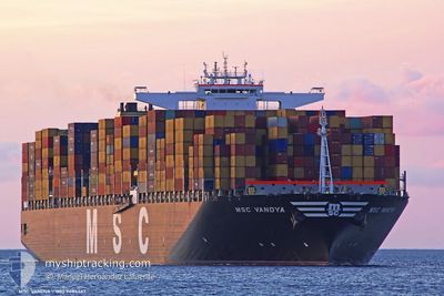
MSC VANDYA
Container Ship
Current Trip
| Time Travelled | 5 days |
|---|---|
| Remaining Time | --- |
| Distance Travelled | 1665.78 nm |
| Remaining Distance | 25.43 nm |
| AVG Speed | 16.1 Knots |
| MAX Speed | 21.2 Knots |
| AVG Wind | 7.5 knots |
| MAX Wind | 13.9 knots |
| MIN Temp | 26.7°C / 80.06°F |
| MAX Temp | 30.3°C / 86.54°F |
| Dybgang | 16 m |
| Position Modtaget | 4 d siden |
Current Position
| Longitude | 97.09717° |
|---|---|
| Latitude | 5.60877° |
| Status | Under way using engine |
| Fart | 18.6 Knots |
| Kurs | 283.4° |
| Område | Malacca Strait |
| Station | T-AIS |
| Position Modtaget | 4 d siden |
Info
Information
The current position of MSC VANDYA is in Malacca Strait with coordinates 5.60877° / 97.09717° as reported on 2024-04-12 12:05 by AIS to our vessel tracker app. The vessel's current speed is 18.6 Knots and is heading at the port of COLOMBO. The estimated time of arrival as calculated by MyShipTracking vessel tracking app is 2024-04-15 00:30 LT
The vessel MSC VANDYA (IMO: 9484467, MMSI: 373005000) is a Container Ship that was built in 2012 ( 12 år gamle ). It's sailing under the flag of [PA] Panama.
In this page you can find informations about the vessels current position, last detected port calls, and current voyage information. If the vessels is not in coverage by AIS you will find the latest position.
The current position of MSC VANDYA is detected by our AIS receivers and we are not responsible for the reliability of the data. The last position was recorded while the vessel was in Coverage by the Ais receivers of our vessel tracking app.
The current draught of MSC VANDYA as reported by AIS is 16 meters
Weather
| Temperature | 28.9°C / 84.02°F |
|---|---|
| Wind Speed | 6 knots |
| Direction | 142° SE |
| Pressure | 1008.4 hPa |
| Humidity | 73.7 % |
| Cloud Coverage | 63 % |
Featured Company
Last Port Calls
| Port | Arrival | Departure | Time In Port |
|---|---|---|---|
| 2024-04-10 15:06 | 2024-04-11 08:15 | 17 h | |
| 2024-03-26 22:24 | 2024-03-28 09:17 | 1 d | |
| 2024-03-24 00:17 | 2024-03-25 02:53 | 1 d | |
| 2024-02-29 06:03 | 2024-03-01 09:36 | 1 d | |
| 2024-02-16 22:35 | 2024-02-24 13:16 | 7 d | |
| 2024-02-01 19:12 |
Most Visited Ports (Last year)
| Port | Arrivals | |
|---|---|---|
| 5 | ||
| 5 | ||
| 5 | ||
| 4 | ||
| 4 | ||
| 4 |
Last Trips
| Origin | Departure | Destination | Arrival | Distance | |
|---|---|---|---|---|---|
| 2024-03-28 17:17 | 2024-04-10 23:06 | 2866.95 nm | |||
| 2024-03-25 11:53 | 2024-03-27 06:24 | 487.69 nm | |||
| 2024-03-01 01:36 | 2024-03-24 09:17 | 6169.16 nm | |||
| 2024-02-24 05:16 | 2024-02-28 22:03 | 514.60 nm | |||
| 2024-02-02 04:12 | 2024-02-16 14:35 | 6024.52 nm |
Events
| Tid | Hændelsen | Detaljer | Position / Dest | Info |
|---|---|---|---|---|
| 2024-04-16 15:18 | STOP Sejllads |
7.00167 / 79.42667
LKCMB
|
Fart: Kurs: -1° |
|
| 2024-04-16 08:39 | START Sejllads |
7.13216 / 79.44163
LKCMB
|
Fart: 3.8 kn Kurs: 182° |
|
| 2024-04-15 17:42 | STOP Sejllads |
6.86500 / 79.43166
LKCMB
|
Fart: Kurs: -1° |
|
| 2024-04-13 23:42 | START Sejllads |
5.72167 / 86.61500
LKCMB
|
Fart: 6 kn Kurs: 271° |
|
| 2024-04-13 23:15 | STOP Sejllads |
5.72500 / 86.62666
LKCMB
|
Fart: Kurs: -1° |
|
| 2024-04-12 12:08 | Status er ændret | Default Under way using engine |
5.61188 / 97.08446
LKCMB
|
Fart: 18.6 kn Kurs: 283.4° |
| 2024-04-12 12:05 | Udenfor Dækning |
5.60877 / 97.09717
Malacca Strait
LKCMB
|
Fart: 18.6 kn Kurs: 283.4° |
|
| 2024-04-12 11:58 | Ændre havområde | Indonesian part of the Malacca Strait Malaysian part of the Singapore Strait |
5.60033 / 97.13293
Malacca Strait
LKCMB
|
Fart: 18.6 kn Kurs: 283.2° |
| 2024-04-12 11:58 | Status er ændret | Under way using engine Default |
5.60033 / 97.13293
LKCMB
|
Fart: 18.5 kn Kurs: 284° |
| 2024-04-12 11:48 | Indenfor Dækning |
5.60033 / 97.13293
Malacca Strait
LKCMB
|
Fart: 18.6 kn Kurs: 283.2° |