
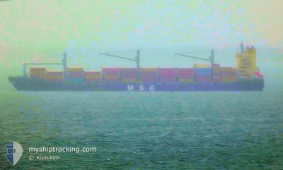
MSC SAMIRA III
Container Ship
Current Trip
| Time Travelled | 11 days |
|---|---|
| Remaining Time | 22 mins |
| Distance Travelled | 1663.59 nm |
| Remaining Distance | 3.72 nm |
| AVG Speed | 9.7 Knots |
| MAX Speed | 18 Knots |
| AVG Wind | 14.3 knots |
| MAX Wind | 41 knots |
| MIN Temp | 5.4°C / 41.72°F |
| MAX Temp | 25.4°C / 77.72°F |
| Dybgang | 9.6 m |
| Position Modtaget | 1 m siden |
Current Position
| Longitude | -78.80345° |
|---|---|
| Latitude | 26.44733° |
| Status | Under way using engine |
| Fart | 9.3 Knots |
| Kurs | 145.8° |
| Område | North Atlantic Ocean |
| Station | T-AIS |
| Position Modtaget | 1 m siden |
Info
Information
The current position of MSC SAMIRA III is in North Atlantic Ocean with coordinates 26.44733° / -78.80345° as reported on 2024-04-24 03:14 by AIS to our vessel tracker app. The vessel's current speed is 9.3 Knots and is heading at the port of FREEPORT (BS). The estimated time of arrival as calculated by MyShipTracking vessel tracking app is 2024-04-24 03:38 LT
The vessel MSC SAMIRA III (IMO: 9434462, MMSI: 636020952) is a Container Ship that was built in 2009 ( 15 år gamle ). It's sailing under the flag of [LR] Liberia.
In this page you can find informations about the vessels current position, last detected port calls, and current voyage information. If the vessels is not in coverage by AIS you will find the latest position.
The current position of MSC SAMIRA III is detected by our AIS receivers and we are not responsible for the reliability of the data. The last position was recorded while the vessel was in Coverage by the Ais receivers of our vessel tracking app.
The current draught of MSC SAMIRA III as reported by AIS is 9.6 meters
Weather
| Temperature | 21.5°C / 70.7°F |
|---|---|
| Wind Speed | 11 knots |
| Direction | 73° ENE |
| Pressure | 1021.7 hPa |
| Humidity | 59.9 % |
| Cloud Coverage | 15 % |
Featured Company
Last Port Calls
| Port | Arrival | Departure | Time In Port |
|---|---|---|---|
| 2024-04-11 15:28 | 2024-04-12 16:35 | 1 d | |
| 2024-04-07 20:55 | 2024-04-09 15:21 | 1 d | |
| 2024-04-03 15:35 | 2024-04-05 06:23 | 1 d | |
| 2024-03-29 08:35 | 2024-03-30 05:11 | 20 h | |
| 2024-03-21 17:12 | 2024-03-23 06:55 | 1 d | |
| 2024-03-13 15:43 | 2024-03-14 02:01 | 10 h | |
| 2024-03-11 14:49 | 2024-03-12 05:04 | 14 h | |
| 2024-03-08 02:21 | |||
| 2024-02-27 07:48 | 2024-02-29 21:30 | 2 d | |
| 2024-02-23 16:51 | 2024-02-25 03:15 | 1 d |
Most Visited Ports (Last year)
| Port | Arrivals | |
|---|---|---|
| 7 | ||
| 5 | ||
| 4 | ||
| 4 | ||
| 3 | ||
| 3 |
Last Trips
| Origin | Departure | Destination | Arrival | Distance | |
|---|---|---|---|---|---|
| 2024-04-09 12:51 | 2024-04-11 12:28 | 738.99 nm | |||
| 2024-04-05 02:23 | 2024-04-07 18:25 | 770.00 nm | |||
| 2024-03-30 01:11 | 2024-04-03 11:35 | 1549.87 nm | |||
| 2024-03-23 02:55 | 2024-03-29 04:35 | 1045.18 nm | |||
| 2024-03-13 20:01 | 2024-03-21 13:12 | 1328.98 nm | |||
| 2024-03-11 23:04 | 2024-03-13 09:43 | 255.26 nm | |||
| 2024-03-07 21:21 | 2024-03-11 08:49 | 1198.64 nm | |||
| 2024-02-24 23:45 | 2024-02-27 03:48 | 733.07 nm | |||
| 2024-02-21 08:40 | 2024-02-23 13:21 | 731.25 nm | |||
| 2024-02-16 02:25 | 2024-02-20 15:32 | 1550.13 nm |
Events
| Tid | Hændelsen | Detaljer | Position / Dest | Info |
|---|---|---|---|---|
| 2024-04-24 02:16 | Status er ændret | Under way using engine Default |
26.41524 / -78.79831
BSFPO
|
Fart: 6.2 kn Kurs: 319° |
| 2024-04-24 02:10 | Status er ændret | Default Under way using engine |
26.40752 / -78.79074
BSFPO
|
Fart: 6.1 kn Kurs: 318.7° |
| 2024-04-24 01:19 | START Sejllads | 10.81 nm, South of FREEPORT (BS) |
26.34837 / -78.72328
BSFPO
|
Fart: 3.4 kn Kurs: 168° |
| 2024-04-23 23:55 | Status er ændret | Under way using engine Default |
26.35399 / -78.71153
BSFPO
|
Fart: 0.5 kn Kurs: 144° |
| 2024-04-23 23:50 | Indenfor Dækning |
26.35399 / -78.71153
North Atlantic Ocean
|
Fart: 0.5 kn Kurs: 249° |
|
| 2024-04-23 22:55 | Status er ændret | Default Under way using engine |
26.35780 / -78.70299
BSFPO
|
Fart: 0.3 kn Kurs: 142° |
| 2024-04-23 22:46 | Udenfor Dækning |
26.35847 / -78.70178
North Atlantic Ocean
|
Fart: 0.3 kn Kurs: 239.9° |
|
| 2024-04-23 22:05 | Status er ændret | Under way using engine Default |
26.36070 / -78.69671
BSFPO
|
Fart: 0.4 kn Kurs: 143° |
| 2024-04-23 22:05 | Indenfor Dækning |
26.36064 / -78.69700
North Atlantic Ocean
|
Fart: 0.4 kn Kurs: 255.4° |
|
| 2024-04-23 19:38 | STOP Sejllads | 10.5 nm, South East of FREEPORT (BS) |
26.36613 / -78.68712
BSFPO
|
Fart: 0.3 kn Kurs: 84° |