
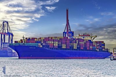
MSC RIDA VIII
Container Ship
Current Trip
| Trip Time | 22 h, 0 mins |
|---|---|
| Trip Distance | 185.64 nm |
| AVG Speed | 14.4 Knots |
| MAX Speed | 14.4 Knots |
| Dybgang | 12.8 m |
| AVG Wind | 14.7 knots |
| MAX Wind | 27.5 knots |
| MIN Temp | 7°C / 44.6°F |
| MAX Temp | 10.6°C / 51.08°F |
| Position Modtaget | 4 m siden |
Current Position
| Longitude | --- |
|---|---|
| Latitude | --- |
| Status | Moored |
| Fart | |
| Kurs | 179° |
| Område | The Coastal Waters of Southeast Alaska and British Columbia |
| Station | T-AIS |
| Position Modtaget | 4 m siden |
Info
Information
The current position of MSC RIDA VIII is in The Coastal Waters of Southeast Alaska and British Columbia with coordinates 47.57658° / -122.36080° as reported on 2025-12-07 01:06 by AIS to our vessel tracker app. The vessel's current speed is 0 Knots and is currently inside the port of SEATTLE.
The vessel MSC RIDA VIII (IMO: 9393307, MMSI: 255803480) is a Container Ship that was built in 2009 ( 16 år gamle ). It's sailing under the flag of [PT] Portugal.
In this page you can find informations about the vessels current position, last detected port calls, and current voyage information. If the vessels is not in coverage by AIS you will find the latest position.
The current position of MSC RIDA VIII is detected by our AIS receivers and we are not responsible for the reliability of the data. The last position was recorded while the vessel was in Coverage by the Ais receivers of our vessel tracking app.
The current draught of MSC RIDA VIII as reported by AIS is 12.8 meters
Weather
| Temperature | 9.8°C / 49.64°F |
|---|---|
| Wind Speed | 11 knots |
| Direction | 209° SSW |
| Pressure | 1017.1 hPa |
| Humidity | 76.3 % |
| Cloud Coverage | 100 % |
Featured Company
Last Port Calls
| Port | Arrival | Departure | Time In Port |
|---|---|---|---|
| 2025-12-06 05:36 | |||
| 2025-12-02 05:10 | 2025-12-05 07:36 | 3 d | |
| 2025-11-28 21:39 | 2025-11-30 01:24 | 1 d | |
| 2025-11-12 14:44 | 2025-11-13 18:04 | 1 d | |
| 2025-11-10 04:58 | 2025-11-10 15:52 | 10 h | |
| 2025-10-28 05:32 | 2025-10-30 01:28 | 1 d |
Most Visited Ports (Last year)
| Port | Arrivals | |
|---|---|---|
| 5 | ||
| 5 | ||
| 4 | ||
| 4 | ||
| 3 | ||
| 2 |
Last Trips
| Origin | Departure | Destination | Arrival | Distance | |
|---|---|---|---|---|---|
| 2025-12-05 07:36 | 2025-12-06 05:36 | 185.64 nm | |||
| 2025-11-30 01:24 | 2025-12-02 05:10 | 655.27 nm | |||
| 2025-11-13 18:04 | 2025-11-28 21:39 | 6144.99 nm | |||
| 2025-11-10 15:52 | 2025-11-12 14:44 | 493.87 nm | |||
| 2025-10-30 01:28 | 2025-11-10 04:58 | 1056.25 nm | |||
| 2025-09-25 13:30 | 2025-10-28 05:32 | 11436.74 nm |
Events
| Tid | Hændelsen | Detaljer | Position / Dest | Info |
|---|---|---|---|---|
| 2025-12-06 15:21 | Status er ændret | Moored Default |
47.57682 / -122.36097
[US] SEATTLE
|
Fart: Kurs: 179° |
| 2025-12-06 15:18 | Status er ændret | Default Moored |
47.57683 / -122.36095
[US] SEATTLE
|
Fart: Kurs: 179° |
| 2025-12-06 14:51 | Status er ændret | Moored Under way using engine |
47.57688 / -122.36092
[US] SEATTLE
|
Fart: Kurs: 179° |
| 2025-12-06 14:23 | STOP Sejllads |
47.57712 / -122.36073
[US] SEATTLE
|
Fart: 0.3 kn Kurs: 180° |
|
| 2025-12-06 13:36 | Skibe i havn |
|
47.61213 / -122.38990
[US] SEATTLE
|
Fart: 8.9 kn Kurs: 129° |
| 2025-12-06 09:22 | Ændre havområde | United States part of the The Coastal Waters of Southeast Alaska and British Columbia Canadian part of the The Coastal Waters of Southeast Alaska and British Columbia |
48.22410 / -123.49917
The Coastal Waters of Southeast Alaska and British Columbia
USSEA
|
Fart: 13.1 kn Kurs: 186° |
| 2025-12-06 07:11 | Ændre havområde | Canadian part of the The Coastal Waters of Southeast Alaska and British Columbia United States part of the The Coastal Waters of Southeast Alaska and British Columbia |
48.51037 / -123.20472
The Coastal Waters of Southeast Alaska and British Columbia
USSEA
|
Fart: 17 kn Kurs: 175° |
| 2025-12-06 06:34 | Ændre havområde | United States part of the The Coastal Waters of Southeast Alaska and British Columbia Canadian part of the The Coastal Waters of Southeast Alaska and British Columbia |
48.69102 / -123.26327
The Coastal Waters of Southeast Alaska and British Columbia
USSEA
|
Fart: 16.5 kn Kurs: 192° |
| 2025-12-06 05:55 | Ændre havområde | Canadian part of the The Coastal Waters of Southeast Alaska and British Columbia United States part of the The Coastal Waters of Southeast Alaska and British Columbia |
48.78425 / -123.01697
The Coastal Waters of Southeast Alaska and British Columbia
USSEA
|
Fart: 16.2 kn Kurs: 227° |
| 2025-12-06 04:55 | Ændre havområde | United States part of the The Coastal Waters of Southeast Alaska and British Columbia Canadian part of the The Coastal Waters of Southeast Alaska and British Columbia |
48.99745 / -123.28833
The Coastal Waters of Southeast Alaska and British Columbia
USSEA
|
Fart: 17.2 kn Kurs: 132° |