
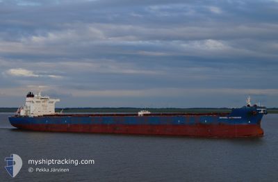
MARAN ASTRONOMER
Bulk Carrier
Current Trip
GN BFA
| Time Travelled | --- |
|---|---|
| Remaining Time | --- |
| Distance Travelled | --- |
| Remaining Distance | --- |
| AVG Speed | --- |
| MAX Speed | --- |
| AVG Wind | --- |
| MAX Wind | --- |
| MIN Temp | --- |
| MAX Temp | --- |
| Dybgang | 12 m |
| Position Modtaget | 3 h, 24 m siden |
Current Position
| Longitude | -14.46543° |
|---|---|
| Latitude | 9.88742° |
| Status | At anchor |
| Fart | |
| Kurs | 206° |
| Område | North Atlantic Ocean |
| Station | T-AIS |
| Position Modtaget | 3 h, 24 m siden |
Info
Information
The current position of MARAN ASTRONOMER is in North Atlantic Ocean with coordinates 9.88742° / -14.46543° as reported on 2024-04-19 02:59 by AIS to our vessel tracker app. The vessel's current speed is 0 Knots
The vessel MARAN ASTRONOMER (IMO: 9581239, MMSI: 241160000) is a Bulk Carrier that was built in 2012 ( 12 år gamle ). It's sailing under the flag of [GR] Greece.
In this page you can find informations about the vessels current position, last detected port calls, and current voyage information. If the vessels is not in coverage by AIS you will find the latest position.
The current position of MARAN ASTRONOMER is detected by our AIS receivers and we are not responsible for the reliability of the data. The last position was recorded while the vessel was in Coverage by the Ais receivers of our vessel tracking app.
The current draught of MARAN ASTRONOMER as reported by AIS is 12 meters
Weather
| Temperature | 25.8°C / 78.44°F |
|---|---|
| Wind Speed | 8 knots |
| Direction | 303° WNW |
| Pressure | 1008.2 hPa |
| Humidity | 80.3 % |
| Cloud Coverage | 10 % |
Featured Company
Last Port Calls
Most Visited Ports (Last year)
| Port | Arrivals | |
|---|---|---|
| 3 | ||
| 1 | ||
| 1 |
Last Trips
| Origin | Departure | Destination | Arrival | Distance |
|---|
Events
| Tid | Hændelsen | Detaljer | Position / Dest | Info |
|---|---|---|---|---|
| 2024-04-19 03:11 | Status er ændret | Default At anchor |
9.88767 / -14.46578
GN BFA
|
Fart: Kurs: 206° |
| 2024-04-19 02:59 | Udenfor Dækning |
9.88742 / -14.46543
North Atlantic Ocean
|
Fart: Kurs: 319.2° |
|
| 2024-04-19 02:50 | Indenfor Dækning |
9.88731 / -14.46541
North Atlantic Ocean
|
Fart: Kurs: 304.1° |
|
| 2024-04-19 01:50 | Status er ændret | Default At anchor |
9.88676 / -14.46500
GN BFA
|
Fart: Kurs: 233° |
| 2024-04-19 01:17 | Udenfor Dækning |
9.88619 / -14.46451
North Atlantic Ocean
|
Fart: Kurs: 317.4° |
|
| 2024-04-19 01:05 | ETA er ændret | 2025/02/27 11:00 2024/02/27 06:30 |
9.88587 / -14.46438
GN BFA
|
Fart: Kurs: 239° |
| 2024-04-19 00:56 | Status er ændret | At anchor Default |
9.88572 / -14.46428
GN BFA
|
Fart: Kurs: 252° |
| 2024-04-19 00:47 | Status er ændret | Default At anchor |
9.88539 / -14.46414
GN BFA
|
Fart: 0.1 kn Kurs: 256° |
| 2024-04-19 00:44 | Status er ændret | At anchor Default |
9.88520 / -14.46418
GN BFA
|
Fart: Kurs: 302° |
| 2024-04-19 00:44 | Indenfor Dækning |
9.88520 / -14.46418
North Atlantic Ocean
|
Fart: 0.1 kn Kurs: 43.9° |