

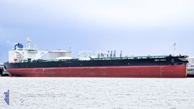
KRITI HERO
Tanker

Current Trip
| Time Travelled | 3 days |
|---|---|
| Remaining Time | 1 day |
| Distance Travelled | 898.56 nm |
| Remaining Distance | 581.71 nm |
| AVG Speed | 9.8 Knots |
| MAX Speed | 14 Knots |
| AVG Wind | 19.6 knots |
| MAX Wind | 32 knots |
| MIN Temp | 7.5°C / 45.5°F |
| MAX Temp | 13.2°C / 55.76°F |
| Dybgang | 9.4 m |
| Position Modtaget | 1 d siden |
Current Position
| Longitude | --- |
|---|---|
| Latitude | --- |
| Status | Under way using engine |
| Fart | 7.1 Knots |
| Kurs | 207.8° |
| Område | Celtic Sea |
| Station | T-AIS |
| Position Modtaget | 1 d siden |
Information
The current position of KRITI HERO is in Celtic Sea with coordinates 48.88005° / -5.87652° as reported on 2025-02-25 22:39 by AIS to our vessel tracker app. The vessel's current speed is 7.1 Knots and is heading at the port of GIBRALTAR. The estimated time of arrival as calculated by MyShipTracking vessel tracking app is 2025-03-01 17:53 LT
The vessel KRITI HERO (IMO: 9887308, MMSI: 636020098) is a Tanker It's sailing under the flag of [LR] Liberia.
In this page you can find informations about the vessels current position, last detected port calls, and current voyage information. If the vessels is not in coverage by AIS you will find the latest position.
The current position of KRITI HERO is detected by our AIS receivers and we are not responsible for the reliability of the data. The last position was recorded while the vessel was in Coverage by the Ais receivers of our vessel tracking app.
The current draught of KRITI HERO as reported by AIS is 9.4 meters
Weather
| Temperature | 13.1°C / 55.58°F |
|---|---|
| Wind Speed | 22 knots |
| Direction | 124° SE |
| Pressure | 1013.9 hPa |
| Humidity | 87.4 % |
| Cloud Coverage | 97 % |


Featured Company
Last Trips
| Origin | Departure | Destination | Arrival | Distance | |
|---|---|---|---|---|---|
| 2025-02-08 02:37 | 2025-02-18 06:31 | 2963.94 nm | |||
| 2025-01-25 08:56 | 2025-02-06 00:34 | 961.90 nm | |||
| 2024-12-25 10:04 | 2025-01-24 09:10 | 3619.10 nm | |||
| 2024-12-04 04:18 | 2024-12-23 04:01 | 2205.49 nm | |||
| 2024-11-20 10:18 | 2024-12-01 14:43 | 2166.69 nm |
Events
| Tid | Hændelsen | Detaljer | Position / Dest | Info |
|---|---|---|---|---|
| 2025-02-25 22:41 | Status er ændret | Default Under way using engine |
48.87394 / -5.88160
GIGIB
|
Fart: 7.1 kn Kurs: 207.8° |
| 2025-02-25 22:39 | Status er ændret | Under way using engine Default |
48.88005 / -5.87652
GIGIB
|
Fart: 8.9 kn Kurs: 241° |
| 2025-02-25 22:39 | Udenfor Dækning |
48.88005 / -5.87652
Celtic Sea
GIGIB
|
Fart: 7.1 kn Kurs: 207.8° |
|
| 2025-02-25 22:39 | Fundet i havområde | French part of the Celtic Sea |
48.88005 / -5.87652
Celtic Sea
GIGIB
|
Fart: 7.1 kn Kurs: 207.8° |
| 2025-02-25 22:21 | Indenfor Dækning |
48.88005 / -5.87652
Celtic Sea
GIGIB
|
Fart: 7.1 kn Kurs: 207.8° |
|
| 2025-02-25 20:26 | START Sejllads |
49.06437 / -5.39942
GIGIB
|
Fart: 8.3 kn Kurs: 240° |
|
| 2025-02-25 20:11 | STOP Sejllads |
49.08290 / -5.34468
GIGIB
|
Fart: 0.3 kn Kurs: 248° |
|
| 2025-02-25 17:31 | START Sejllads |
49.31385 / -4.81956
GIGIB
|
Fart: 7.5 kn Kurs: 239° |
|
| 2025-02-25 17:27 | STOP Sejllads |
49.31870 / -4.80678
GIGIB
|
Fart: 0.2 kn Kurs: 245° |
|
| 2025-02-25 13:59 | Udenfor Dækning |
49.55610 / -4.15361
English Channel
GIGIB
|
Fart: 7.7 kn Kurs: 240.7° |