
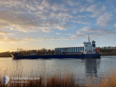
KIRKE
General Cargo
Current Trip
| Time Travelled | 3 days |
|---|---|
| Remaining Time | --- |
| Distance Travelled | 529.33 nm |
| Remaining Distance | --- |
| AVG Speed | 10.4 Knots |
| MAX Speed | 12.1 Knots |
| AVG Wind | 17.3 knots |
| MAX Wind | 26.2 knots |
| MIN Temp | -0.5°C / 31.1°F |
| MAX Temp | 3.3°C / 37.94°F |
| Dybgang | 4.2 m |
| Position Modtaget | 13 h, 18 m siden |
Current Position
| Longitude | 28.97629° |
|---|---|
| Latitude | 60.74442° |
| Status | Under way using engine |
| Fart | 32 Knots |
| Kurs | 67.7° |
| Område | Gulf of Finland |
| Station | T-AIS |
| Position Modtaget | 13 h, 18 m siden |
Info
Information
The current position of KIRKE is in Gulf of Finland with coordinates 60.74442° / 28.97629° as reported on 2024-04-23 15:03 by AIS to our vessel tracker app. The vessel's current speed is 32 Knots and is heading at the port of ST PETERSBURG. The estimated time of arrival as calculated by MyShipTracking vessel tracking app is 2024-04-22 23:00 LT
The vessel KIRKE (IMO: 9413456, MMSI: 305597000) is a General Cargo that was built in 2007 ( 17 år gamle ). It's sailing under the flag of [AG] Antigua Barbuda.
In this page you can find informations about the vessels current position, last detected port calls, and current voyage information. If the vessels is not in coverage by AIS you will find the latest position.
The current position of KIRKE is detected by our AIS receivers and we are not responsible for the reliability of the data. The last position was recorded while the vessel was in Coverage by the Ais receivers of our vessel tracking app.
The current draught of KIRKE as reported by AIS is 4.2 meters
Weather
| Temperature | 0.6°C / 33.08°F |
|---|---|
| Wind Speed | 7 knots |
| Direction | 203° SSW |
| Pressure | 1016.3 hPa |
| Humidity | 89.2 % |
| Cloud Coverage | 100 % |
Featured Company
Last Port Calls
| Port | Arrival | Departure | Time In Port |
|---|---|---|---|
| 2024-04-19 12:32 | 2024-04-20 19:05 | 1 d | |
| 2024-04-09 11:00 | 2024-04-17 09:40 | 7 d | |
| 2024-03-30 17:26 | 2024-03-31 19:30 | 1 d | |
| 2024-03-23 17:03 | 2024-03-25 22:20 | 2 d | |
| 2024-03-22 00:43 | 2024-03-22 03:33 | 2 h | |
| 2024-03-15 00:09 | 2024-03-16 20:39 | 1 d | |
| 2024-03-06 03:04 | 2024-03-11 15:20 | 5 d | |
| 2024-03-01 23:10 | 2024-03-03 09:26 | 1 d | |
| 2024-02-14 22:29 | 2024-02-21 10:43 | 6 d | |
| 2024-02-06 14:34 | 2024-02-10 14:25 | 3 d |
Most Visited Ports (Last year)
| Port | Arrivals | |
|---|---|---|
| 12 | ||
| 4 | ||
| 4 | ||
| 2 | ||
| 2 | ||
| 2 |
Last Trips
| Origin | Departure | Destination | Arrival | Distance | |
|---|---|---|---|---|---|
| 2024-04-17 12:40 | 2024-04-19 14:32 | 571.05 nm | |||
| 2024-03-31 20:30 | 2024-04-09 14:00 | 1908.85 nm | |||
| 2024-03-25 23:20 | 2024-03-30 17:26 | 722.67 nm | |||
| 2024-03-22 04:33 | 2024-03-23 18:03 | 332.33 nm | |||
| 2024-03-16 23:39 | 2024-03-22 01:43 | 930.01 nm | |||
| 2024-03-11 16:20 | 2024-03-15 03:09 | 852.65 nm | |||
| 2024-03-03 12:26 | 2024-03-06 04:04 | 767.10 nm | |||
| 2024-02-21 11:43 | 2024-03-02 02:10 | 649.72 nm | |||
| 2024-02-10 15:25 | 2024-02-14 23:29 | 652.73 nm | |||
| 2024-02-06 14:59 | 2024-02-06 15:34 | 3.08 nm |
Events
| Tid | Hændelsen | Detaljer | Position / Dest | Info |
|---|---|---|---|---|
| 2024-04-23 15:12 | Status er ændret | Default Under way using engine |
60.74442 / 28.97629
RULED
|
Fart: 32 kn Kurs: 67.7° |
| 2024-04-23 15:03 | Udenfor Dækning |
60.74442 / 28.97629
Gulf of Finland
|
Fart: 32 kn Kurs: 67.7° |
|
| 2024-04-23 14:42 | Indenfor Dækning |
60.74442 / 28.97629
Gulf of Finland
|
Fart: 32 kn Kurs: 67.7° |
|
| 2024-04-22 21:18 | Status er ændret | Default Under way using engine |
60.03274 / 28.83093
RULED
|
Fart: 11.8 kn Kurs: 91.9° |
| 2024-04-22 21:10 | Status er ændret | Under way using engine Default |
60.03344 / 28.77305
RULED
|
Fart: 11.8 kn Kurs: 93° |
| 2024-04-22 21:10 | Udenfor Dækning |
60.03344 / 28.77305
Gulf of Finland
RULED
|
Fart: 11.8 kn Kurs: 91.9° |
|
| 2024-04-22 20:42 | Status er ændret | Default Under way using engine |
60.03742 / 28.59045
RULED
|
Fart: 11.6 kn Kurs: 92.9° |
| 2024-04-22 14:14 | Ændre havområde | Russian part of the Gulf of Finland Estonian part of the Gulf of Finland |
59.95316 / 26.42740
Gulf of Finland
RULED
|
Fart: 10.1 kn Kurs: 72° |
| 2024-04-22 13:31 | Status er ændret | Under way using engine Default |
59.92121 / 26.20017
RULED
|
Fart: 10 kn Kurs: 77° |
| 2024-04-22 13:31 | Indenfor Dækning |
59.92197 / 26.20631
Gulf of Finland
RULED
|
Fart: 10 kn Kurs: 75.6° |