
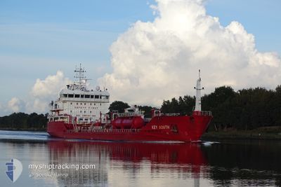
KEY SOUTH
Oil/Chemical Tanker
Current Trip
| Time Travelled | 3 days |
|---|---|
| Remaining Time | 10 h, 55 mins |
| Distance Travelled | 841.30 nm |
| Remaining Distance | 114.45 nm |
| AVG Speed | 10.3 Knots |
| MAX Speed | 12.1 Knots |
| AVG Wind | 11.4 knots |
| MAX Wind | 27 knots |
| MIN Temp | -2.3°C / 27.86°F |
| MAX Temp | 7.8°C / 46.04°F |
| Dybgang | 5.6 m |
| Position Modtaget | 48 m siden |
Current Position
| Longitude | 20.56802° |
|---|---|
| Latitude | 63.41419° |
| Status | Under way using engine |
| Fart | 10.2 Knots |
| Kurs | 36.7° |
| Område | Gulf of Bothnia |
| Station | T-AIS |
| Position Modtaget | 48 m siden |
Info
Information
The current position of KEY SOUTH is in Gulf of Bothnia with coordinates 63.41419° / 20.56802° as reported on 2024-04-19 17:42 by AIS to our vessel tracker app. The vessel's current speed is 10.2 Knots and is heading at the port of HARAHOLMEN. The estimated time of arrival as calculated by MyShipTracking vessel tracking app is 2024-04-20 05:26 LT
The vessel KEY SOUTH (IMO: 9479802, MMSI: 248221000) is a Oil/Chemical Tanker that was built in 2010 ( 14 år gamle ). It's sailing under the flag of [MT] Malta.
In this page you can find informations about the vessels current position, last detected port calls, and current voyage information. If the vessels is not in coverage by AIS you will find the latest position.
The current position of KEY SOUTH is detected by our AIS receivers and we are not responsible for the reliability of the data. The last position was recorded while the vessel was in Coverage by the Ais receivers of our vessel tracking app.
The current draught of KEY SOUTH as reported by AIS is 5.6 meters
Weather
| Temperature | -1.4°C / 29.48°F |
|---|---|
| Wind Speed | 26 knots |
| Direction | 32° NNE |
| Pressure | 1012 hPa |
| Humidity | 77.6 % |
| Cloud Coverage | 100 % |
Featured Company
Last Port Calls
| Port | Arrival | Departure | Time In Port |
|---|---|---|---|
| 2024-04-14 13:50 | 2024-04-16 07:49 | 1 d | |
| 2024-04-13 17:20 | 2024-04-14 09:37 | 16 h | |
| 2024-04-11 01:05 | 2024-04-11 11:35 | 10 h | |
| 2024-04-09 14:56 | 2024-04-11 00:25 | 1 d | |
| 2024-04-05 20:13 | 2024-04-06 18:04 | 21 h | |
| 2024-04-04 09:57 | 2024-04-04 18:12 | 8 h | |
| 2024-03-31 10:11 | 2024-04-03 04:33 | 2 d | |
| 2024-03-27 18:01 | 2024-03-28 23:01 | 1 d | |
| 2024-03-26 21:30 | 2024-03-26 22:41 | 1 h | |
| 2024-03-26 00:01 | 2024-03-26 16:22 | 16 h |
Most Visited Ports (Last year)
| Port | Arrivals | |
|---|---|---|
| 9 | ||
| 8 | ||
| 8 | ||
| 6 | ||
| 5 | ||
| 5 |
Last Trips
| Origin | Departure | Destination | Arrival | Distance | |
|---|---|---|---|---|---|
| 2024-04-14 11:37 | 2024-04-14 15:50 | 48.80 nm | |||
| 2024-04-11 13:35 | 2024-04-13 19:20 | 530.46 nm | |||
| 2024-04-11 02:25 | 2024-04-11 03:05 | 2.89 nm | |||
| 2024-04-06 20:04 | 2024-04-09 16:56 | 541.91 nm | |||
| 2024-04-04 20:12 | 2024-04-05 22:13 | 200.30 nm | |||
| 2024-04-03 06:33 | 2024-04-04 11:57 | 123.11 nm | |||
| 2024-03-29 01:01 | 2024-03-31 12:11 | 467.02 nm | |||
| 2024-03-26 23:41 | 2024-03-27 20:01 | 239.51 nm | |||
| 2024-03-26 17:22 | 2024-03-26 22:30 | 48.54 nm | |||
| 2024-03-25 20:32 | 2024-03-26 01:01 | 48.98 nm |
Events
| Tid | Hændelsen | Detaljer | Position / Dest | Info |
|---|---|---|---|---|
| 2024-04-19 17:48 | Status er ændret | Default Under way using engine |
63.42806 / 20.59118
SEPIT
|
Fart: 10.2 kn Kurs: 36.7° |
| 2024-04-19 16:46 | Status er ændret | Under way using engine Default |
63.29132 / 20.34661
SEPIT
|
Fart: 9.9 kn Kurs: 36° |
| 2024-04-19 16:40 | Status er ændret | Default Under way using engine |
63.27838 / 20.32678
SEPIT
|
Fart: 10.1 kn Kurs: 13.2° |
| 2024-04-19 16:30 | Status er ændret | Under way using engine Default |
63.25199 / 20.30733
SEPIT
|
Fart: 9.9 kn Kurs: 14° |
| 2024-04-19 16:28 | Status er ændret | Default Under way using engine |
63.24704 / 20.30460
SEPIT
|
Fart: 10 kn Kurs: 14.5° |
| 2024-04-19 16:14 | ETA er ændret | 2024/04/20 05:00 2024/04/20 03:00 |
63.20771 / 20.28353
SEPIT
|
Fart: 9.8 kn Kurs: 13.4° |
| 2024-04-19 16:01 | Status er ændret | Under way using engine Default |
63.17272 / 20.26569
SEPIT
|
Fart: 10 kn Kurs: 12° |
| 2024-04-19 15:52 | Status er ændret | Default Under way using engine |
63.14929 / 20.25524
SEPIT
|
Fart: 10.3 kn Kurs: 10.4° |
| 2024-04-19 15:19 | Fundet i havområde | Finnish part of the Gulf of Bothnia |
63.05722 / 20.21500
Gulf of Bothnia
SEPIT
|
Fart: 10.3 kn Kurs: 11.3° |
| 2024-04-19 15:19 | Indenfor Dækning |
63.05722 / 20.21500
Gulf of Bothnia
SEPIT
|
Fart: 10.3 kn Kurs: 11.3° |