
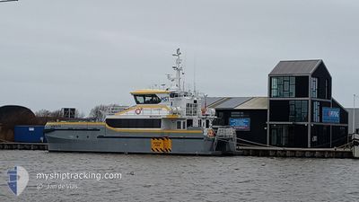
HST TYNEMOUTH
Not available
Current Trip
| Time Travelled | 2 days |
|---|---|
| Remaining Time | --- |
| Distance Travelled | --- |
| Remaining Distance | --- |
| AVG Speed | --- |
| MAX Speed | --- |
| AVG Wind | --- |
| MAX Wind | --- |
| MIN Temp | --- |
| MAX Temp | --- |
| Dybgang | 1.7 m |
| Position Modtaget | 2 d siden |
Current Position
| Longitude | 6.82509° |
|---|---|
| Latitude | 53.48182° |
| Status | Under way using engine |
| Fart | 18.9 Knots |
| Kurs | 338.2° |
| Område | North Sea |
| Station | T-AIS |
| Position Modtaget | 2 d siden |
Info
Information
The current position of HST TYNEMOUTH is in North Sea with coordinates 53.48182° / 6.82509° as reported on 2024-04-22 13:58 by AIS to our vessel tracker app. The vessel's current speed is 18.9 Knots
The vessel HST TYNEMOUTH (IMO: 9958975, MMSI: 232046488) is a Not available It's sailing under the flag of [GB] United Kingdom.
In this page you can find informations about the vessels current position, last detected port calls, and current voyage information. If the vessels is not in coverage by AIS you will find the latest position.
The current position of HST TYNEMOUTH is detected by our AIS receivers and we are not responsible for the reliability of the data. The last position was recorded while the vessel was in Coverage by the Ais receivers of our vessel tracking app.
The current draught of HST TYNEMOUTH as reported by AIS is 1.7 meters
Weather
| Temperature | 6.7°C / 44.06°F |
|---|---|
| Wind Speed | 15 knots |
| Direction | 27° NNE |
| Pressure | 1024.6 hPa |
| Humidity | 55.7 % |
| Cloud Coverage | 100 % |
Featured Company
Last Port Calls
| Port | Arrival | Departure | Time In Port |
|---|---|---|---|
| 2024-04-22 12:41 | 2024-04-22 13:54 | 1 h | |
| 2024-04-13 15:32 | 2024-04-22 12:14 | 8 d | |
| 2024-04-06 15:44 | 2024-04-08 05:01 | 1 d | |
| 2024-04-06 05:08 | |||
| 2024-04-03 16:21 | 2024-04-04 11:27 | 19 h | |
| 2024-04-02 14:25 | 2024-04-03 05:06 | 14 h | |
| 2024-04-01 05:17 | |||
| 2024-03-25 19:05 | 2024-03-28 15:35 | 2 d | |
| 2024-03-25 07:27 | |||
| 2024-03-20 22:23 | 2024-03-23 10:13 | 2 d |
Most Visited Ports (Last year)
| Port | Arrivals | |
|---|---|---|
| 24 | ||
| 22 | ||
| 6 | ||
| 5 | ||
| 1 | ||
| 1 |
Last Trips
| Origin | Departure | Destination | Arrival | Distance | |
|---|---|---|---|---|---|
| 2024-04-22 14:14 | 2024-04-22 14:41 | 1.12 nm | |||
| 2024-04-08 07:01 | 2024-04-13 17:32 | 258.47 nm | |||
| 2024-04-06 07:08 | 2024-04-06 17:44 | 101.36 nm | |||
| 2024-04-03 07:06 | 2024-04-03 18:21 | 102.61 nm | |||
| 2024-04-01 07:17 | 2024-04-02 16:25 | 209.16 nm | |||
| 2024-03-25 08:27 | 2024-03-25 20:05 | 54.58 nm | |||
| 2024-03-20 22:56 | 2024-03-20 23:23 | 1.57 nm | |||
| 2024-03-19 17:26 | 2024-03-19 17:40 | 1.50 nm |
Events
| Tid | Hændelsen | Detaljer | Position / Dest | Info |
|---|---|---|---|---|
| 2024-04-22 13:58 | Udenfor Dækning |
53.48182 / 6.82509
North Sea
NL EEM
|
Fart: 18.9 kn Kurs: 338.2° |
|
| 2024-04-22 13:56 | START Sejllads | 1.21 nm, North of EEMSHAVEN |
53.47175 / 6.83157
NL EEM
|
Fart: 18.7 kn Kurs: 338.9° |
| 2024-04-22 13:55 | STOP Sejllads | 0.91 nm, North of EEMSHAVEN |
53.46684 / 6.83474
NL EEM
|
Fart: Kurs: 0° |
| 2024-04-22 13:54 | Afsejlet fra sidste havn |
|
53.46491 / 6.83594
NL EEM
|
Fart: 15.7 kn Kurs: 347° |
| 2024-04-22 13:47 | START Sejllads |
53.45715 / 6.82228
[NL] EEMSHAVEN
|
Fart: 6 kn Kurs: 102° |
|
| 2024-04-22 12:52 | STOP Sejllads |
53.45723 / 6.81887
[NL] EEMSHAVEN
|
Fart: 0.3 kn Kurs: 164° |
|
| 2024-04-22 12:49 | Destination er ændret | NL EEM DE EKM TWBII DE BKM |
53.45749 / 6.82106
[NL] EEMSHAVEN
|
Fart: 4.4 kn Kurs: 260° |
| 2024-04-22 12:49 | ETA er ændret | 2024/04/22 18:00 2024/04/13 18:00 |
53.45749 / 6.82106
[NL] EEMSHAVEN
|
Fart: 4.4 kn Kurs: 260° |
| 2024-04-22 12:41 | Skibe i havn |
|
53.46166 / 6.83710
[NL] EEMSHAVEN
|
Fart: 16.8 kn Kurs: 163.2° |
| 2024-04-22 12:41 | Ændre havområde | Dutch part of the North Sea German part of the North Sea |
53.46410 / 6.83584
North Sea
|
Fart: 15.6 kn Kurs: 165° |