
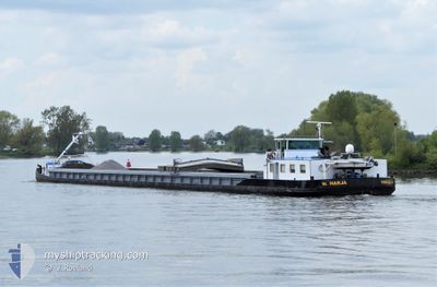
HARJA
Other Type
Current Trip
AALST
| Time Travelled | 1 day |
|---|---|
| Remaining Time | --- |
| Distance Travelled | 98.37 nm |
| Remaining Distance | --- |
| AVG Speed | 7.3 Knots |
| MAX Speed | 9.2 Knots |
| AVG Wind | 15.7 knots |
| MAX Wind | 22 knots |
| MIN Temp | 6.3°C / 43.34°F |
| MAX Temp | 10.3°C / 50.54°F |
| Dybgang | 0.1 m |
| Position Modtaget | 7 h, 23 m siden |
Current Position
| Longitude | 4.61687° |
|---|---|
| Latitude | 51.20130° |
| Status | Under way using engine |
| Fart | 6.1 Knots |
| Kurs | 117.3° |
| Område | North Sea |
| Station | T-AIS |
| Position Modtaget | 7 h, 23 m siden |
Info
Information
The current position of HARJA is in North Sea with coordinates 51.20130° / 4.61687° as reported on 2024-04-20 06:50 by AIS to our vessel tracker app. The vessel's current speed is 6.1 Knots
The vessel HARJA (MMSI: 244710002) is a Other Type It's sailing under the flag of [NL] Netherlands.
In this page you can find informations about the vessels current position, last detected port calls, and current voyage information. If the vessels is not in coverage by AIS you will find the latest position.
The current position of HARJA is detected by our AIS receivers and we are not responsible for the reliability of the data. The last position was recorded while the vessel was in Coverage by the Ais receivers of our vessel tracking app.
The current draught of HARJA as reported by AIS is 0.1 meters
Weather
| Temperature | 6.5°C / 43.7°F |
|---|---|
| Wind Speed | 9 knots |
| Direction | 341° NNW |
| Pressure | 1020.9 hPa |
| Humidity | 70.7 % |
| Cloud Coverage | 80 % |
Featured Company
Last Port Calls
| Port | Arrival | Departure | Time In Port |
|---|---|---|---|
| 2024-04-19 06:38 | 2024-04-19 07:21 | 42 m | |
| 2024-04-12 01:44 | |||
| 2024-03-14 17:15 | 2024-03-15 15:39 | 22 h | |
| 2024-02-19 18:15 | 2024-02-20 09:22 | 15 h | |
| 2024-02-09 18:45 | 2024-02-10 04:28 | 9 h | |
| 2024-02-09 16:11 | 2024-02-09 18:24 | 2 h | |
| 2024-02-08 16:15 |
Events
| Tid | Hændelsen | Detaljer | Position / Dest | Info |
|---|---|---|---|---|
| 2024-04-20 06:50 | Udenfor Dækning |
51.20130 / 4.61687
North Sea
|
Fart: 6.1 kn Kurs: 117.3° |
|
| 2024-04-20 06:16 | START Sejllads | 1.25 nm, South East of WIJNEGEM |
51.22541 / 4.54183
AALST
|
Fart: 4.3 kn Kurs: 108.4° |
| 2024-04-20 06:13 | Status er ændret | Under way using engine Moored |
51.22638 / 4.53807
AALST
|
Fart: Kurs: 511° |
| 2024-04-20 05:51 | Status er ændret | Moored Under way using engine |
51.22693 / 4.53623
AALST
|
Fart: 1.9 kn Kurs: 511° |
| 2024-04-20 05:51 | STOP Sejllads | 1.02 nm, South East of WIJNEGEM |
51.22693 / 4.53623
AALST
|
Fart: 0.1 kn Kurs: 511° |
| 2024-04-20 05:24 | START Sejllads | 0.51 nm, North West of WIJNEGEM |
51.23825 / 4.49967
AALST
|
Fart: 3.5 kn Kurs: 103.2° |
| 2024-04-20 05:22 | Status er ændret | Under way using engine Moored |
51.23853 / 4.49754
AALST
|
Fart: 0.2 kn Kurs: 511° |
| 2024-04-19 20:59 | STOP Sejllads | 0.63 nm, West of WIJNEGEM |
51.23873 / 4.49667
AALST
|
Fart: 0.3 kn Kurs: 511° |
| 2024-04-19 20:59 | Status er ændret | Moored Under way using engine |
51.23874 / 4.49653
AALST
|
Fart: 1.2 kn Kurs: 511° |
| 2024-04-19 18:04 | Status er ændret | Under way using engine Moored |
51.44799 / 4.23125
AALST
|
Fart: 0.9 kn Kurs: 511° |