
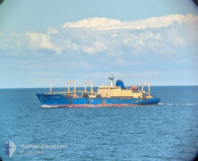
GOGLAND REEFER
Reefer
Current Trip
| Trip Time | 1 day |
|---|---|
| Trip Distance | 603.23 nm |
| AVG Speed | 15.5 Knots |
| MAX Speed | 17.2 Knots |
| Dybgang | 7.3 m |
| AVG Wind | 14.6 knots |
| MAX Wind | 20.3 knots |
| MIN Temp | -1.6°C / 29.12°F |
| MAX Temp | 4.1°C / 39.38°F |
| Position Modtaget | 1 d siden |
Current Position
| Longitude | 19.81499° |
|---|---|
| Latitude | 54.66743° |
| Status | Under way using engine |
| Fart | 5.9 Knots |
| Kurs | 118.7° |
| Område | Baltic Sea |
| Station | T-AIS |
| Position Modtaget | 1 d siden |
Info
Information
The current position of GOGLAND REEFER is in Baltic Sea with coordinates 54.66743° / 19.81499° as reported on 2024-04-22 07:11 by AIS to our vessel tracker app. The vessel's current speed is 5.9 Knots and is currently inside the port of KALININGRAD.
The vessel GOGLAND REEFER (IMO: 8509533, MMSI: 273218630) is a Reefer that was built in 1988 ( 36 år gamle ). It's sailing under the flag of [RU] Russia.
In this page you can find informations about the vessels current position, last detected port calls, and current voyage information. If the vessels is not in coverage by AIS you will find the latest position.
The current position of GOGLAND REEFER is detected by our AIS receivers and we are not responsible for the reliability of the data. The last position was recorded while the vessel was in Coverage by the Ais receivers of our vessel tracking app.
The current draught of GOGLAND REEFER as reported by AIS is 7.3 meters
Weather
| Temperature | 5.7°C / 42.26°F |
|---|---|
| Wind Speed | 7 knots |
| Direction | 232° SW |
| Pressure | 1016.9 hPa |
| Humidity | 63.7 % |
| Cloud Coverage | 97 % |
Featured Company
Last Port Calls
| Port | Arrival | Departure | Time In Port |
|---|---|---|---|
| 2024-04-22 10:20 | |||
| 2024-04-17 02:24 | 2024-04-20 18:24 | 3 d | |
| 2024-04-08 15:53 | 2024-04-15 08:14 | 6 d | |
| 2024-04-03 02:41 | 2024-04-06 10:04 | 3 d | |
| 2024-03-22 16:29 | 2024-04-01 07:45 | 9 d | |
| 2024-03-15 03:43 | 2024-03-20 10:12 | 5 d | |
| 2024-02-27 11:01 |
Most Visited Ports (Last year)
| Port | Arrivals | |
|---|---|---|
| 12 | ||
| 4 | ||
| 1 |
Last Trips
| Origin | Departure | Destination | Arrival | Distance | |
|---|---|---|---|---|---|
| 2024-04-20 21:24 | 2024-04-22 12:20 | 603.23 nm | |||
| 2024-04-15 10:14 | 2024-04-17 05:24 | 594.50 nm | |||
| 2024-04-06 13:04 | 2024-04-08 17:53 | 609.36 nm | |||
| 2024-04-01 09:45 | 2024-04-03 05:41 | 598.26 nm | |||
| 2024-03-20 13:12 | 2024-03-22 18:29 | 586.78 nm | |||
| 2024-02-27 14:01 | 2024-03-15 06:43 | 3301.37 nm |
Events
| Tid | Hændelsen | Detaljer | Position / Dest | Info |
|---|---|---|---|---|
| 2024-04-22 11:12 | STOP Sejllads |
54.70165 / 20.47573
[RU] KALININGRAD
|
Fart: 0.2 kn Kurs: 153° |
|
| 2024-04-22 10:20 | Skibe i havn |
|
54.69252 / 20.41719
[RU] KALININGRAD
|
Fart: 6.2 kn Kurs: 83° |
| 2024-04-22 07:26 | Status er ændret | Default Under way using engine |
54.65008 / 19.86250
RU KGD
|
Fart: 5.9 kn Kurs: 118.7° |
| 2024-04-22 07:11 | Udenfor Dækning |
54.66743 / 19.81499
Baltic Sea
RU KGD
|
Fart: 5.9 kn Kurs: 118.7° |
|
| 2024-04-22 07:08 | Status er ændret | Under way using engine Default |
54.66956 / 19.80836
RU KGD
|
Fart: 1.9 kn Kurs: 94° |
| 2024-04-22 06:40 | Status er ændret | Default Under way using engine |
54.68170 / 19.76219
RU KGD
|
Fart: 2.8 kn Kurs: 97° |
| 2024-04-22 05:20 | Ændre havområde | Russian part of the Baltic Sea Polish part of the Baltic Sea |
54.77970 / 19.34420
Baltic Sea
RU KGD
|
Fart: 15.5 kn Kurs: 97.6° |
| 2024-04-22 03:52 | Ændre havområde | Polish part of the Baltic Sea Estonian part of the Baltic Sea |
55.14947 / 19.10724
Baltic Sea
RU KGD
|
Fart: 16.7 kn Kurs: 163° |
| 2024-04-22 03:51 | Status er ændret | Under way using engine Default |
55.14999 / 19.10698
RU KGD
|
Fart: 16.3 kn Kurs: 164° |
| 2024-04-22 03:51 | Indenfor Dækning |
55.14947 / 19.10724
Baltic Sea
RU KGD
|
Fart: 16.7 kn Kurs: 163° |