
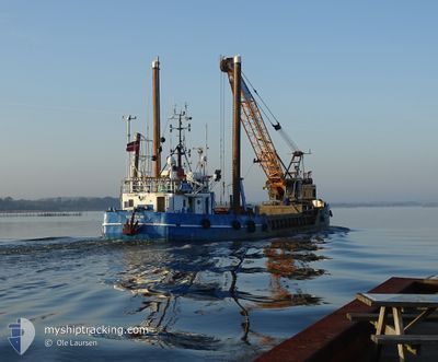
ELISABETH HOEJ
Grab Hopper Dredger
Current Trip
AALBAEK-STRANDBY
| Time Travelled | 8 days |
|---|---|
| Remaining Time | --- |
| Distance Travelled | 60.88 nm |
| Remaining Distance | --- |
| AVG Speed | 6 Knots |
| MAX Speed | 9 Knots |
| AVG Wind | 12.4 knots |
| MAX Wind | 27 knots |
| MIN Temp | 2.1°C / 35.78°F |
| MAX Temp | 11.9°C / 53.42°F |
| Dybgang | 2 m |
| Position Modtaget | 1 m siden |
Current Position
| Longitude | 10.43267° |
|---|---|
| Latitude | 57.59193° |
| Status | Restricted manoeuverability |
| Fart | |
| Kurs | 83° |
| Område | Kattegat |
| Station | T-AIS |
| Position Modtaget | 1 m siden |
Info
Information
The current position of ELISABETH HOEJ is in Kattegat with coordinates 57.59193° / 10.43267° as reported on 2024-04-20 07:02 by AIS to our vessel tracker app. The vessel's current speed is 0 Knots
The vessel ELISABETH HOEJ (IMO: 6922391, MMSI: 219001647) is a Grab Hopper Dredger that was built in 1969 ( 55 år gamle ). It's sailing under the flag of [DK] Denmark.
In this page you can find informations about the vessels current position, last detected port calls, and current voyage information. If the vessels is not in coverage by AIS you will find the latest position.
The current position of ELISABETH HOEJ is detected by our AIS receivers and we are not responsible for the reliability of the data. The last position was recorded while the vessel was in Coverage by the Ais receivers of our vessel tracking app.
The current draught of ELISABETH HOEJ as reported by AIS is 2 meters
Weather
| Temperature | 5.1°C / 41.18°F |
|---|---|
| Wind Speed | 6 knots |
| Direction | 289° WNW |
| Pressure | 1015.2 hPa |
| Humidity | 60.4 % |
| Cloud Coverage | 26 % |
Featured Company
Last Port Calls
| Port | Arrival | Departure | Time In Port |
|---|---|---|---|
| 2024-04-11 18:28 | 2024-04-12 04:04 | 9 h | |
| 2024-04-11 08:04 | 2024-04-11 10:15 | 2 h | |
| 2024-04-09 10:34 | 2024-04-11 04:15 | 1 d | |
| 2024-04-07 17:59 | 2024-04-08 04:18 | 10 h | |
| 2024-04-07 12:11 | 2024-04-07 13:04 | 52 m | |
| 2024-03-31 21:24 | 2024-04-01 04:40 | 7 h | |
| 2024-02-14 08:04 | 2024-03-31 03:57 | ||
| 2024-02-13 10:24 | 2024-02-13 11:35 | 1 h | |
| 2024-02-13 10:14 |
Most Visited Ports (Last year)
| Port | Arrivals | |
|---|---|---|
| 187 | ||
| 73 | ||
| 43 | ||
| 29 | ||
| 26 | ||
| 24 |
Last Trips
| Origin | Departure | Destination | Arrival | Distance | |
|---|---|---|---|---|---|
| 2024-04-11 12:15 | 2024-04-11 20:28 | 15.72 nm | |||
| 2024-04-11 06:15 | 2024-04-11 10:04 | 15.00 nm | |||
| 2024-04-08 06:18 | 2024-04-09 12:34 | 47.93 nm | |||
| 2024-04-07 15:04 | 2024-04-07 19:59 | 10.70 nm | |||
| 2024-04-01 06:40 | 2024-04-07 14:11 | 209.25 nm | |||
| 2024-03-31 05:57 | 2024-03-31 23:24 | 141.97 nm | |||
| 2024-02-13 12:35 | 2024-02-14 09:04 | 151.31 nm | |||
| 2024-02-13 11:14 | 2024-02-13 11:24 | 1.72 nm |
Events
| Tid | Hændelsen | Detaljer | Position / Dest | Info |
|---|---|---|---|---|
| 2024-04-20 06:27 | STOP Sejllads | 6.35 nm, North of STRANDBY |
57.59196 / 10.43245
AALBAEK-STRANDBY
|
Fart: 0.3 kn Kurs: 85° |
| 2024-04-20 06:21 | START Sejllads | 5.82 nm, North West of STRANDBY |
57.58351 / 10.43754
AALBAEK-STRANDBY
|
Fart: 7.8 kn Kurs: 340° |
| 2024-04-20 05:35 | STOP Sejllads | 5.73 nm, North West of STRANDBY |
57.58167 / 10.43678
AALBAEK-STRANDBY
|
Fart: 0.1 kn Kurs: 184° |
| 2024-04-20 05:27 | START Sejllads | 6.35 nm, North of STRANDBY |
57.59199 / 10.43323
AALBAEK-STRANDBY
|
Fart: 3.1 kn Kurs: 97° |
| 2024-04-18 17:07 | STOP Sejllads | 6.4 nm, North West of STRANDBY |
57.59195 / 10.42872
AALBAEK-STRANDBY
|
Fart: 0.1 kn Kurs: 282° |
| 2024-04-18 16:59 | START Sejllads | 6.01 nm, North West of STRANDBY |
57.58621 / 10.43463
AALBAEK-STRANDBY
|
Fart: 7.3 kn Kurs: 35° |
| 2024-04-18 16:05 | STOP Sejllads | 5.9 nm, North West of STRANDBY |
57.58413 / 10.43394
AALBAEK-STRANDBY
|
Fart: Kurs: 275° |
| 2024-04-18 15:57 | START Sejllads | 6.33 nm, North of STRANDBY |
57.59187 / 10.43377
AALBAEK-STRANDBY
|
Fart: 3.1 kn Kurs: 112° |
| 2024-04-18 12:21 | STOP Sejllads | 6.4 nm, North West of STRANDBY |
57.59201 / 10.42868
AALBAEK-STRANDBY
|
Fart: 0.3 kn Kurs: 263° |
| 2024-04-18 12:07 | START Sejllads | 5.28 nm, North West of STRANDBY |
57.57377 / 10.43803
AALBAEK-STRANDBY
|
Fart: 7 kn Kurs: 2° |