
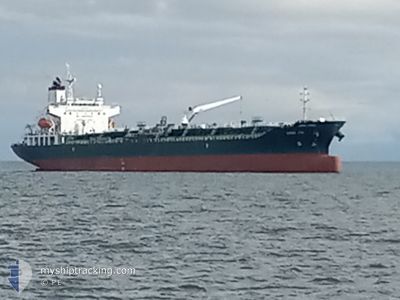
CHEM SOL
Tanker
Current Trip
CNCJK
| Time Travelled | 4 days |
|---|---|
| Remaining Time | --- |
| Distance Travelled | 628.09 nm |
| Remaining Distance | --- |
| AVG Speed | 11.2 Knots |
| MAX Speed | 14.6 Knots |
| AVG Wind | 9.3 knots |
| MAX Wind | 29.9 knots |
| MIN Temp | 10.6°C / 51.08°F |
| MAX Temp | 18.7°C / 65.66°F |
| Dybgang | 9 m |
| Position Modtaget | 4 d siden |
Current Position
| Longitude | 129.09880° |
|---|---|
| Latitude | 34.64424° |
| Status | Under way using engine |
| Fart | 13.5 Knots |
| Kurs | 220.9° |
| Område | Japan Sea |
| Station | T-AIS |
| Position Modtaget | 4 d siden |
Info
Information
The current position of CHEM SOL is in Japan Sea with coordinates 34.64424° / 129.09880° as reported on 2024-04-14 11:17 by AIS to our vessel tracker app. The vessel's current speed is 13.5 Knots
The vessel CHEM SOL (IMO: 9739276, MMSI: 636022067) is a Tanker It's sailing under the flag of [LR] Liberia.
In this page you can find informations about the vessels current position, last detected port calls, and current voyage information. If the vessels is not in coverage by AIS you will find the latest position.
The current position of CHEM SOL is detected by our AIS receivers and we are not responsible for the reliability of the data. The last position was recorded while the vessel was in Coverage by the Ais receivers of our vessel tracking app.
The current draught of CHEM SOL as reported by AIS is 9 meters
Weather
| Temperature | 20.3°C / 68.54°F |
|---|---|
| Wind Speed | 2 knots |
| Direction | 8° N |
| Pressure | 1014.5 hPa |
| Humidity | 49.9 % |
| Cloud Coverage | --- |
Featured Company
Last Port Calls
| Port | Arrival | Departure | Time In Port |
|---|---|---|---|
| 2024-04-13 17:32 | 2024-04-14 07:05 | 13 h | |
| 2024-04-11 03:33 | 2024-04-12 07:57 | 1 d | |
| 2024-03-20 14:29 | 2024-03-21 21:24 | 1 d | |
| 2024-03-16 11:38 | 2024-03-18 02:10 | 1 d | |
| 2024-03-14 17:19 | 2024-03-15 05:54 | 12 h | |
| 2024-03-08 08:00 | 2024-03-09 01:55 | 17 h |
Last Trips
| Origin | Departure | Destination | Arrival | Distance | |
|---|---|---|---|---|---|
| 2024-04-12 16:57 | 2024-04-14 02:32 | 54.33 nm | |||
| 2024-03-21 14:24 | 2024-04-11 12:33 | 6034.41 nm | |||
| 2024-03-17 19:10 | 2024-03-20 07:29 | 139.48 nm | |||
| 2024-03-14 22:54 | 2024-03-16 04:38 | 9.89 nm | |||
| 2024-03-08 17:55 | 2024-03-14 10:19 | 1182.25 nm | |||
| 2024-01-06 06:59 | 2024-03-08 00:00 | 7550.94 nm |
Events
| Tid | Hændelsen | Detaljer | Position / Dest | Info |
|---|---|---|---|---|
| 2024-04-17 08:48 | STOP Sejllads | 3.62 nm, West of JIANGYIN |
31.93906 / 120.10656
CNCJK
|
Fart: 0.1 kn Kurs: 291° |
| 2024-04-16 23:47 | START Sejllads | 8.82 nm, South East of TAICANG |
31.58004 / 121.33736
CNCJK
|
Fart: 5.2 kn Kurs: 264° |
| 2024-04-16 10:29 | STOP Sejllads | 9.13 nm, South East of TAICANG |
31.57491 / 121.34060
CNCJK
|
Fart: 0.1 kn Kurs: 8° |
| 2024-04-15 23:50 | START Sejllads |
31.22931 / 123.03160
CNCJK
|
Fart: 8.6 kn Kurs: 185° |
|
| 2024-04-15 18:26 | STOP Sejllads |
31.24019 / 123.02991
CNCJK
|
Fart: Kurs: 117° |
|
| 2024-04-14 11:22 | Status er ændret | Default Under way using engine |
34.63092 / 129.08881
CNCJK
|
Fart: 13.5 kn Kurs: 220.9° |
| 2024-04-14 11:17 | Udenfor Dækning |
34.64424 / 129.09880
Japan Sea
CNCJK
|
Fart: 13.5 kn Kurs: 220.9° |
|
| 2024-04-14 09:49 | Ændre havområde | Japanese part of the Japan Sea South Korean part of the Japan Sea |
34.90938 / 129.31441
Japan Sea
CNCJK
|
Fart: 12.6 kn Kurs: 208.2° |
| 2024-04-14 08:54 | ETA er ændret | 2024/04/15 19:00 2024/04/11 02:00 |
35.09337 / 129.39702
CNCJK
|
Fart: 12.9 kn Kurs: 186° |
| 2024-04-14 08:00 | Dybgangen er ændret | 9 9.1 |
35.29640 / 129.41976
CNCJK
|
Fart: 13.2 kn Kurs: 183.4° |