
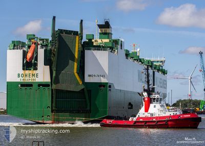
BOHEME
Vehicles Carrier
Current Trip
| Time Travelled | 24 days |
|---|---|
| Remaining Time | --- |
| Distance Travelled | 9534.59 nm |
| Remaining Distance | --- |
| AVG Speed | 16.3 Knots |
| MAX Speed | 20.8 Knots |
| AVG Wind | 12.5 knots |
| MAX Wind | 27.9 knots |
| MIN Temp | 5.3°C / 41.54°F |
| MAX Temp | 29.6°C / 85.28°F |
| Dybgang | 9.6 m |
| Position Modtaget | 3 d siden |
Current Position
| Longitude | 17.88966° |
|---|---|
| Latitude | -34.49541° |
| Status | Under way using engine |
| Fart | 18 Knots |
| Kurs | 320.5° |
| Område | South Atlantic Ocean |
| Station | T-AIS |
| Position Modtaget | 3 d siden |
Info
Information
The current position of BOHEME is in South Atlantic Ocean with coordinates -34.49541° / 17.88966° as reported on 2024-04-16 01:53 by AIS to our vessel tracker app. The vessel's current speed is 18 Knots and is heading at the port of ROTTERDAM. The estimated time of arrival as calculated by MyShipTracking vessel tracking app is 2024-05-02 00:00 LT
The vessel BOHEME (IMO: 9176565, MMSI: 563262000) is a Vehicles Carrier that was built in 1999 ( 25 år gamle ). It's sailing under the flag of [SG] Singapore.
In this page you can find informations about the vessels current position, last detected port calls, and current voyage information. If the vessels is not in coverage by AIS you will find the latest position.
The current position of BOHEME is detected by our AIS receivers and we are not responsible for the reliability of the data. The last position was recorded while the vessel was in Coverage by the Ais receivers of our vessel tracking app.
The current draught of BOHEME as reported by AIS is 9.6 meters
Weather
| Temperature | 23.8°C / 74.84°F |
|---|---|
| Wind Speed | 16 knots |
| Direction | 105° ESE |
| Pressure | 1015.4 hPa |
| Humidity | 84.2 % |
| Cloud Coverage | 19 % |
Featured Company
Last Port Calls
| Port | Arrival | Departure | Time In Port |
|---|---|---|---|
| 2024-03-24 15:58 | 2024-03-26 03:25 | 1 d | |
| 2024-02-20 13:54 | 2024-02-24 08:01 | 3 d | |
| 2024-02-02 04:45 | 2024-02-02 12:24 | 7 h | |
| 2024-02-01 06:34 | 2024-02-01 12:31 | 5 h |
Most Visited Ports (Last year)
| Port | Arrivals | |
|---|---|---|
| 5 | ||
| 3 | ||
| 3 | ||
| 2 | ||
| 2 | ||
| 2 |
Last Trips
| Origin | Departure | Destination | Arrival | Distance | |
|---|---|---|---|---|---|
| 2024-02-24 12:01 | 2024-03-25 00:58 | 7302.49 nm | |||
| 2024-02-02 21:24 | 2024-02-20 17:54 | 6122.30 nm | |||
| 2024-02-01 21:31 | 2024-02-02 13:45 | 64.37 nm | |||
| 2024-01-31 15:00 | 2024-02-01 15:34 | 64.70 nm |
Events
| Tid | Hændelsen | Detaljer | Position / Dest | Info |
|---|---|---|---|---|
| 2024-04-16 01:57 | Status er ændret | Default Under way using engine |
-34.48006 / 17.87474
NL RTM
|
Fart: 18 kn Kurs: 320.5° |
| 2024-04-16 01:53 | Status er ændret | Under way using engine Default |
-34.49541 / 17.88966
NL RTM
|
Fart: 17.9 kn Kurs: 322° |
| 2024-04-16 01:53 | Udenfor Dækning |
-34.49541 / 17.88966
South Atlantic Ocean
NL RTM
|
Fart: 18 kn Kurs: 320.5° |
|
| 2024-04-16 01:44 | Status er ændret | Default Under way using engine |
-34.53330 / 17.92615
NL RTM
|
Fart: 18 kn Kurs: 318.6° |
| 2024-04-16 01:39 | Status er ændret | Under way using engine Default |
-34.55287 / 17.94581
NL RTM
|
Fart: 18 kn Kurs: 319° |
| 2024-04-16 01:17 | Status er ændret | Default Under way using engine |
-34.63564 / 18.03227
NL RTM
|
Fart: 17.7 kn Kurs: 319.8° |
| 2024-04-16 00:38 | Status er ændret | Under way using engine Default |
-34.77137 / 18.18997
NL RTM
|
Fart: 17.6 kn Kurs: 308° |
| 2024-04-16 00:34 | Status er ændret | Default Under way using engine |
-34.78453 / 18.21050
NL RTM
|
Fart: 17.5 kn Kurs: 307.5° |
| 2024-04-16 00:28 | Status er ændret | Under way using engine Default |
-34.80012 / 18.23488
NL RTM
|
Fart: 17.6 kn Kurs: 308° |
| 2024-04-16 00:25 | Status er ændret | Default Under way using engine |
-34.81126 / 18.25234
NL RTM
|
Fart: 17.6 kn Kurs: 308.6° |