
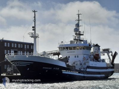
BOEMMELBAS
Fishing Vessel
Current Trip
CH16
| Time Travelled | 10 days |
|---|---|
| Remaining Time | --- |
| Distance Travelled | 902.24 nm |
| Remaining Distance | --- |
| AVG Speed | 9.7 Knots |
| MAX Speed | 12.1 Knots |
| AVG Wind | 10.4 knots |
| MAX Wind | 31 knots |
| MIN Temp | 4°C / 39.2°F |
| MAX Temp | 9°C / 48.2°F |
| Dybgang | 6.5 m |
| Position Modtaget | 1 m siden |
Current Position
| Longitude | 5.24300° |
|---|---|
| Latitude | 59.61188° |
| Status | Under way using engine |
| Fart | |
| Kurs | 29° |
| Område | North Sea |
| Station | T-AIS |
| Position Modtaget | 1 m siden |
Info
Information
The current position of BOEMMELBAS is in North Sea with coordinates 59.61188° / 5.24300° as reported on 2024-04-25 03:47 by AIS to our vessel tracker app. The vessel's current speed is 0 Knots
The vessel BOEMMELBAS (IMO: 9223148, MMSI: 257180000) is a Fishing Vessel that was built in 2000 ( 24 år gamle ). It's sailing under the flag of [NO] Norway.
In this page you can find informations about the vessels current position, last detected port calls, and current voyage information. If the vessels is not in coverage by AIS you will find the latest position.
The current position of BOEMMELBAS is detected by our AIS receivers and we are not responsible for the reliability of the data. The last position was recorded while the vessel was in Coverage by the Ais receivers of our vessel tracking app.
The current draught of BOEMMELBAS as reported by AIS is 6.5 meters
Weather
| Temperature | 2.3°C / 36.14°F |
|---|---|
| Wind Speed | 3 knots |
| Direction | 64° ENE |
| Pressure | 1003.8 hPa |
| Humidity | 78.7 % |
| Cloud Coverage | 19 % |
Featured Company
Last Port Calls
| Port | Arrival | Departure | Time In Port |
|---|---|---|---|
| 2024-04-14 11:00 | 2024-04-14 19:18 | 8 h | |
| 2024-04-12 20:51 | 2024-04-13 17:33 | 20 h | |
| 2024-04-12 18:17 | 2024-04-12 20:22 | 2 h | |
| 2024-04-06 20:02 | 2024-04-06 20:15 | 12 m | |
| 2024-04-05 05:12 | 2024-04-05 06:06 | 53 m | |
| 2024-04-03 14:11 | 2024-04-03 19:07 | 4 h | |
| 2024-04-02 01:51 | 2024-04-02 02:53 | 1 h | |
| 2024-03-27 15:37 | 2024-04-01 12:30 | 4 d | |
| 2024-03-26 16:13 | 2024-03-27 07:41 | 15 h | |
| 2024-03-26 08:14 | 2024-03-26 09:32 | 1 h |
Last Trips
| Origin | Departure | Destination | Arrival | Distance | |
|---|---|---|---|---|---|
| 2024-04-13 19:33 | 2024-04-14 13:00 | 178.69 nm | |||
| 2024-04-12 22:22 | 2024-04-12 22:51 | 4.29 nm | |||
| 2024-04-06 22:15 | 2024-04-12 20:17 | 175.36 nm | |||
| 2024-04-05 08:06 | 2024-04-06 22:02 | 437.75 nm | |||
| 2024-04-03 21:07 | 2024-04-05 07:12 | 230.59 nm | |||
| 2024-04-02 04:53 | 2024-04-03 16:11 | 437.38 nm | |||
| 2024-04-01 14:30 | 2024-04-02 03:51 | 160.50 nm | |||
| 2024-03-27 08:41 | 2024-03-27 16:37 | 10.71 nm | |||
| 2024-03-26 10:32 | 2024-03-26 17:13 | 9.90 nm | |||
| 2024-03-26 03:54 | 2024-03-26 09:14 | 57.04 nm |
Events
| Tid | Hændelsen | Detaljer | Position / Dest | Info |
|---|---|---|---|---|
| 2024-04-23 10:58 | STOP Sejllads | 0.28 nm, North East of LANGEVAG |
59.61188 / 5.24302
CH16
|
Fart: 0.1 kn Kurs: 28° |
| 2024-04-23 02:40 | Fundet i havområde | Norwegian part of the North Sea |
60.12088 / 2.65025
North Sea
|
Fart: 10.4 kn Kurs: 117.2° |
| 2024-04-23 02:40 | Indenfor Dækning |
60.12088 / 2.65025
North Sea
|
Fart: 10.4 kn Kurs: 117.2° |
|
| 2024-04-23 00:01 | Udenfor Dækning |
60.34178 / 1.82808
North Sea
|
Fart: 10.4 kn Kurs: 116.7° |
|
| 2024-04-23 00:01 | Fundet i havområde | United Kingdom part of the North Sea |
60.34178 / 1.82808
North Sea
|
Fart: 10.4 kn Kurs: 116.7° |
| 2024-04-23 00:01 | Indenfor Dækning |
60.34178 / 1.82808
North Sea
|
Fart: 10.4 kn Kurs: 116.7° |
|
| 2024-04-21 20:30 | Udenfor Dækning |
60.93513 / -1.05015
North Atlantic Ocean
|
Fart: 8.9 kn Kurs: 277° |
|
| 2024-04-21 20:30 | Fundet i havområde | United Kingdom part of the North Atlantic Ocean |
60.93513 / -1.05015
North Atlantic Ocean
|
Fart: 8.9 kn Kurs: 277° |
| 2024-04-21 20:30 | Indenfor Dækning |
60.93513 / -1.05015
North Atlantic Ocean
|
Fart: 8.9 kn Kurs: 277° |
|
| 2024-04-21 19:15 | Udenfor Dækning |
60.91293 / -.67763
North Sea
|
Fart: 8.6 kn Kurs: 278° |