
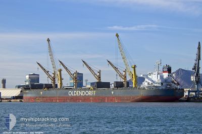
AUGUST OLDENDORFF
Cargo
Current Trip
| Trip Time | 16 days |
|---|---|
| Trip Distance | 3860.97 nm |
| AVG Speed | 9.8 Knots |
| MAX Speed | 13.9 Knots |
| Dybgang | 10.2 m |
| AVG Wind | 14.5 knots |
| MAX Wind | 44 knots |
| MIN Temp | 2.8°C / 37.04°F |
| MAX Temp | 21.2°C / 70.16°F |
| Position Modtaget | 8 d siden |
Current Position
| Longitude | 29.52794° |
|---|---|
| Latitude | 40.76406° |
| Status | Moored |
| Fart | |
| Kurs | 358° |
| Område | Sea of Marmara |
| Station | T-AIS |
| Position Modtaget | 8 d siden |
Info
Information
The current position of AUGUST OLDENDORFF is in Sea of Marmara with coordinates 40.76406° / 29.52794° as reported on 2024-04-11 05:18 by AIS to our vessel tracker app. The vessel's current speed is 0 Knots and is currently inside the port of DILISKELESI.
The vessel AUGUST OLDENDORFF (IMO: 9692686, MMSI: 636020285) is a Cargo It's sailing under the flag of [LR] Liberia.
In this page you can find informations about the vessels current position, last detected port calls, and current voyage information. If the vessels is not in coverage by AIS you will find the latest position.
The current position of AUGUST OLDENDORFF is detected by our AIS receivers and we are not responsible for the reliability of the data. The last position was recorded while the vessel was in Coverage by the Ais receivers of our vessel tracking app.
The current draught of AUGUST OLDENDORFF as reported by AIS is 10.2 meters
Weather
| Temperature | 12.3°C / 54.14°F |
|---|---|
| Wind Speed | 5 knots |
| Direction | 79° E |
| Pressure | 1021.3 hPa |
| Humidity | 77.6 % |
| Cloud Coverage | 1 % |
Featured Company
Most Visited Ports (Last year)
| Port | Arrivals | |
|---|---|---|
| 3 | ||
| 2 | ||
| 1 | ||
| 1 | ||
| 1 | ||
| 1 |
Last Trips
| Origin | Departure | Destination | Arrival | Distance | |
|---|---|---|---|---|---|
| 2024-03-24 21:27 | 2024-04-10 18:45 | 3860.97 nm | |||
| 2024-03-21 13:38 | 2024-03-22 05:58 | 97.25 nm | |||
| 2024-03-14 07:02 | 2024-03-16 17:24 | 572.93 nm | |||
| 2024-02-20 16:43 | 2024-03-11 13:35 | 3687.09 nm | |||
| 2023-12-15 17:00 | 2024-02-19 02:01 | 122.96 nm |
Events
| Tid | Hændelsen | Detaljer | Position / Dest | Info |
|---|---|---|---|---|
| 2024-04-11 05:18 | Udenfor Dækning |
40.76406 / 29.52794
Sea of Marmara
[TR] DILISKELESI
|
Fart: Kurs: 55.8° |
|
| 2024-04-10 16:03 | Status er ændret | Moored Under way using engine |
40.76403 / 29.52797
[TR] DILISKELESI
|
Fart: 0.2 kn Kurs: 358° |
| 2024-04-10 15:52 | STOP Sejllads |
40.76402 / 29.52777
[TR] DILISKELESI
|
Fart: 0.3 kn Kurs: 359° |
|
| 2024-04-10 15:45 | Skibe i havn |
|
40.76232 / 29.52607
[TR] DILISKELESI
|
Fart: 1.9 kn Kurs: 36° |
| 2024-04-10 15:21 | START Sejllads | 2.03 nm, West of DILISKELESI |
40.76336 / 29.49217
TRDLV
|
Fart: 3.1 kn Kurs: 125° |
| 2024-04-10 15:09 | Status er ændret | Under way using engine At anchor |
40.76717 / 29.49318
TRDLV
|
Fart: 0.4 kn Kurs: 246° |
| 2024-04-10 15:02 | Status er ændret | At anchor Default |
40.76671 / 29.49247
TRDLV
|
Fart: 0.1 kn Kurs: 260° |
| 2024-04-10 14:53 | Status er ændret | Default At anchor |
40.76643 / 29.49219
TRDLV
|
Fart: Kurs: 261° |
| 2024-04-10 14:47 | ETA er ændret | 2024/04/10 19:00 2024/04/09 09:00 |
40.76624 / 29.49222
TRDLV
|
Fart: Kurs: 265° |
| 2024-04-10 13:47 | Status er ændret | At anchor Default |
40.76665 / 29.49239
TRDLV
|
Fart: Kurs: 244° |