
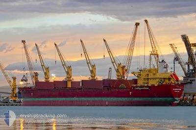
ALANDA STAR
Bulk Carrier
Current Trip
| Time Travelled | 18 days |
|---|---|
| Remaining Time | --- |
| Distance Travelled | 4075.03 nm |
| Remaining Distance | --- |
| AVG Speed | 11.9 Knots |
| MAX Speed | 11.9 Knots |
| AVG Wind | 9.2 knots |
| MAX Wind | 34 knots |
| MIN Temp | 11.1°C / 51.98°F |
| MAX Temp | 26.9°C / 80.42°F |
| Dybgang | 10.5 m |
| Position Modtaget | 4 d siden |
Current Position
| Longitude | -14.02023° |
|---|---|
| Latitude | 27.40283° |
| Status | Under way using engine |
| Fart | 11.5 Knots |
| Kurs | 212.6° |
| Område | North Atlantic Ocean |
| Station | T-AIS |
| Position Modtaget | 4 d siden |
Info
Information
The current position of ALANDA STAR is in North Atlantic Ocean with coordinates 27.40283° / -14.02023° as reported on 2024-04-14 09:44 by AIS to our vessel tracker app. The vessel's current speed is 11.5 Knots
The vessel ALANDA STAR (IMO: 9189677, MMSI: 314468000) is a Bulk Carrier that was built in 1999 ( 25 år gamle ). It's sailing under the flag of [BB] Barbados.
In this page you can find informations about the vessels current position, last detected port calls, and current voyage information. If the vessels is not in coverage by AIS you will find the latest position.
The current position of ALANDA STAR is detected by our AIS receivers and we are not responsible for the reliability of the data. The last position was recorded while the vessel was in Coverage by the Ais receivers of our vessel tracking app.
The current draught of ALANDA STAR as reported by AIS is 10.5 meters
Weather
| Temperature | 24.9°C / 76.82°F |
|---|---|
| Wind Speed | 16 knots |
| Direction | 21° NNE |
| Pressure | 1009.1 hPa |
| Humidity | 50.3 % |
| Cloud Coverage | --- |
Featured Company
Last Port Calls
| Port | Arrival | Departure | Time In Port |
|---|---|---|---|
| 2024-03-31 05:08 | 2024-03-31 05:33 | 24 m | |
| 2024-03-31 02:05 | 2024-03-31 02:21 | 15 m | |
| 2024-03-30 22:22 | 2024-03-30 22:37 | 15 m | |
| 2024-03-30 20:06 | 2024-03-30 20:18 | 11 m | |
| 2024-03-30 19:31 | 2024-03-30 19:36 | 5 m | |
| 2024-03-30 18:28 | 2024-03-30 19:11 | 42 m | |
| 2024-03-30 16:25 | 2024-03-30 16:44 | 19 m | |
| 2024-03-30 14:56 | 2024-03-30 15:36 | 40 m | |
| 2024-03-30 11:04 | 2024-03-30 11:40 | 35 m | |
| 2024-03-30 05:36 | 2024-03-30 05:59 | 22 m |
Most Visited Ports (Last year)
| Port | Arrivals | |
|---|---|---|
| 22 | ||
| 9 | ||
| 5 | ||
| 2 | ||
| 2 | ||
| 2 |
Last Trips
| Origin | Departure | Destination | Arrival | Distance | |
|---|---|---|---|---|---|
| 2024-03-31 05:21 | 2024-03-31 08:08 | 8.54 nm | |||
| 2024-03-31 01:37 | 2024-03-31 05:05 | 12.20 nm | |||
| 2024-03-30 23:18 | 2024-03-31 01:22 | 6.11 nm | |||
| 2024-03-30 22:36 | 2024-03-30 23:06 | 3.73 nm | |||
| 2024-03-30 22:11 | 2024-03-30 22:31 | 4.00 nm | |||
| 2024-03-30 19:44 | 2024-03-30 21:28 | 7.10 nm | |||
| 2024-03-30 18:36 | 2024-03-30 19:25 | 3.53 nm | |||
| 2024-03-30 14:40 | 2024-03-30 17:56 | 18.23 nm | |||
| 2024-03-30 08:59 | 2024-03-30 14:04 | 14.62 nm | |||
| 2024-03-30 06:43 | 2024-03-30 08:36 | 5.68 nm |
Events
| Tid | Hændelsen | Detaljer | Position / Dest | Info |
|---|---|---|---|---|
| 2024-04-17 09:13 | STOP Sejllads | 10.75 nm, South East of GOREE |
14.53180 / -17.27925
SN DKR
|
Fart: 0.3 kn Kurs: 55° |
| 2024-04-14 09:51 | Status er ændret | Default Under way using engine |
27.38308 / -14.03440
SN DKR
|
Fart: 11.5 kn Kurs: 212.6° |
| 2024-04-14 09:44 | Udenfor Dækning |
27.40283 / -14.02023
North Atlantic Ocean
SN DKR
|
Fart: 11.5 kn Kurs: 212.6° |
|
| 2024-04-14 09:34 | ETA er ændret | 2024/04/17 08:00 2024/04/16 18:00 |
27.43141 / -13.99993
SN DKR
|
Fart: 11.5 kn Kurs: 213.7° |
| 2024-04-14 09:34 | Status er ændret | Under way using engine Default |
27.43141 / -13.99993
SN DKR
|
Fart: 11.7 kn Kurs: 212° |
| 2024-04-14 09:32 | Status er ændret | Default Under way using engine |
27.43637 / -13.99637
SN DKR
|
Fart: 11.6 kn Kurs: 212.1° |
| 2024-04-14 09:10 | Status er ændret | Under way using engine Default |
27.49647 / -13.95351
SN DKR
|
Fart: 11.8 kn Kurs: 212° |
| 2024-04-14 09:08 | Status er ændret | Default Under way using engine |
27.50287 / -13.94889
SN DKR
|
Fart: 11.8 kn Kurs: 217.9° |
| 2024-04-14 09:01 | Ændre havområde | Western Saharan part of the North Atlantic Ocean Spanish (Canary Islands) part of the North Atlantic Ocean |
27.52209 / -13.93463
North Atlantic Ocean
SN DKR
|
Fart: 11.8 kn Kurs: 217.9° |
| 2024-04-14 09:01 | Status er ændret | Under way using engine Default |
27.52209 / -13.93463
SN DKR
|
Fart: 11.5 kn Kurs: 214° |