
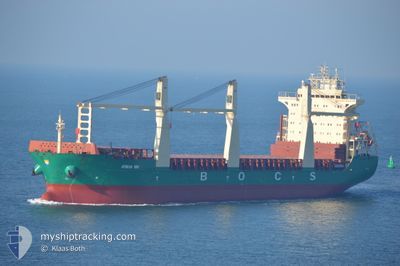
PACIFIC HUMILITY
General Cargo
Current Trip
| Time Travelled | 27 days |
|---|---|
| Remaining Time | --- |
| Distance Travelled | 6412.42 nm |
| Remaining Distance | --- |
| AVG Speed | 10.8 Knots |
| MAX Speed | 15 Knots |
| AVG Wind | 13.3 knots |
| MAX Wind | 40 knots |
| MIN Temp | -2.4°C / 27.68°F |
| MAX Temp | 25.1°C / 77.18°F |
| Dybgang | 10 m |
| Position Modtaget | 1 d siden |
Current Position
| Longitude | 118.21403° |
|---|---|
| Latitude | 38.79990° |
| Status | Under way using engine |
| Fart | 8.8 Knots |
| Kurs | 234.6° |
| Område | Yellow Sea |
| Station | T-AIS |
| Position Modtaget | 1 d siden |
Info
Information
The current position of PACIFIC HUMILITY is in Yellow Sea with coordinates 38.79990° / 118.21403° as reported on 2024-04-18 01:59 by AIS to our vessel tracker app. The vessel's current speed is 8.8 Knots and is heading at the port of ZHENJIANG. The estimated time of arrival as calculated by MyShipTracking vessel tracking app is 2024-04-12 09:00 LT
The vessel PACIFIC HUMILITY (IMO: 9423633, MMSI: 255805550) is a General Cargo that was built in 2010 ( 14 år gamle ). It's sailing under the flag of [PT] Portugal.
In this page you can find informations about the vessels current position, last detected port calls, and current voyage information. If the vessels is not in coverage by AIS you will find the latest position.
The current position of PACIFIC HUMILITY is detected by our AIS receivers and we are not responsible for the reliability of the data. The last position was recorded while the vessel was in Coverage by the Ais receivers of our vessel tracking app.
The current draught of PACIFIC HUMILITY as reported by AIS is 10 meters
Weather
| Temperature | 12.6°C / 54.68°F |
|---|---|
| Wind Speed | 11 knots |
| Direction | 126° SE |
| Pressure | 1011.1 hPa |
| Humidity | 71.1 % |
| Cloud Coverage | 39 % |
Featured Company
Events
| Tid | Hændelsen | Detaljer | Position / Dest | Info |
|---|---|---|---|---|
| 2024-04-18 03:52 | STOP Sejllads | 13.63 nm, South East of TIANJIN |
38.88708 / 118.01255
CNZHE
|
Fart: Kurs: 290° |
| 2024-04-18 02:04 | Status er ændret | Default Under way using engine |
38.80300 / 118.18987
CNZHE
|
Fart: 8.8 kn Kurs: 234.6° |
| 2024-04-18 01:59 | Fundet i havområde | Chinese part of the Yellow Sea |
38.79990 / 118.21403
Yellow Sea
|
Fart: 8.8 kn Kurs: 234.6° |
| 2024-04-18 01:59 | Status er ændret | Under way using engine Default |
38.79990 / 118.21403
CNZHE
|
Fart: 8.9 kn Kurs: 231° |
| 2024-04-18 01:59 | Udenfor Dækning |
38.79990 / 118.21403
Yellow Sea
|
Fart: 8.8 kn Kurs: 234.6° |
|
| 2024-04-18 01:45 | Indenfor Dækning |
38.79990 / 118.21403
Yellow Sea
|
Fart: 8.8 kn Kurs: 234.6° |
|
| 2024-04-15 04:13 | START Sejllads | 10.35 nm, South West of GAOGANG |
32.21518 / 119.66943
CNZHE
|
Fart: 11.3 kn Kurs: 32° |
| 2024-04-13 11:41 | STOP Sejllads | 11.06 nm, South West of GAOGANG |
32.20220 / 119.66133
CNZHE
|
Fart: Kurs: 238° |
| 2024-04-12 13:57 | START Sejllads |
31.21939 / 122.57799
CNZHE
|
Fart: 3.6 kn Kurs: 329° |
|
| 2024-04-12 02:37 | STOP Sejllads |
31.21810 / 122.58064
CNZHE
|
Fart: 0.1 kn Kurs: 91° |